Categories
Accessibility

Accessibility in Vienna

Historical context

The first signs of the existence of Vienna come from the ancient Romain time. Romans set up a military camp named Vindobona in the first century . The camp has disappeared later, in the fifth century after the decline of the Romain Empire.

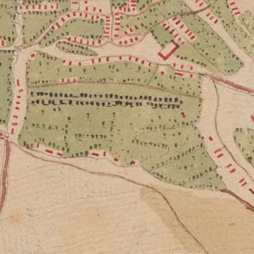
In 1150 the dukes of Bavaria decided to move his principal residence to Vienna. This step allowed Vienna to become a city for the first time. Another sign of the existence of Vienna during the middle age is the fortification wall built in 1200.

At the beginning of the 13th century, Vienna became an important part of a network of trade relations around the Danube. This trade networked used to follow the Danube route and and affected countries around it.

1 source : Stadt Wien Website, From the Roman Military Camp to the End of the First Millenary – History of Vienna, https://www.wien.gv.at/english/history/overview/romans.html

Credit by: authors

In the 14th century a new architectural style appeared in vienna : Gothic style. The city was mostly refashioned with this with this imposing style. One example was the redesign of the church of St. Stephen’s or the Vienna Rathaus. The economy of the city was based the Danube trade but also on the wine growing. Wine growing is still a part of Viennese culture today.

Credit by : Juliette Vincens de Tapol

2 source : Stadt Wien Website, The late medieval Period – History of Vienna, https://www.wien.gv.at/english/history/overview/romans.html

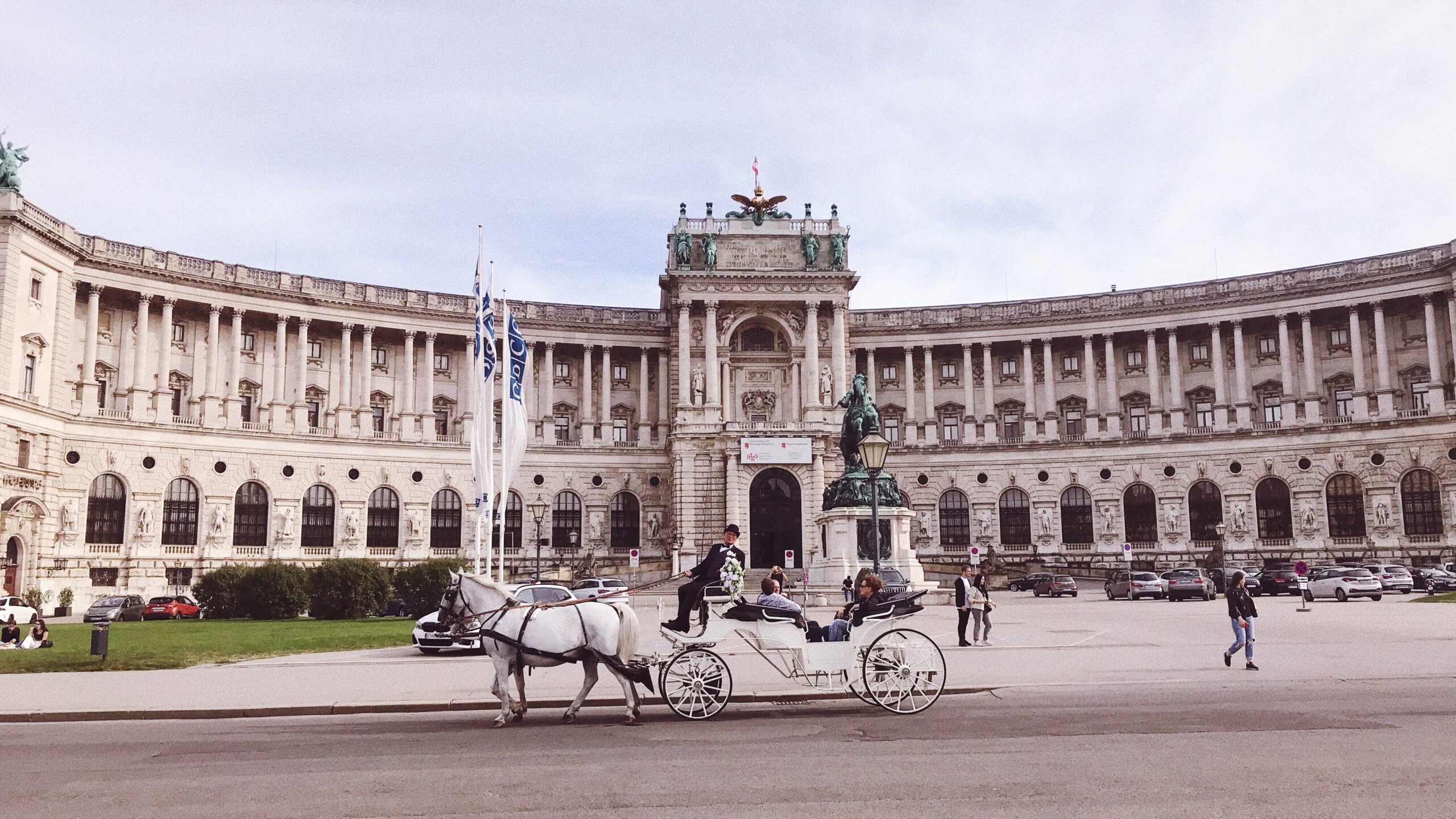
In the 15th century Vienna became the capital of the Holy Roman Empire and tand therefore the emperor’s seat and residence. As a consequence the building and architectural activity of the city was dominated by the viennese court and the church. The aristocratic families built their houses and palaces in Innerestadt but also in the suburbs influencing architecture and culture.

Credit by: Juliette Vincens de Tapol

After the occupation of Napoleon Bonaparte between 1815 and 1848 Vienna’s infrastructures and building were not modern enough to go through the industrial revolution. This need of modernisation began more and more urgent.

“On the one hand, Vienna experienced an age of cultural excellence.  On the other hand, the period was marked by the onset of rapid industrialisation combined with grave social problems.

Quoted in Stadt Wien Website, Napoleonic wars to “Pre-March Period” – History of Vienna, https://www.wien.gv.at/english/history/overview/romans.html

The city has also attempted to modernize on a European scale, for example by building meat markets to improve the city’s food supply, but these attempts have had similar difficulties.

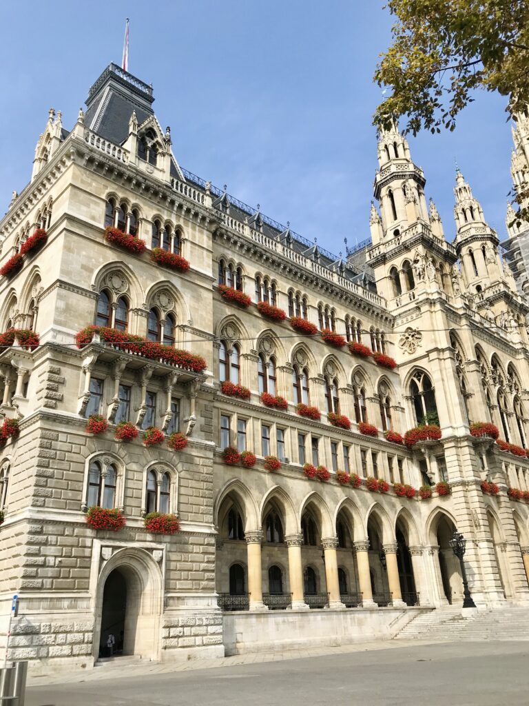
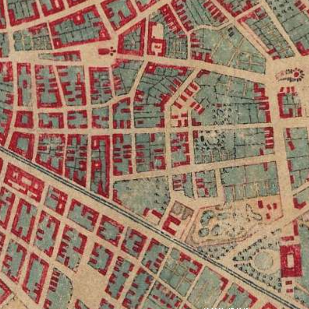
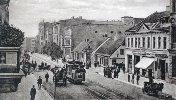
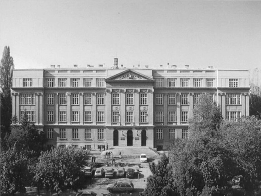
In 1857, Emperor Franz Joseph had the city’s fortifications razed and instead built the “Ringstrasse”, a road encircling the city center, adapted to new transport means. This road welcomed the institutions of the new bourgeoisie. Buildings with a new style of architecture, historicism, have emerged: Museum, Opera House, Government Department but also Parliament building. This new architectural movement was notably led by the Austrian architect Otto Wagner. These luxurious and bourgeois modifications contributed to create a gap between the suburbs and the city center.

Credit by: Juliette Vincens de Tapol

In the 19th century, a project had a major impact on the urban landscape and the morphology of the city : the regulation of the Danube, between 1869 and 1875. A new bed was created with the old branch of the city center, the “Danube Canal”. Merchant navigation was therefore carried out on the main river bypassing the city. These modifications allowed a great economic growth in the area between the Danube Canal and the main river.

3 source : Stadt Wien Website, The “Ringstrasse”-period – History of Vienna, https://www.wien.gv.at/english/history/overview/romans.html

After the Second world war in 1945, more than 20 percent of the building stock was destroyed or largely damaged.

Between 1945 and 1955 the state launched major reconstruction projects in the city. These have had a great impact on urban development and the morphology of the city. The riverbanks of the Danube have been redesigned from scratch with modern designs. This project was the first major urban project since 1875.

4 source : Stadt Wien Website, The years of the Allied Forces in Vienna (1945 to 1955) – History of Vienna, https://www.wien.gv.at/english/history/overview/reconstruction.html

Credit by : Juliette Vincens de Tapol

After the Second World War, more and more attention was paid to the preservation of Vienna’s architectural and urban heritage.  This resulted in the rehabilitation of densely built historic districts.

5 source : Stadt Wien Website, From the “Austrian State Treaty” (1955) to the European Union (1995) – History of Vienna, https://www.wien.gv.at/english/history/overview/international.html

History of accessibility in Europe and Vienna

During the middle-age, disabled people are excluded from the society. People consider them unclean or a victim of the divine curse. Their disability provoked fear for most of the European population.

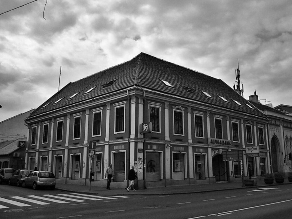
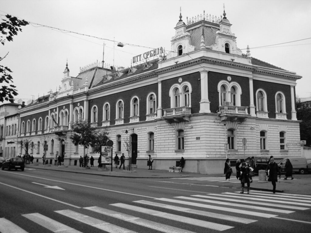
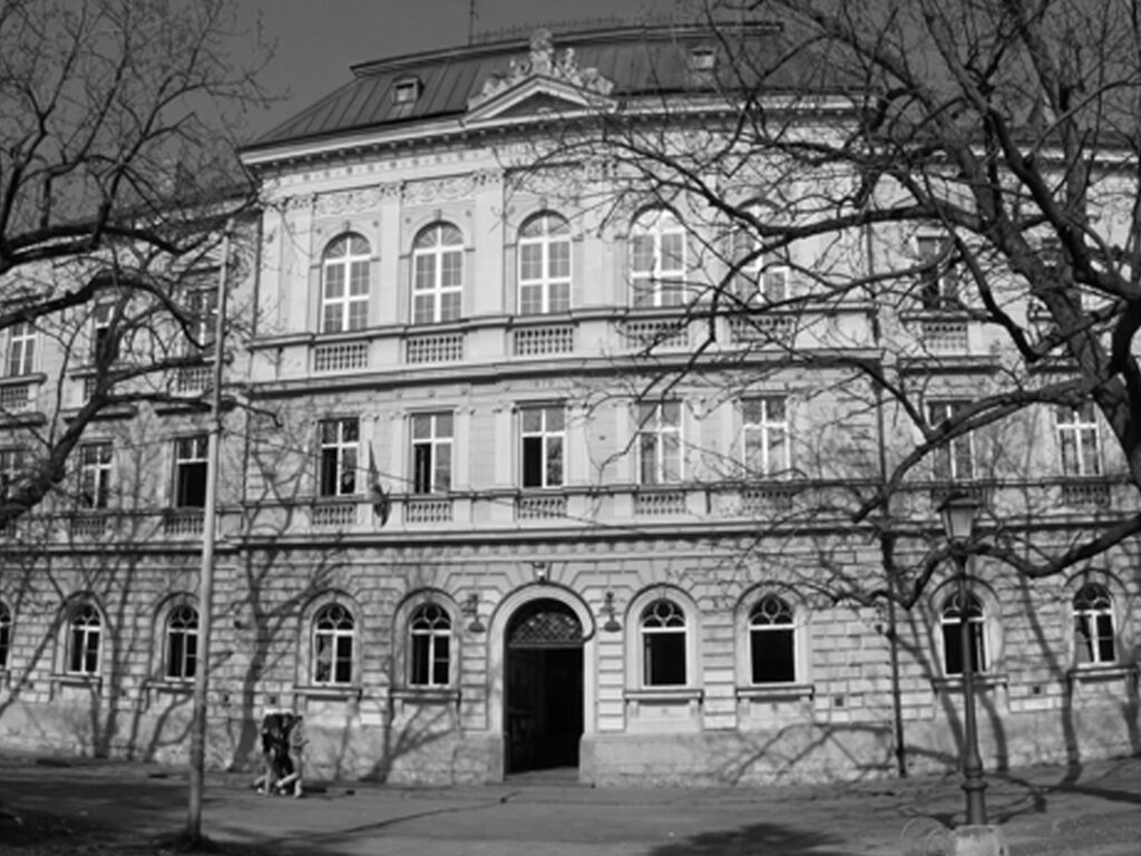
The Innere Stadt of Vienna was built between the middle age and 1850: it was therefore not designed to be accessible to disabled people and inclusive.

After the First World War, a system for the protection of disabled people was created in Europe. It covered only war veterans and war wounded because these people had “sacrificed for their country”. 

After the Second World War, the condition of the handicapped evolved in Europe. Indeed, several millions of people came out of this war injured and disabled, and not only soldiers.

Since that time, organizations and associations have been working to improve social rights and support the disabled in Austria. After the 1970s, a new movement emerged calling for the implementation of human rights for people with disabilities: the SELBSTBESTIMT LEBEN BEWEGUNG.

Today the Vienna’s government try to make the city more accessible and inclusive. The historic center is still a complex place because it is part of the national heritage, an architecture protected by the government as said before. Transformations are therefore complicated.

6 source : Universität Wien Website, History of the disability movement in Austria, June 2018, https://lehrerinnenbildung.univie.ac.at/en/fields-of-work/inclusive-education/research-projects/current-projects/history-of-the-disability-movement-in-austria/
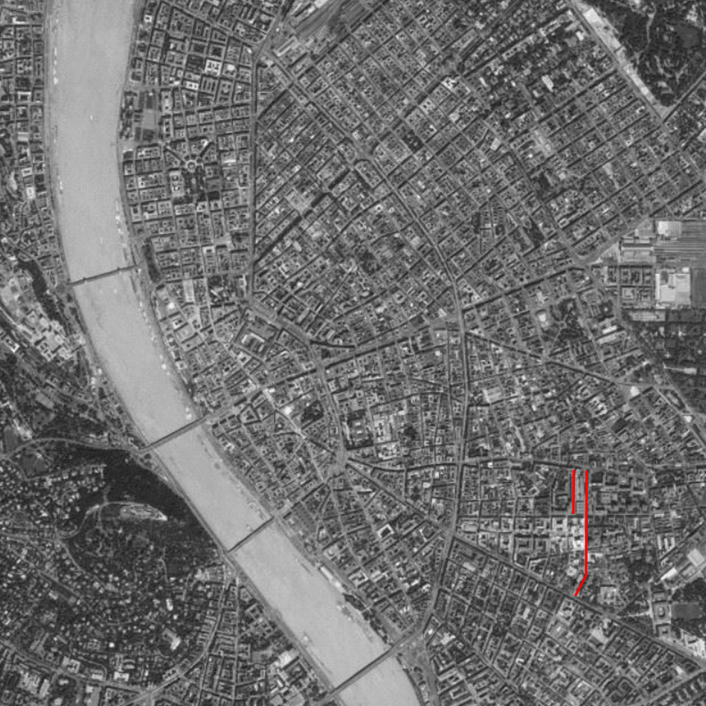
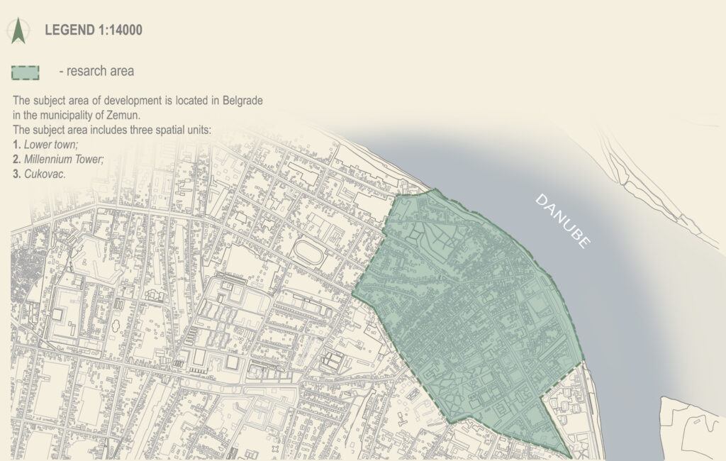
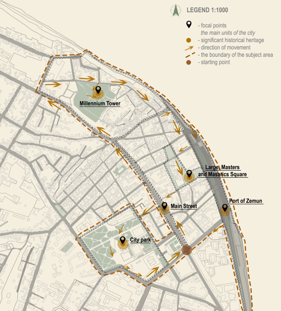
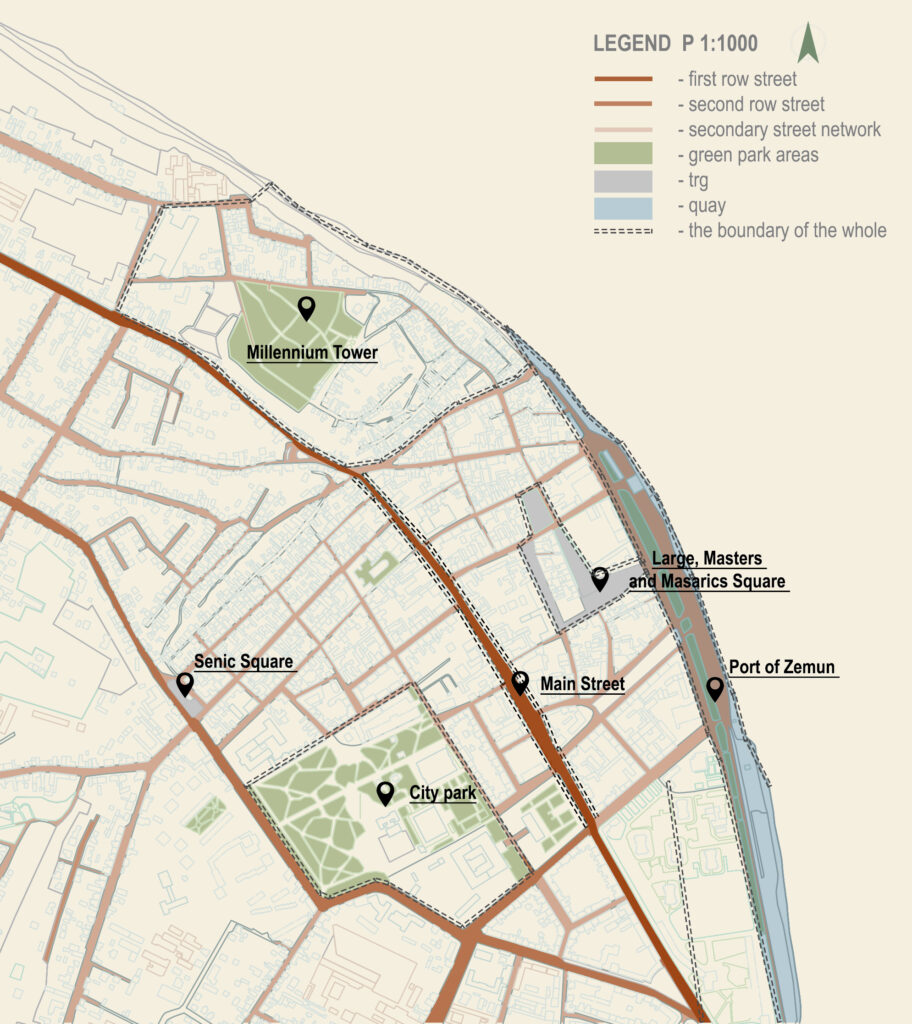
On site

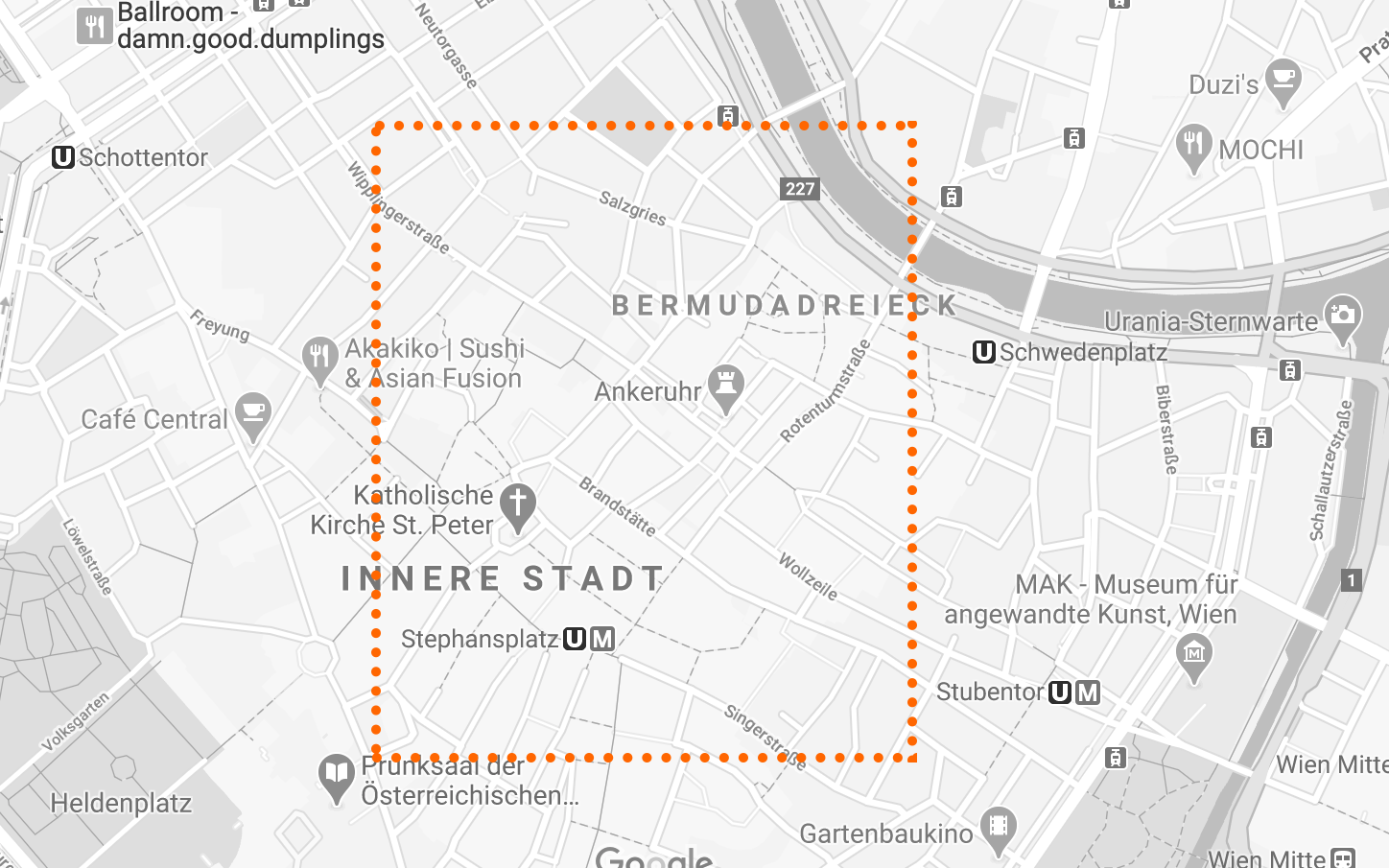
Site : Innere Stadt, between Schwedenplatz and Stephen’s church

Credit : Screenshot Google Maps, https://www.google.com/maps

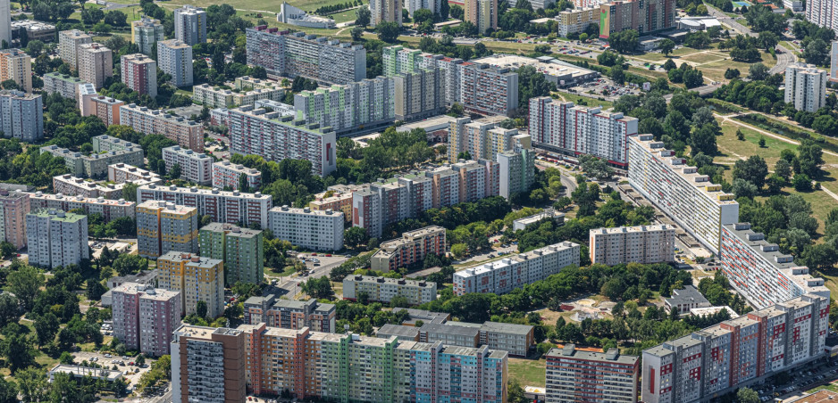
Today, more than 1.7 million people live in Vienna. Vienna is therefore not only the largest city in Austria but also the seventh largest city in the European Union.

The city is densely populated, as you would expect, this large city comes in with around 4,000 people per square kilometer. Therefore the density of Innere Stadt is higher then average with 5,572 people residing per square kilometer.

7 source : World population review, Vienna population 2020, https://worldpopulationreview.com/world-cities/vienna-population

8 source : City population Website, Wien, https://www.citypopulation.de/en/austria/wiencity/901__innere_stadt/

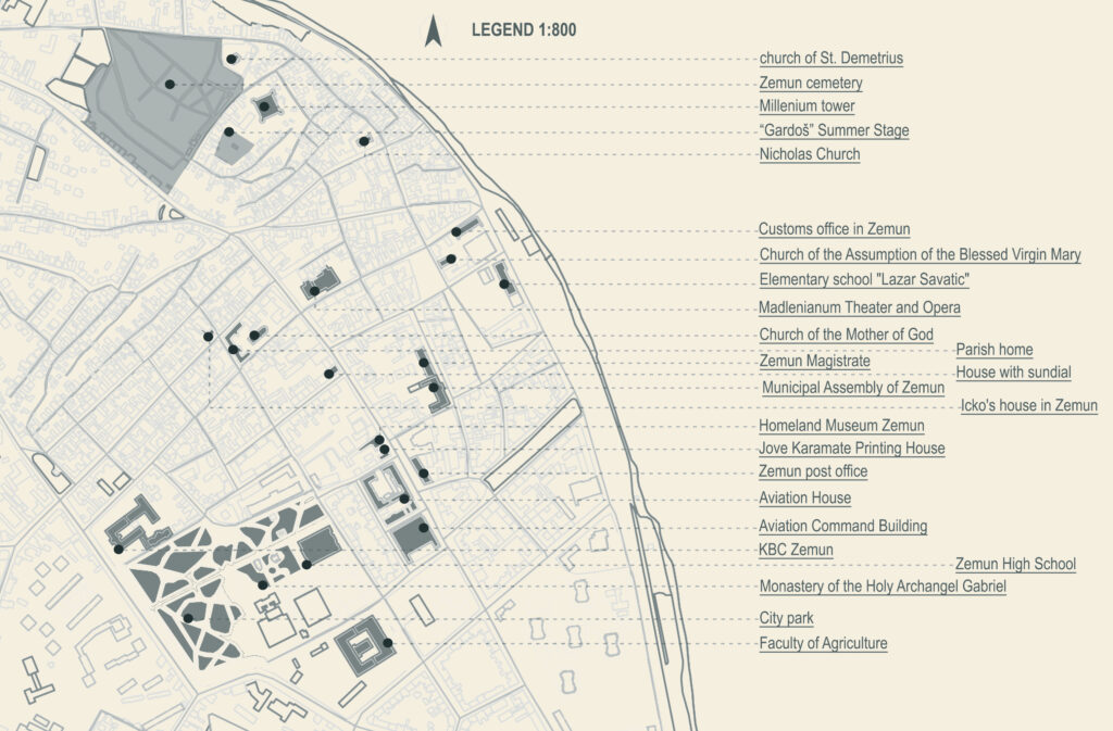
Before 1850 the Innere Stadt was physically the equivalent of the city of Vienna today.

It concentrate most of the significant historic buildings such as Stephansdom or the Hofburg Imperial palace.

Before searching

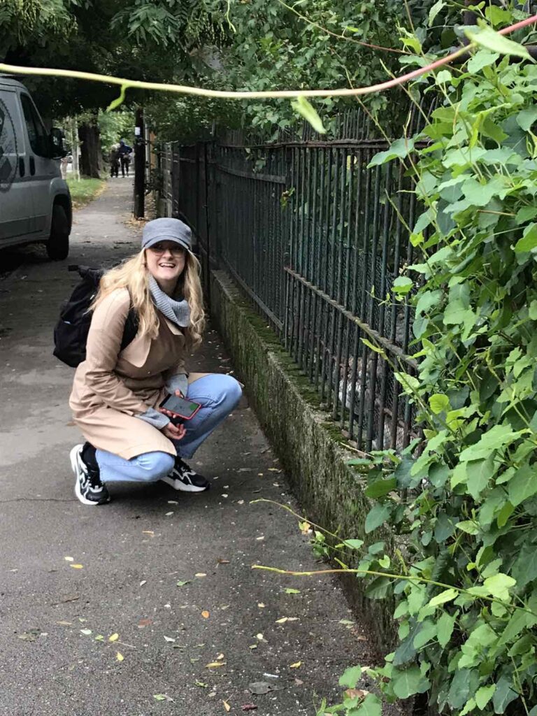
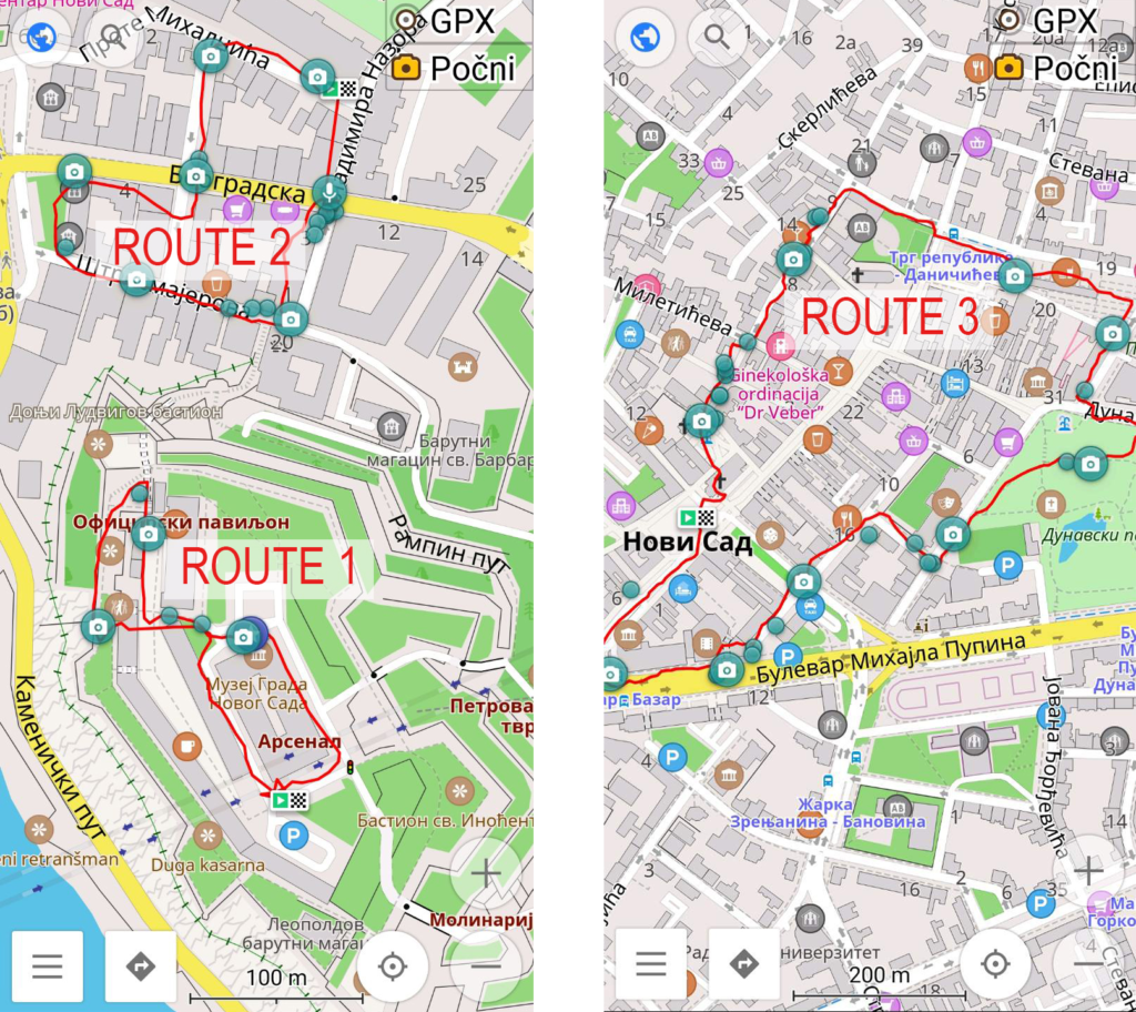
The plan for our searches was to come to the site the fist day to have a walk and take notes of our first impressions.

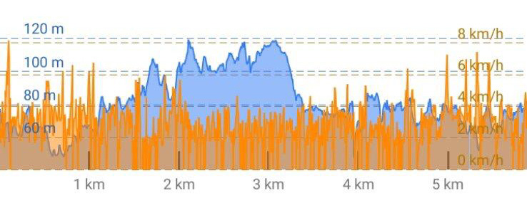
The second day we came back to make a tour with the osmand app and our phones to take some pictures.

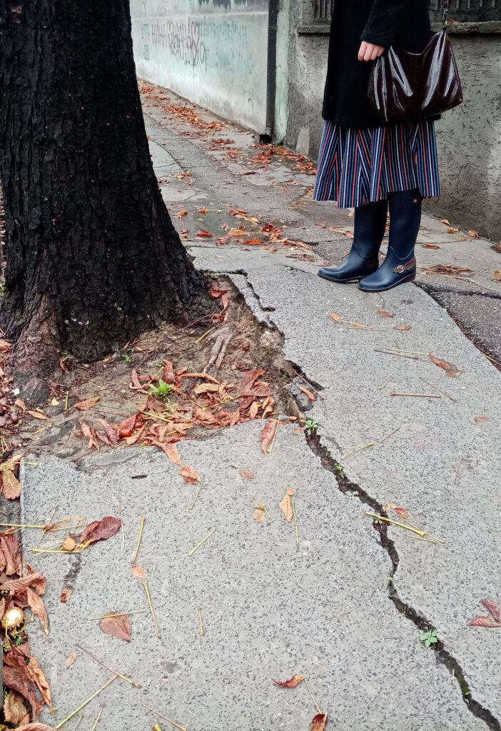
The goal was to have a walk and trying to put ourserves in the shoes of a disabled/ elderly person. At every obstacles that we met we took a picture and added a marker. This is what made our track.

While searching

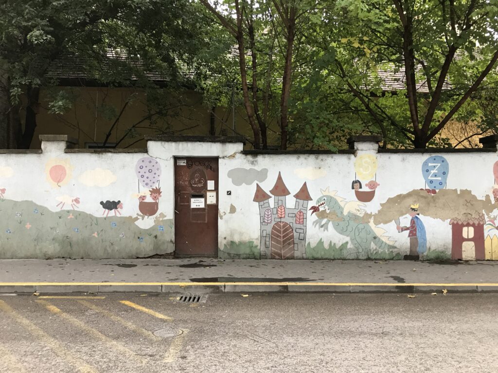
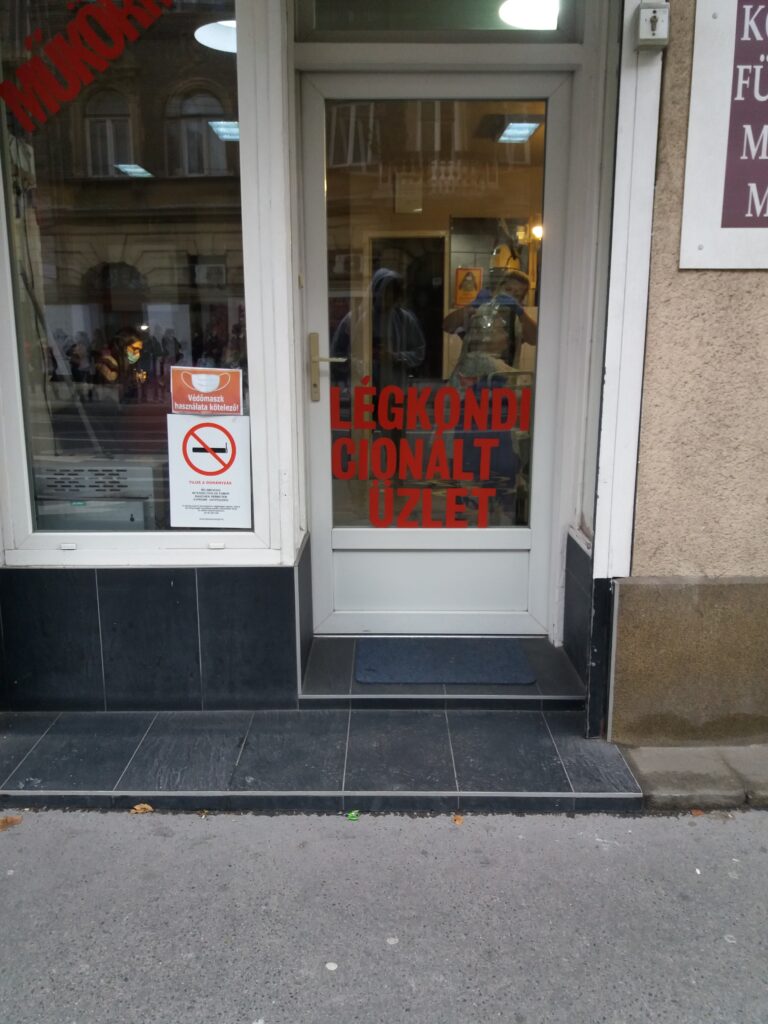
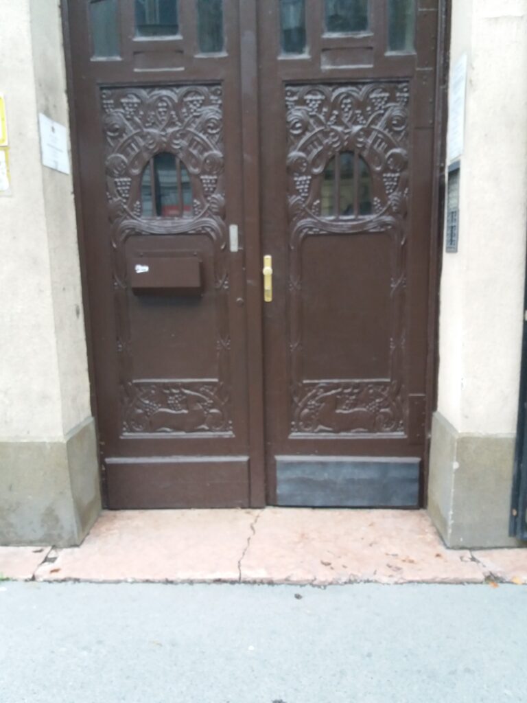
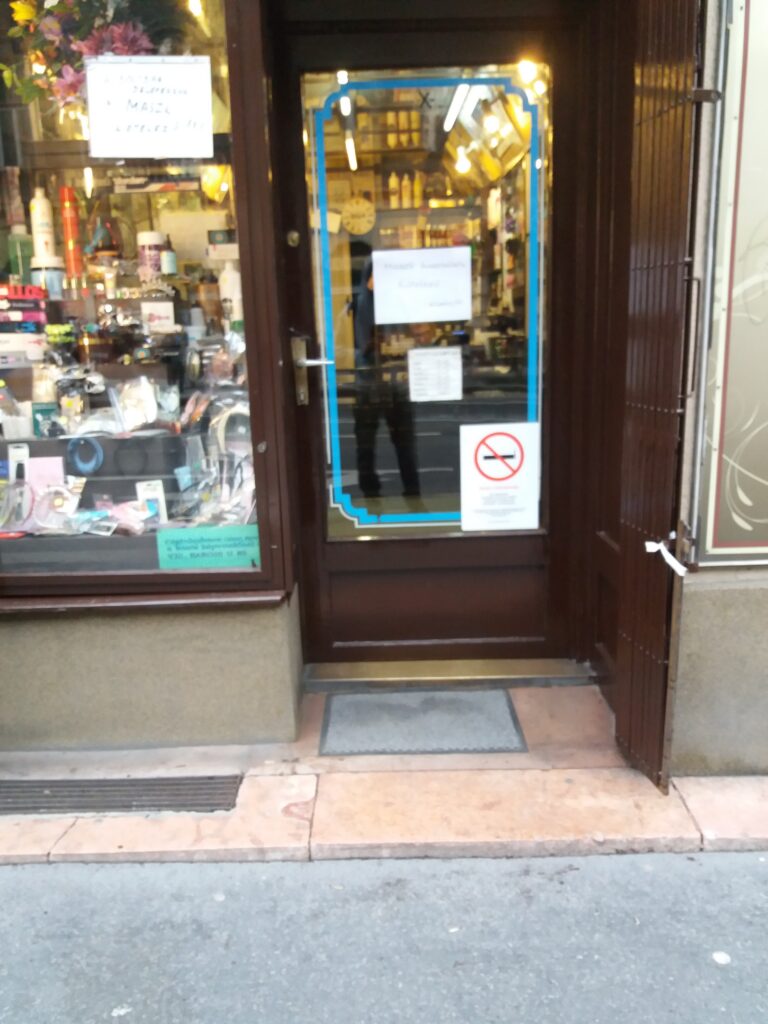
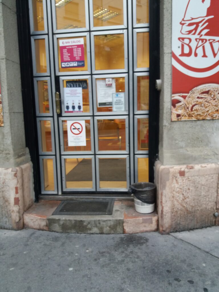
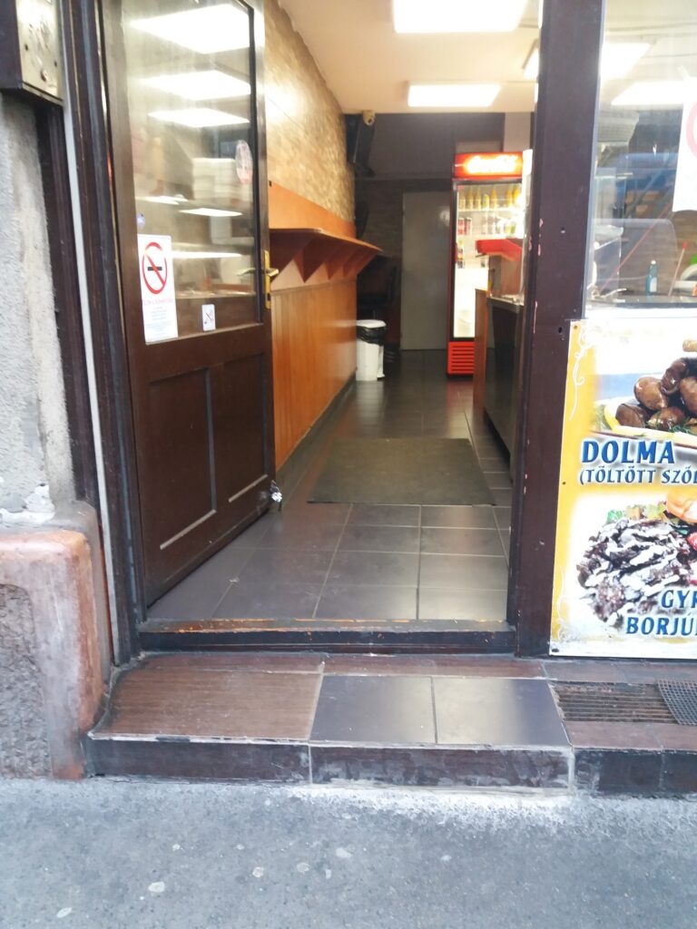
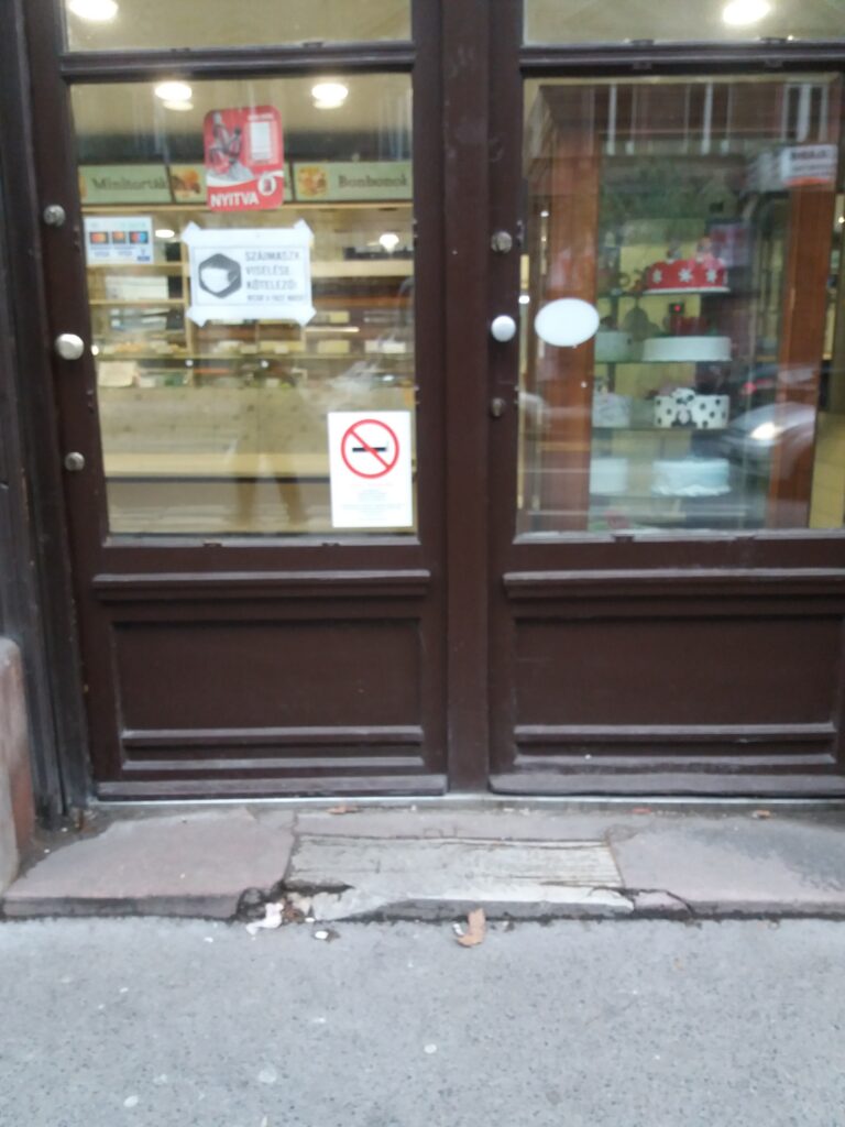
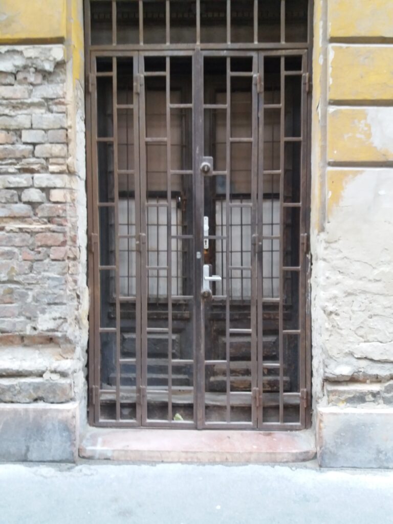
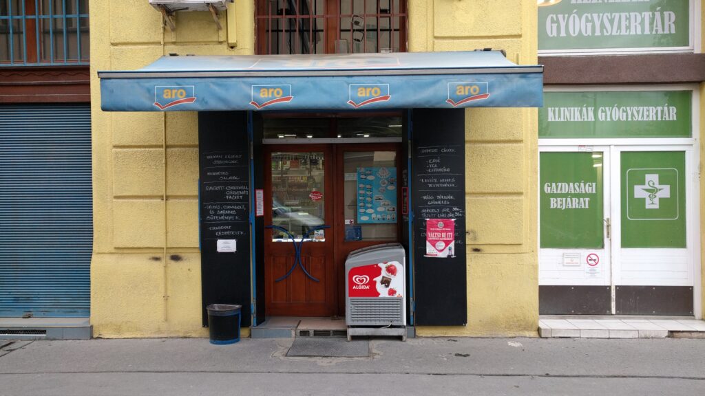
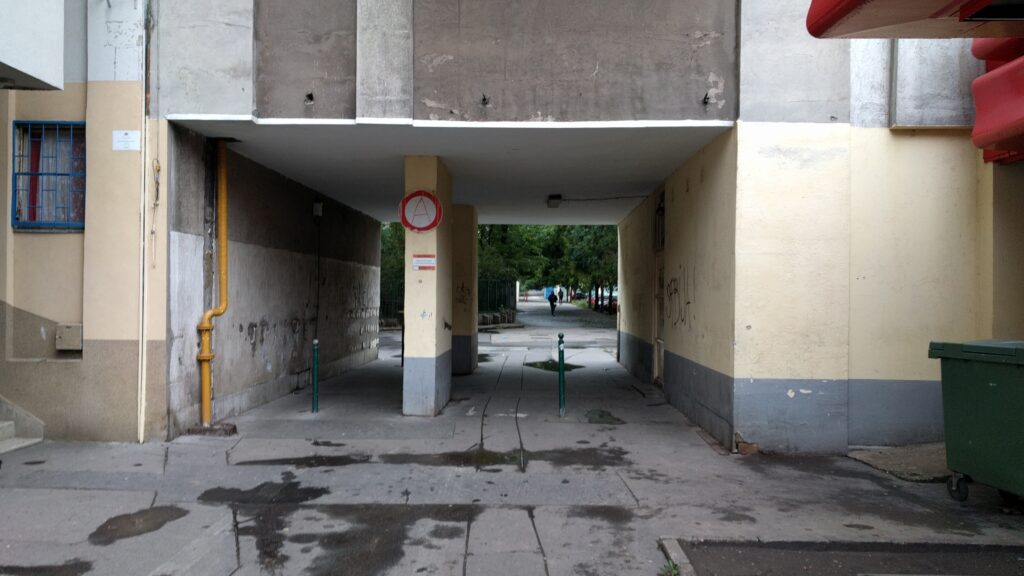
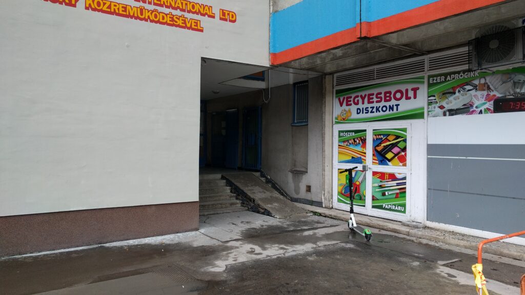
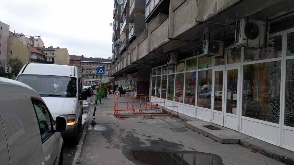
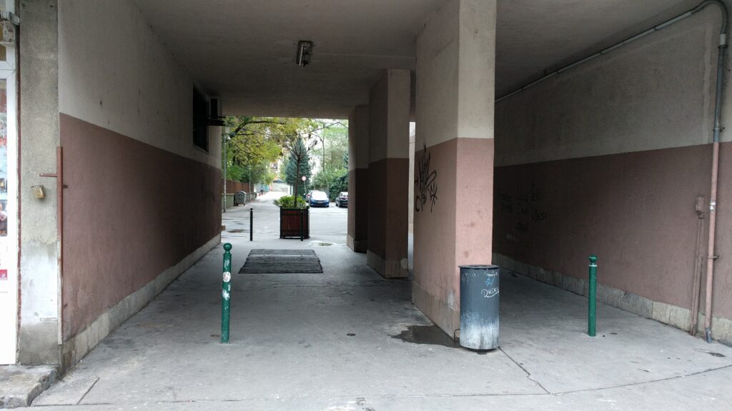
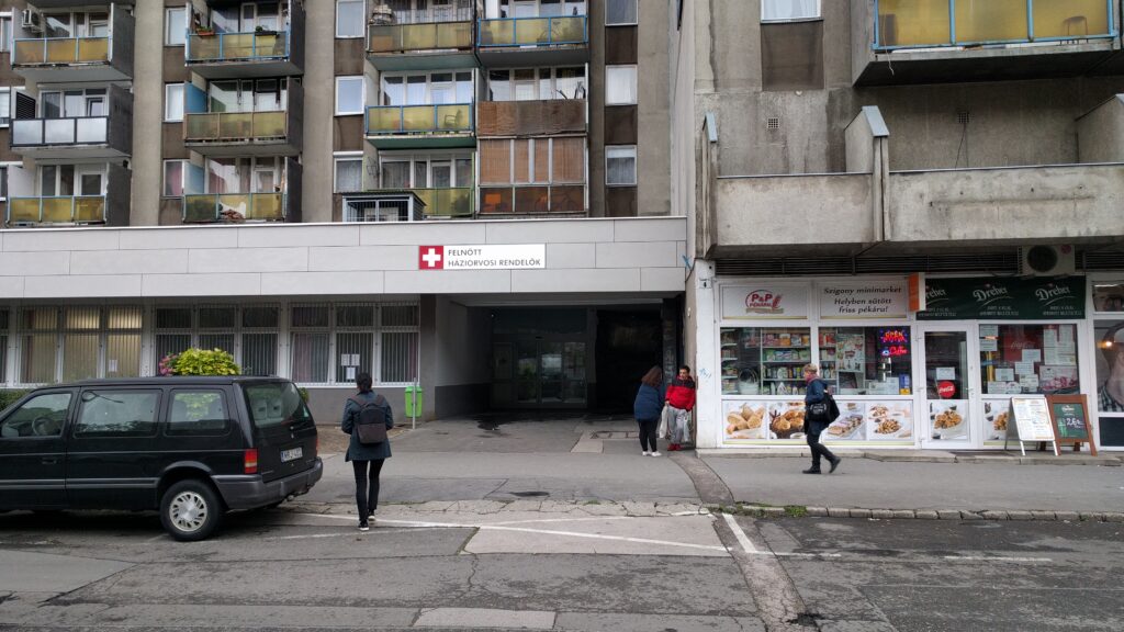
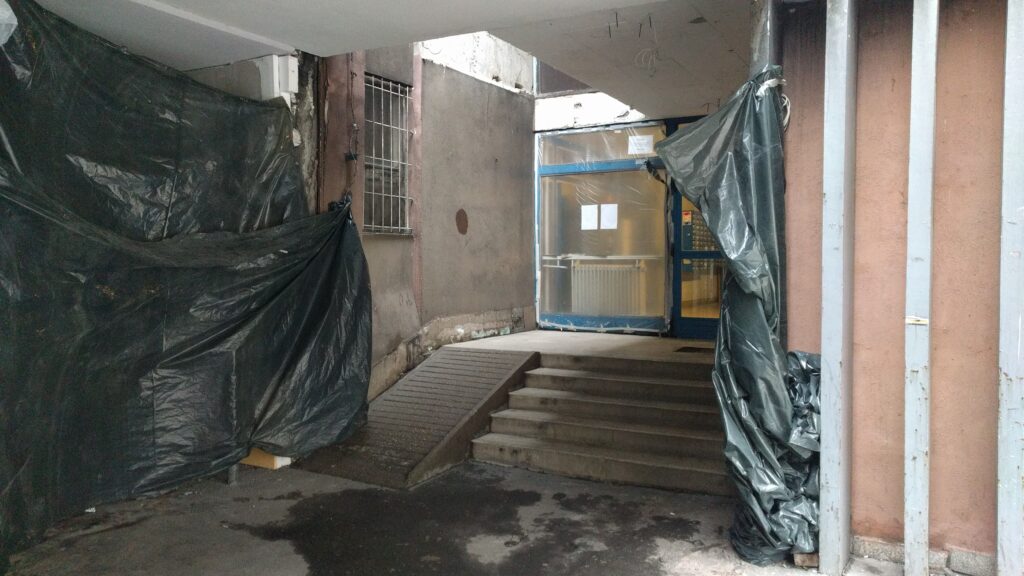
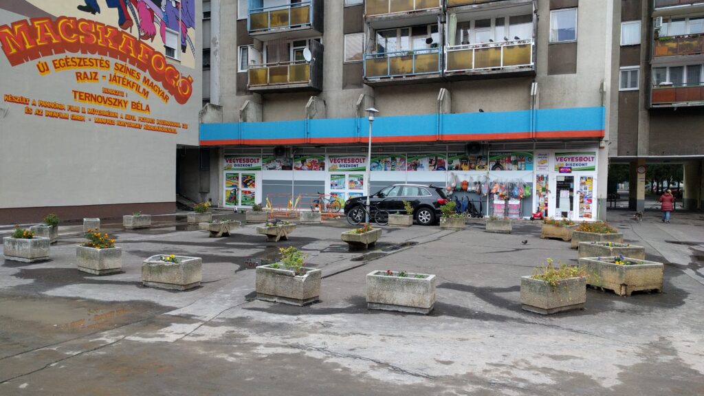
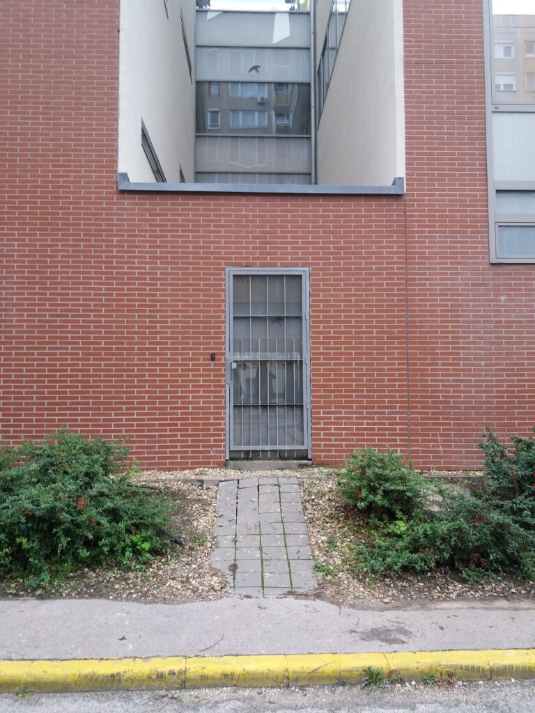
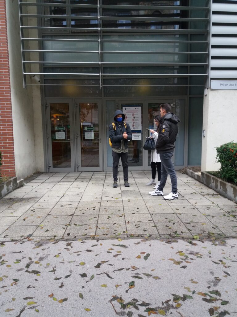
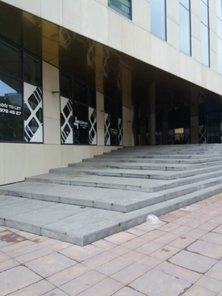
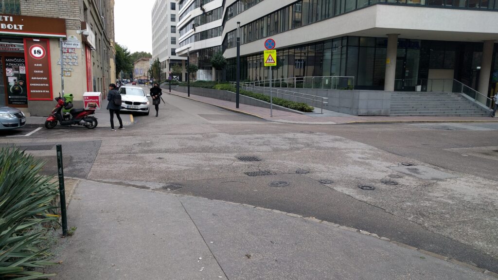
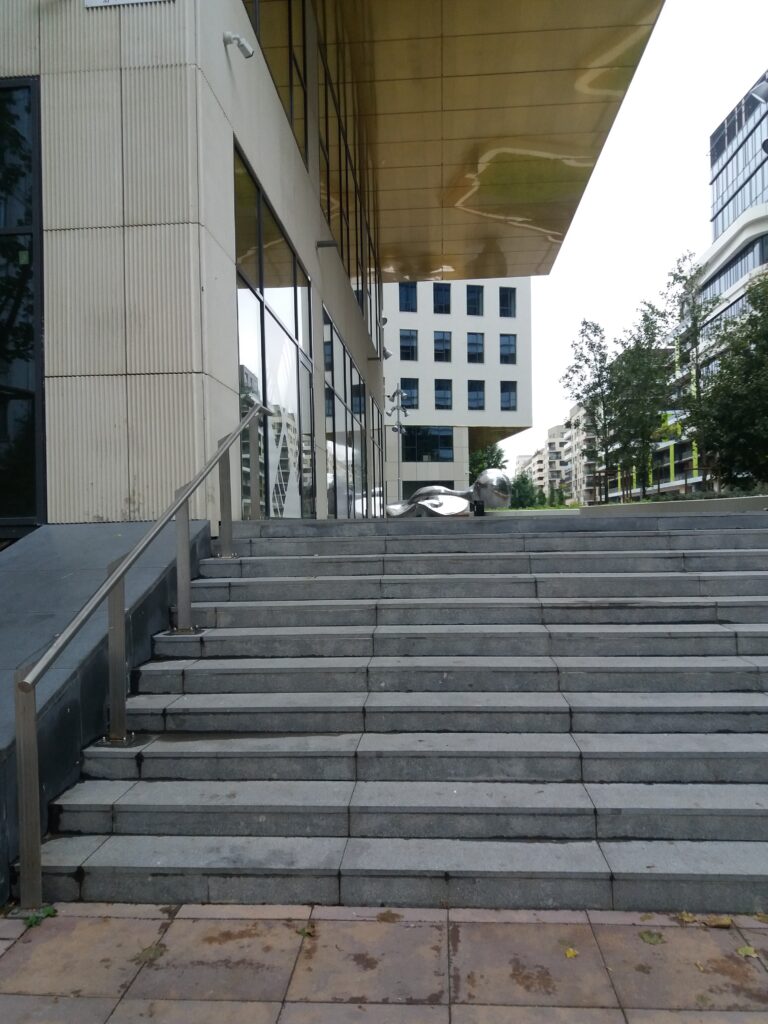
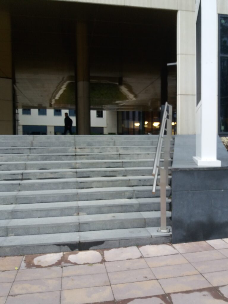
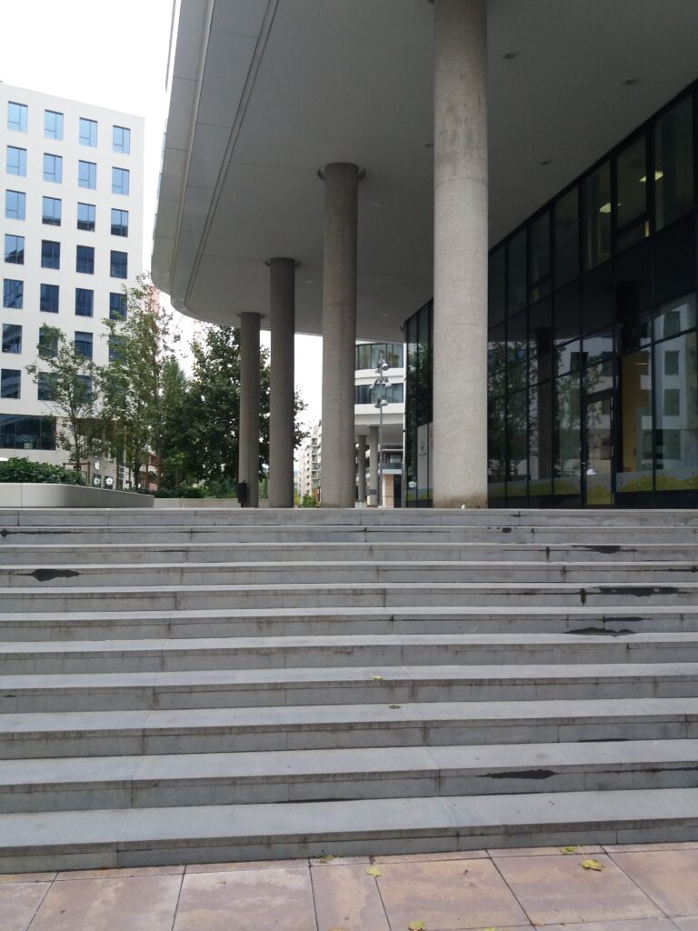
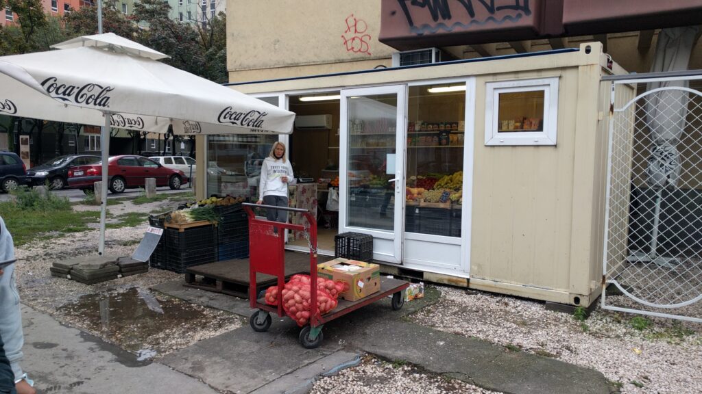
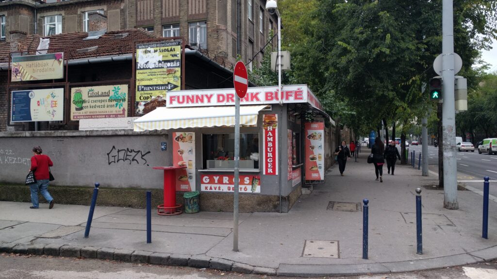
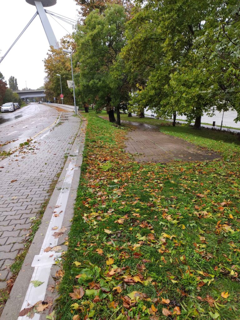
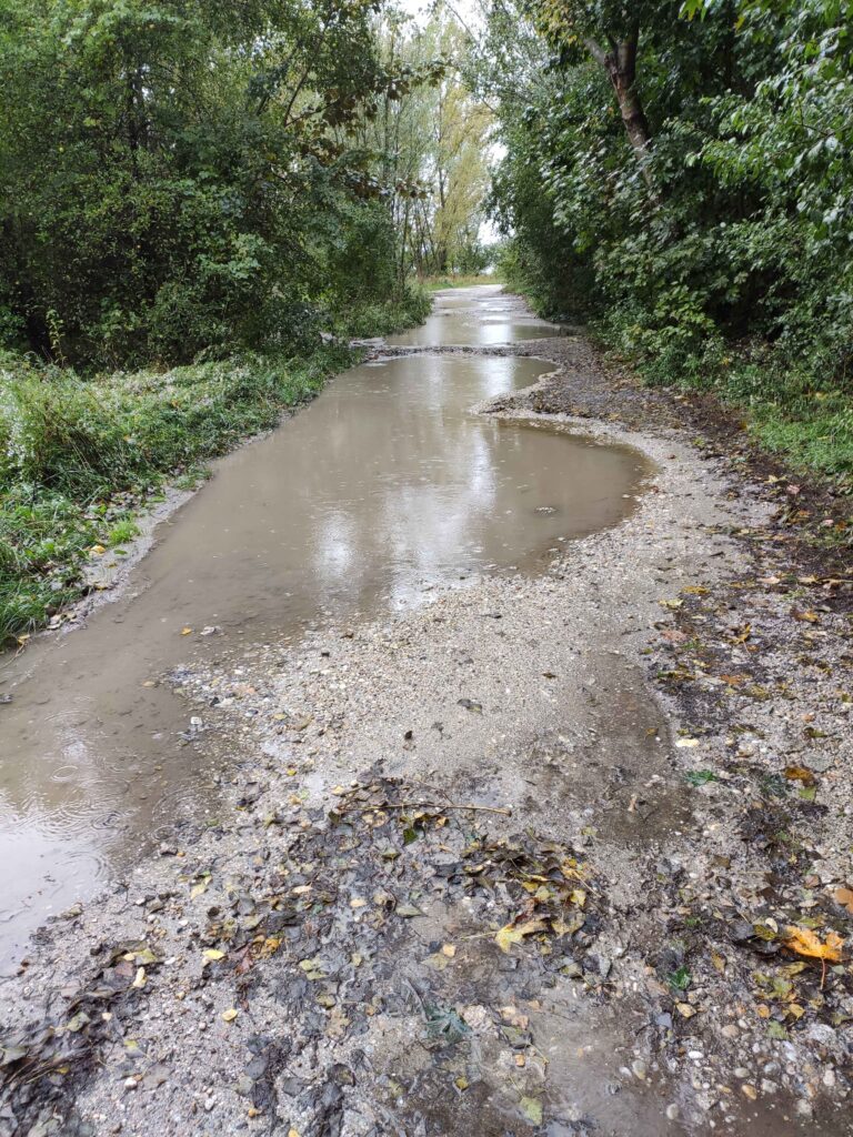
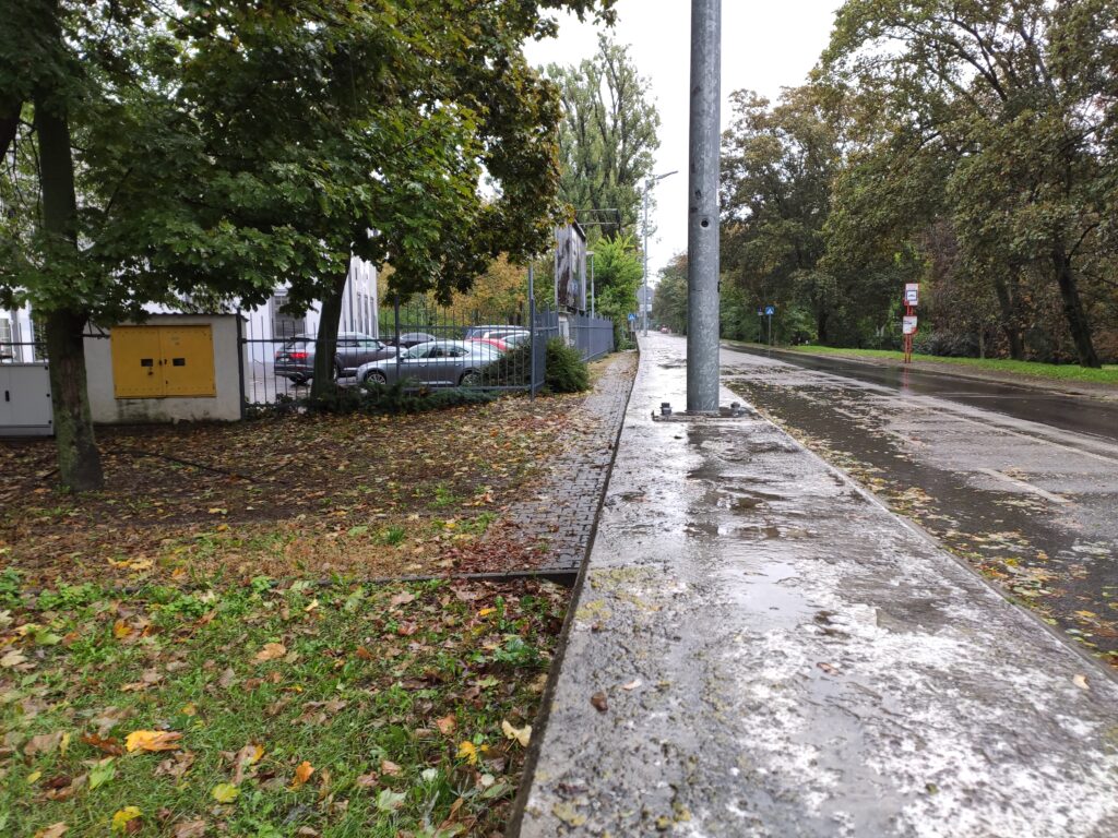
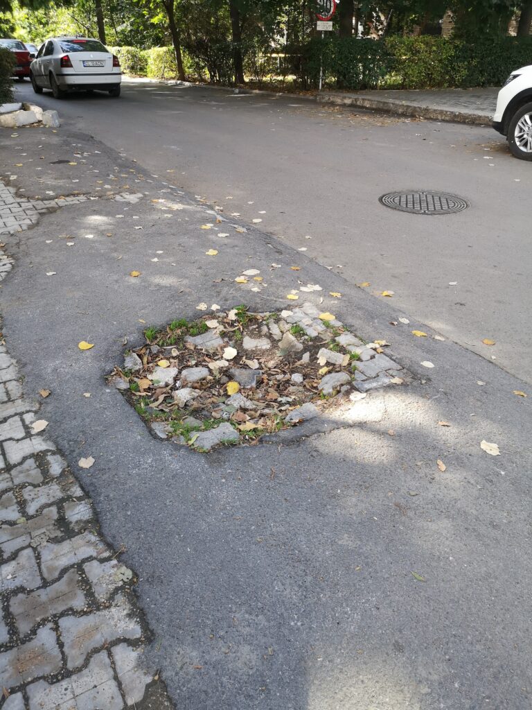
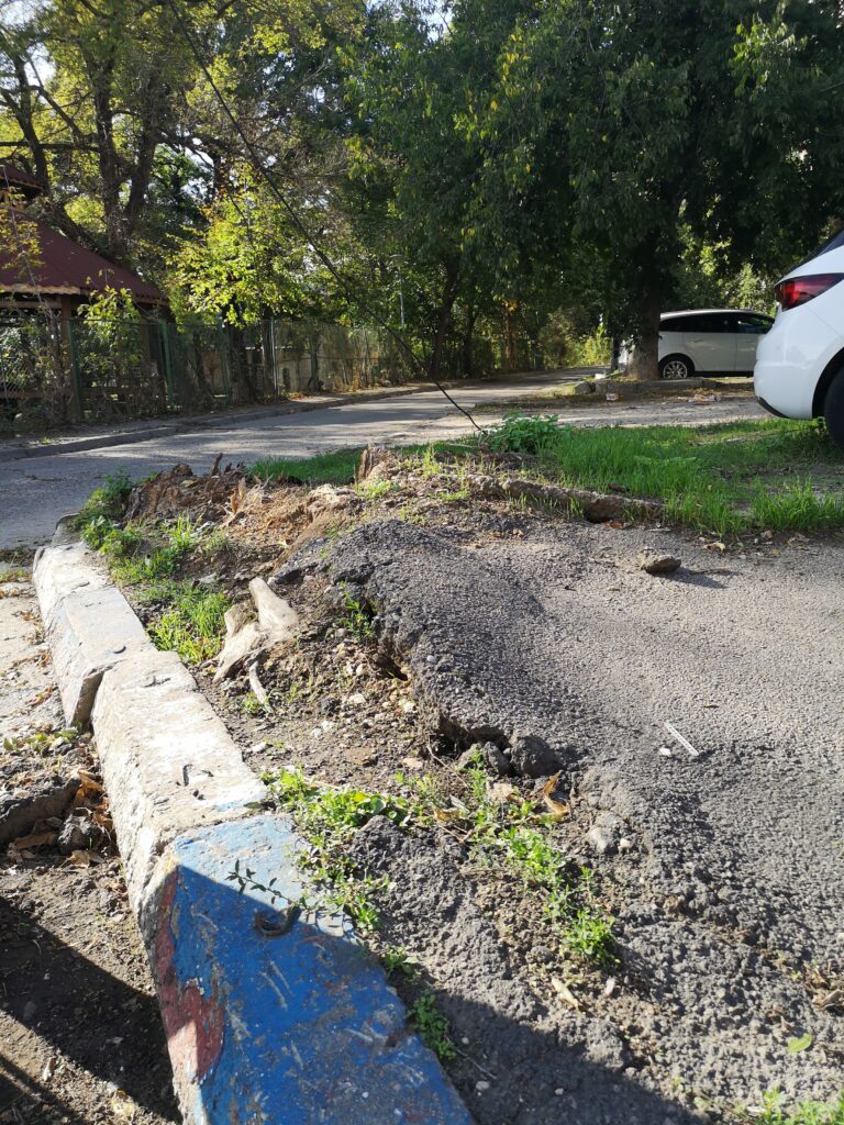
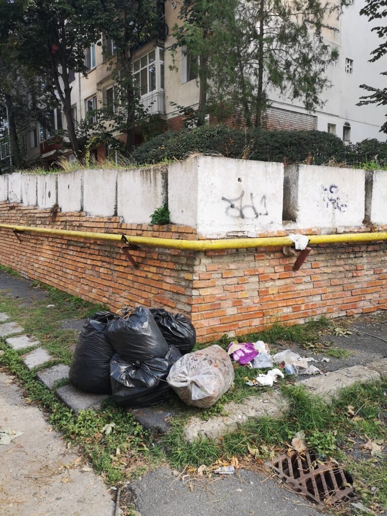
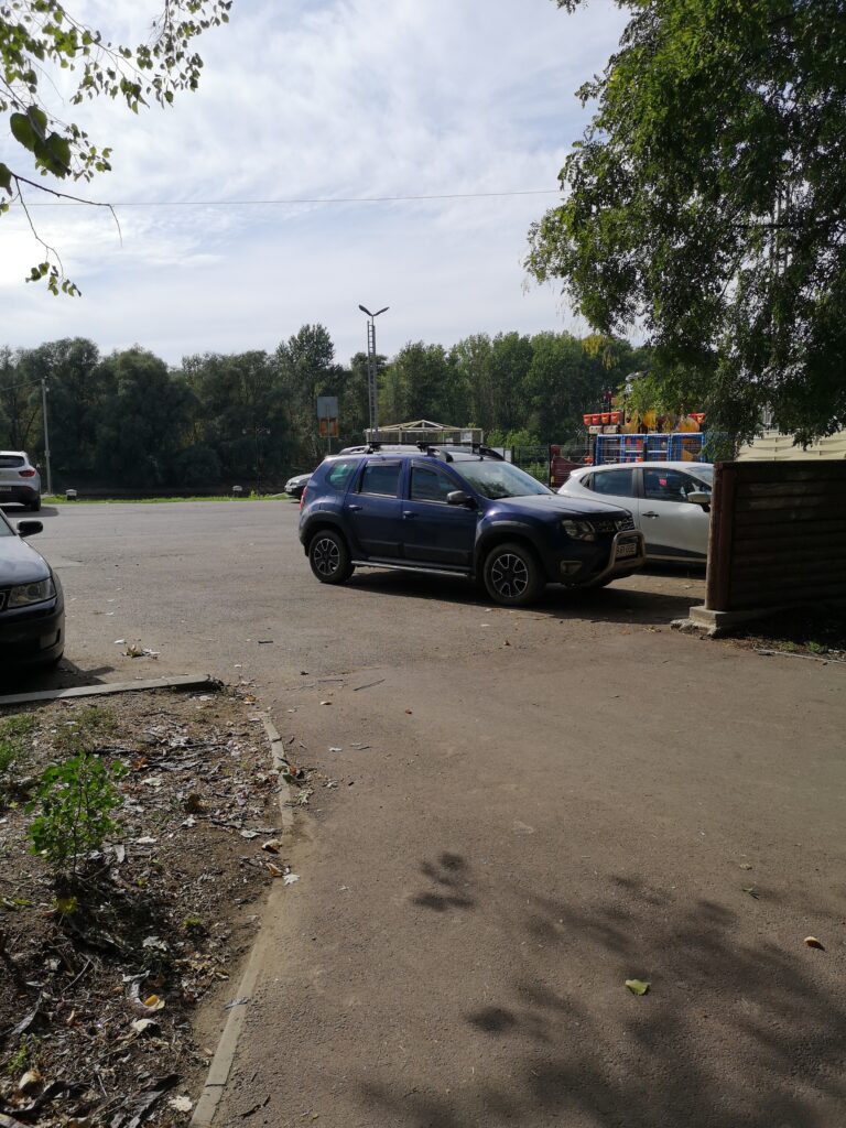
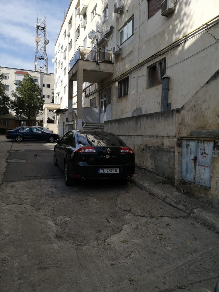
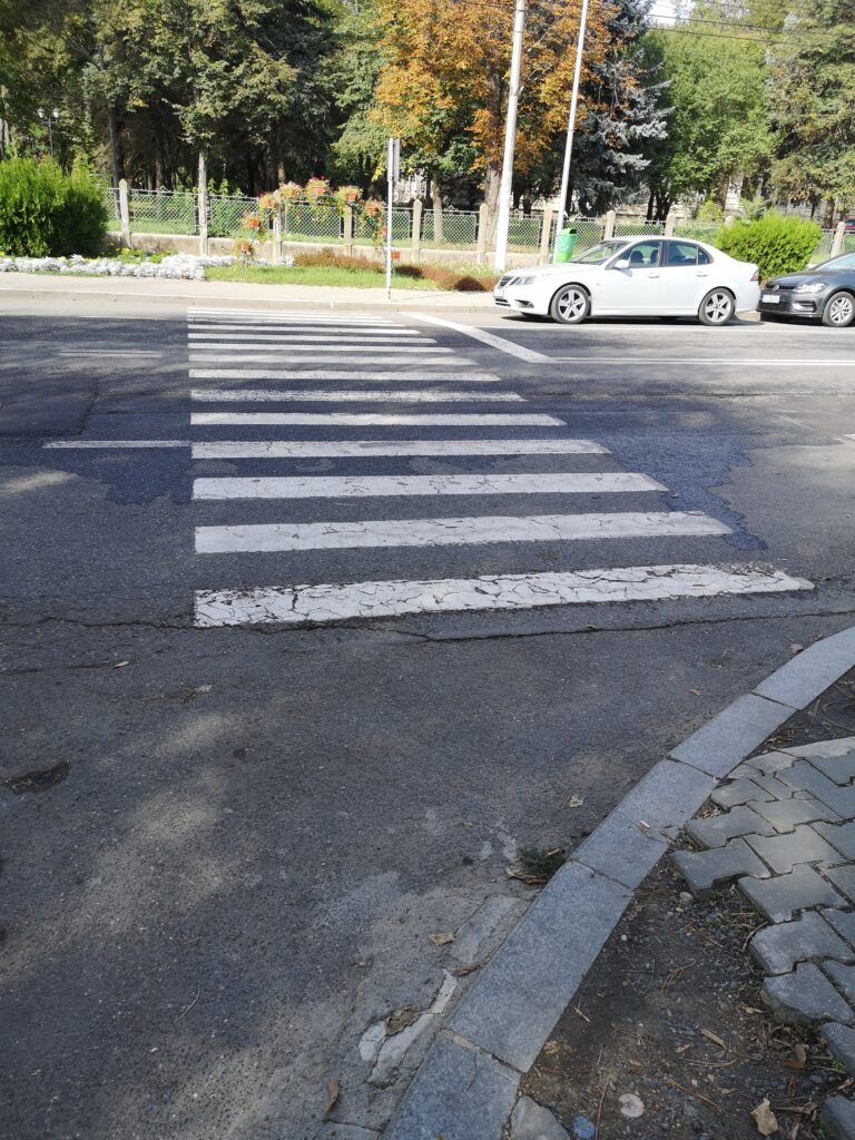
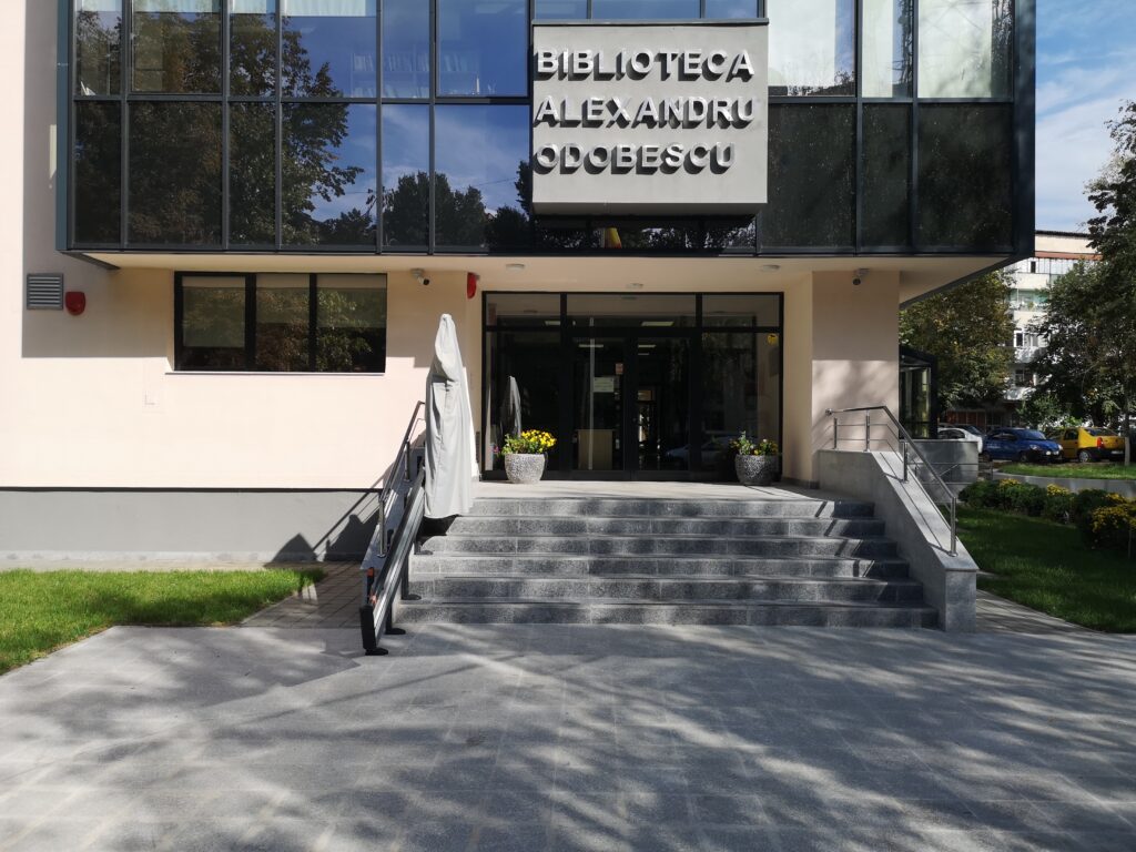
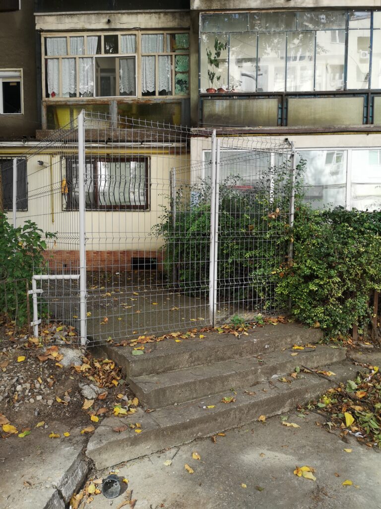
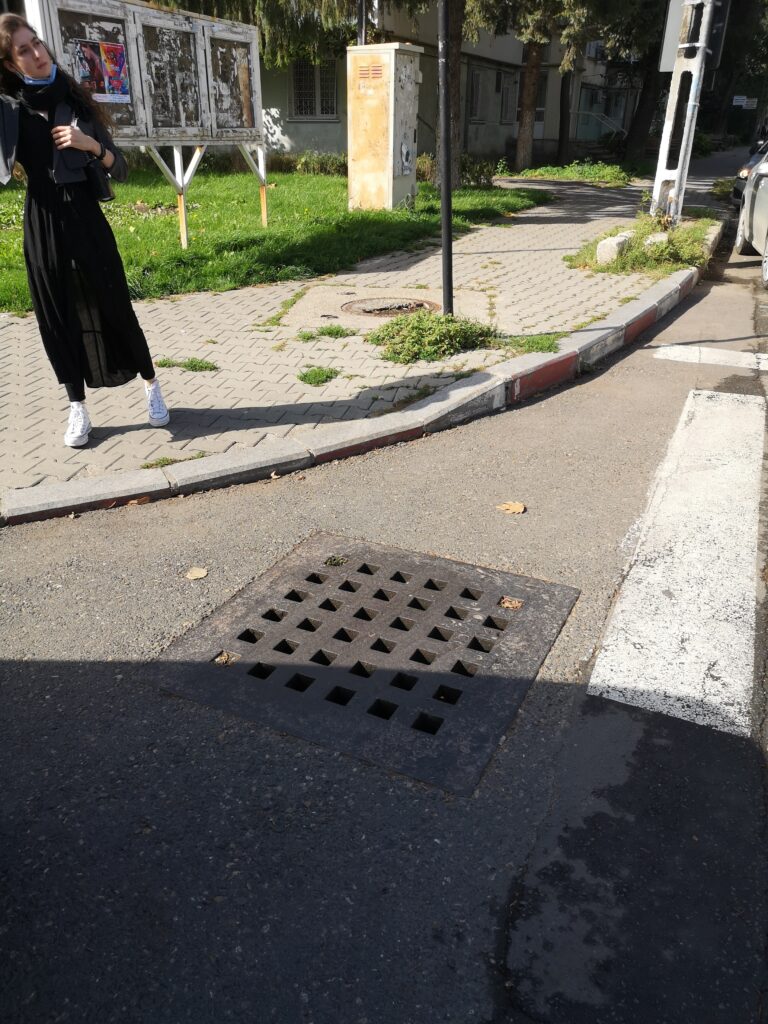
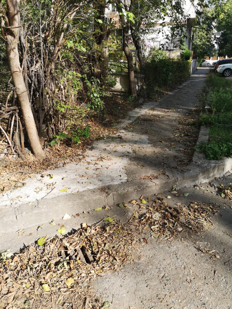
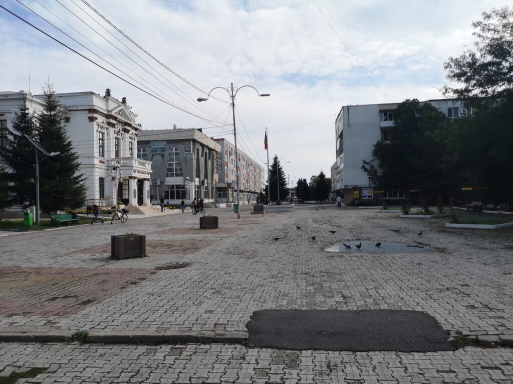
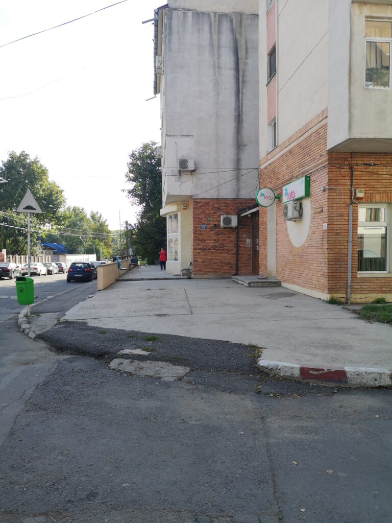
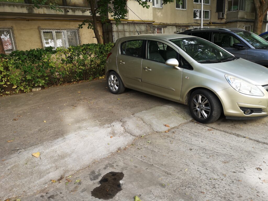
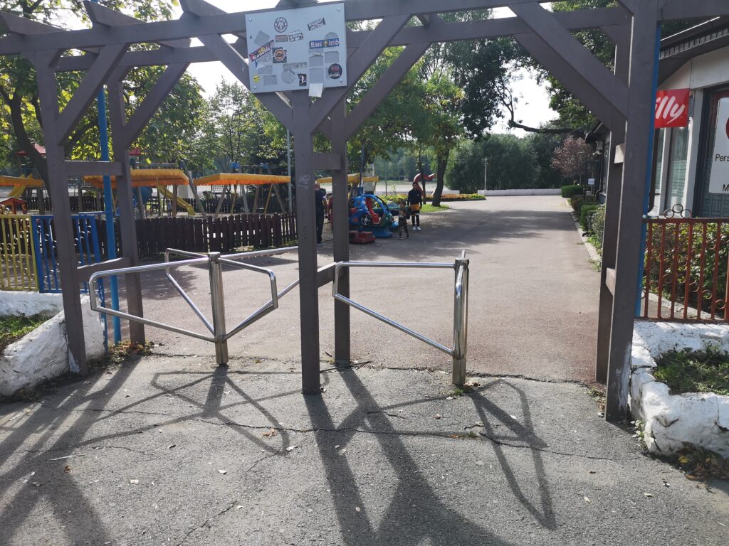
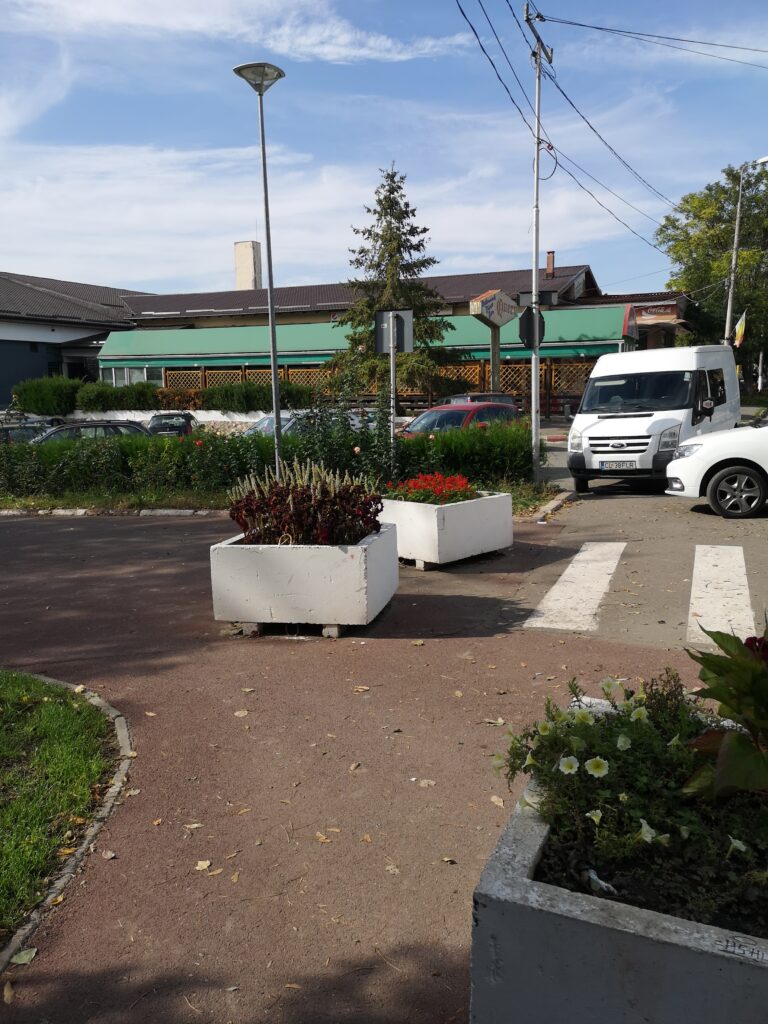
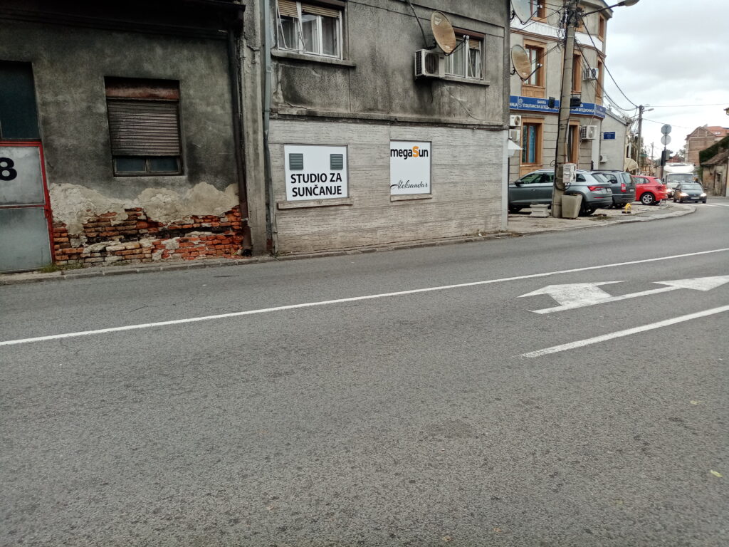
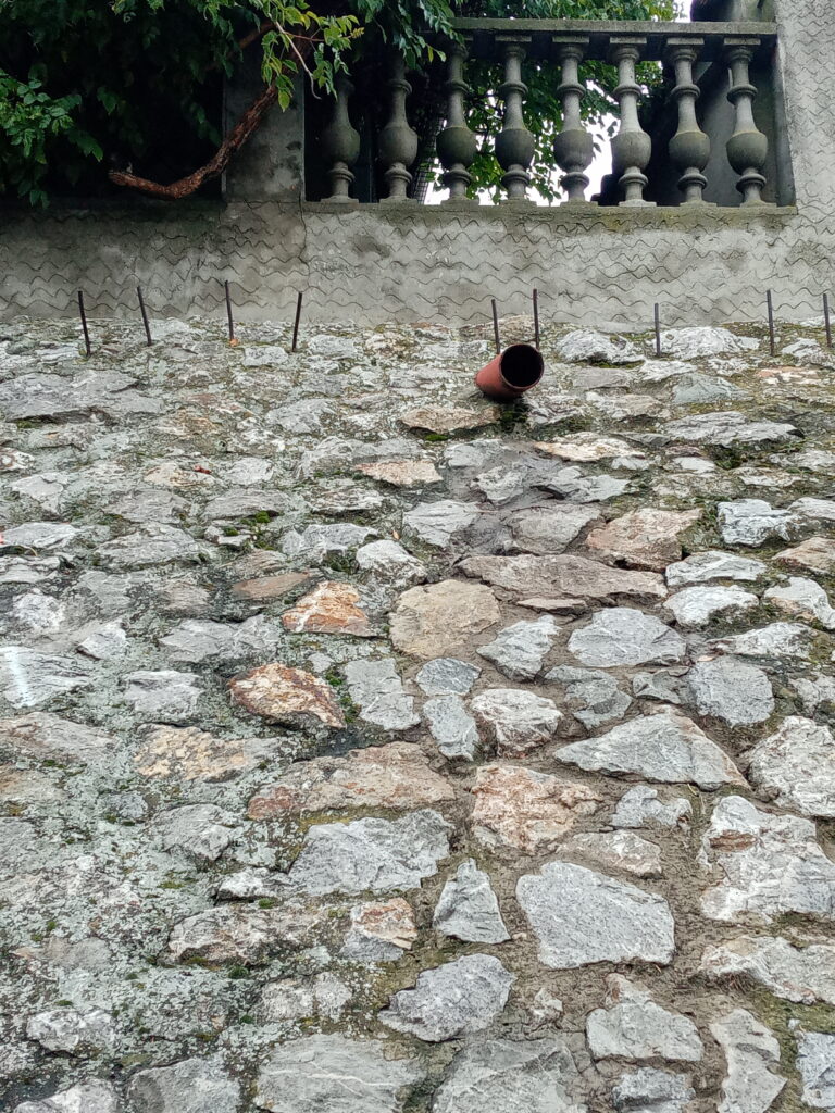
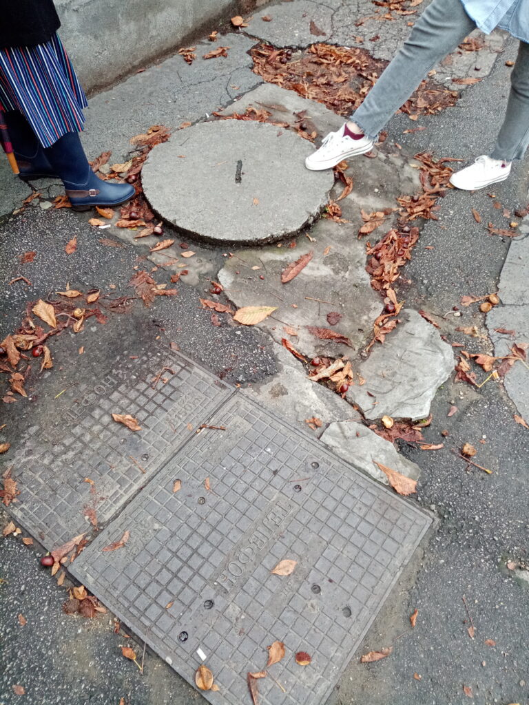
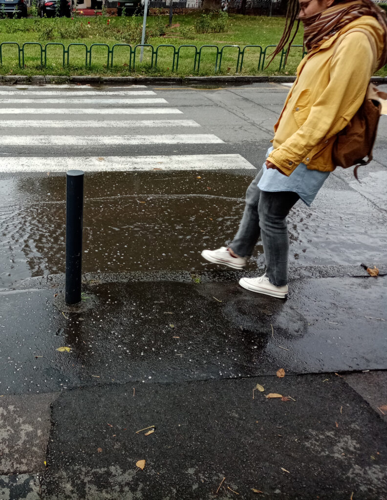
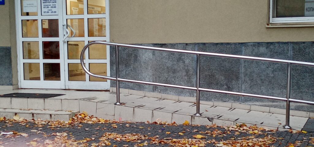
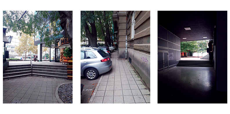
While visiting this place, we made a few statements. The center is mainly pedestrian. Therefore some cars can still access it ( for stores delivery, police etc.). There is not much parking places (and no disabled parking places) which makes it complicated to access for some people. 

Credit by : Juliette Vincens de Tapol

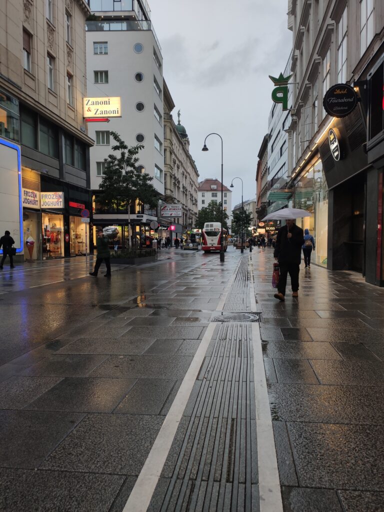
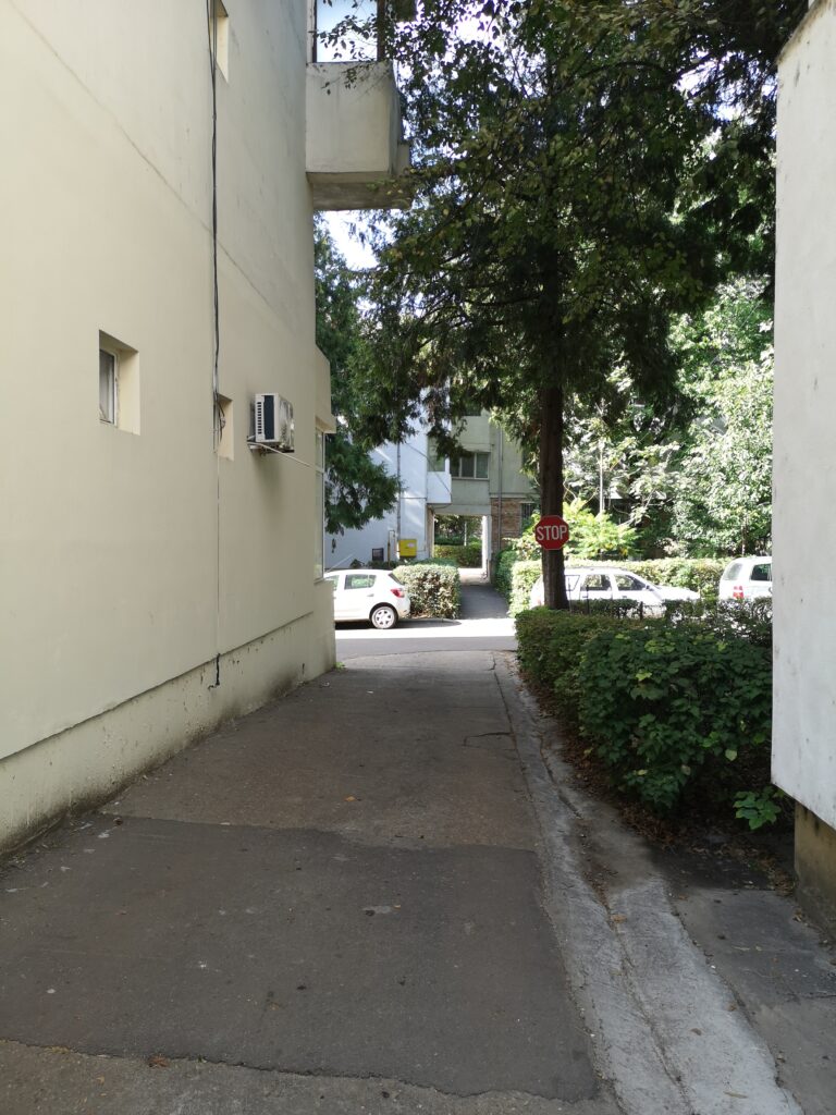
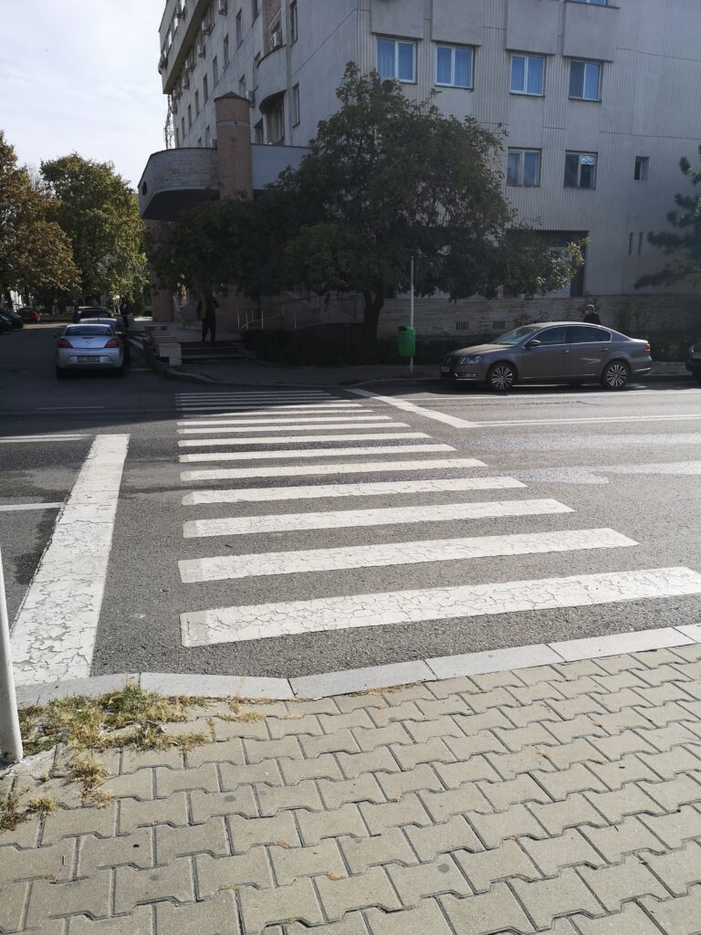
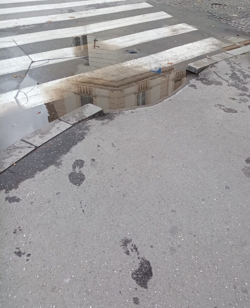
We also found this place quite ambiguous : in fact it is mainly pedestrian so there is no traffic light and crossing lines but some cars are still riding. This situation can be quite hard for blind people that cannot really know where cars run. 

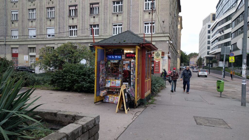
There is no maps of the city in braille as well. 

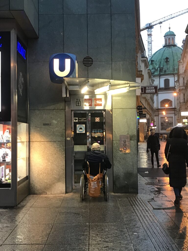
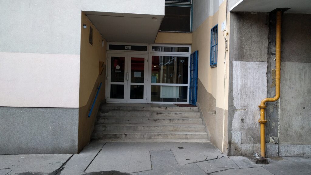
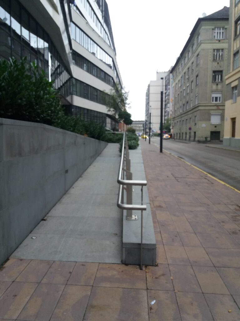
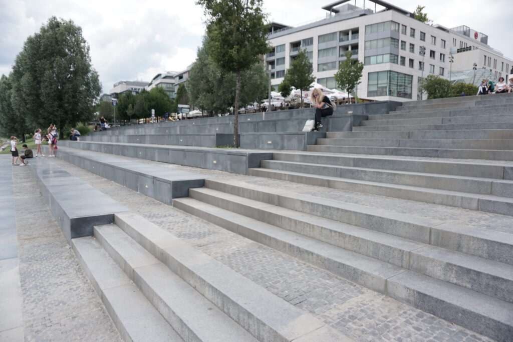
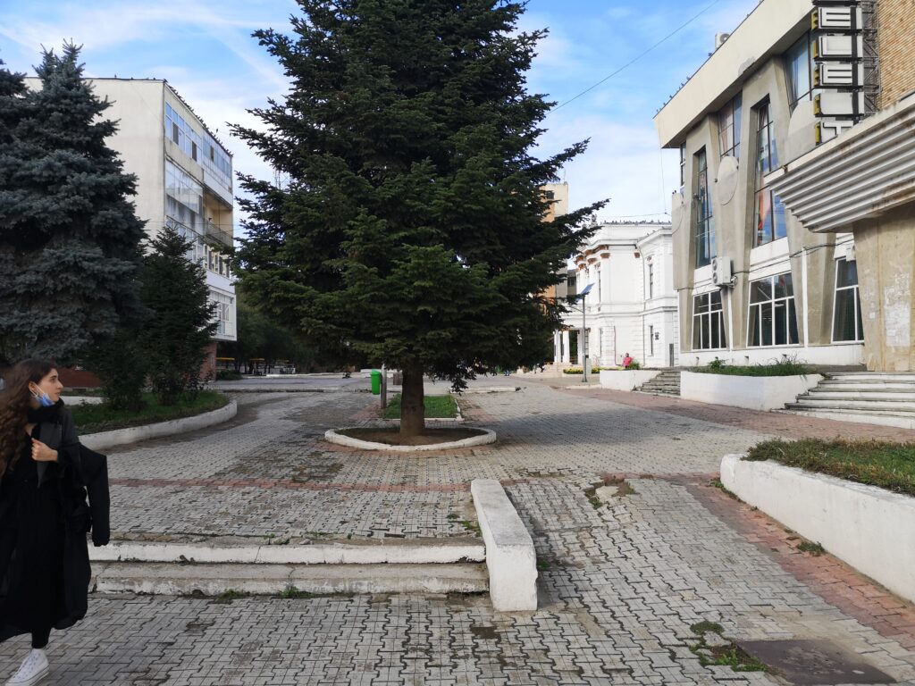
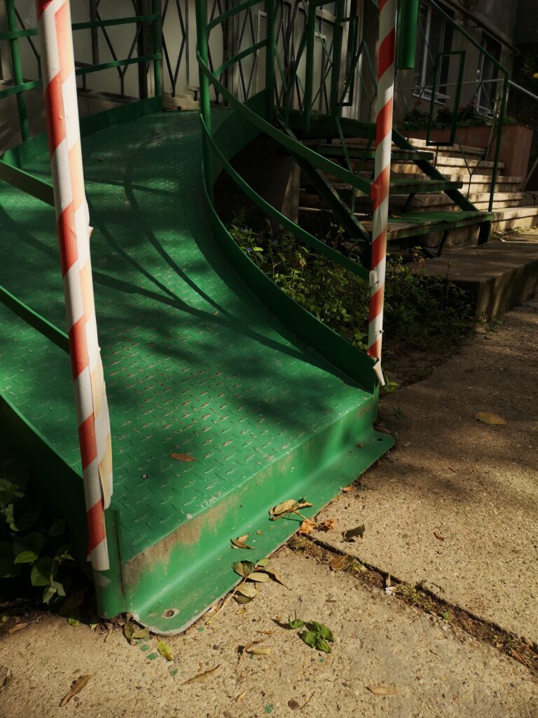
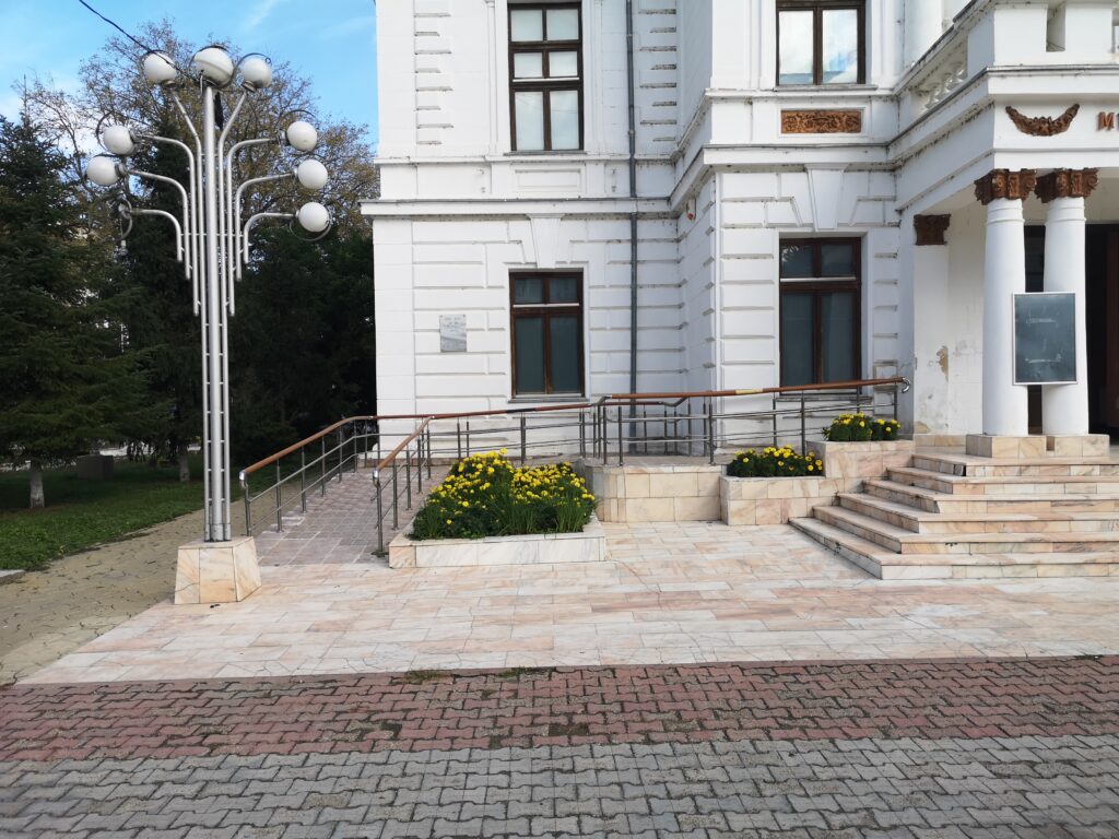
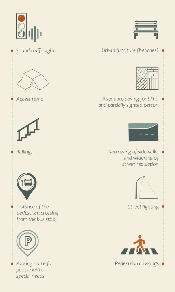
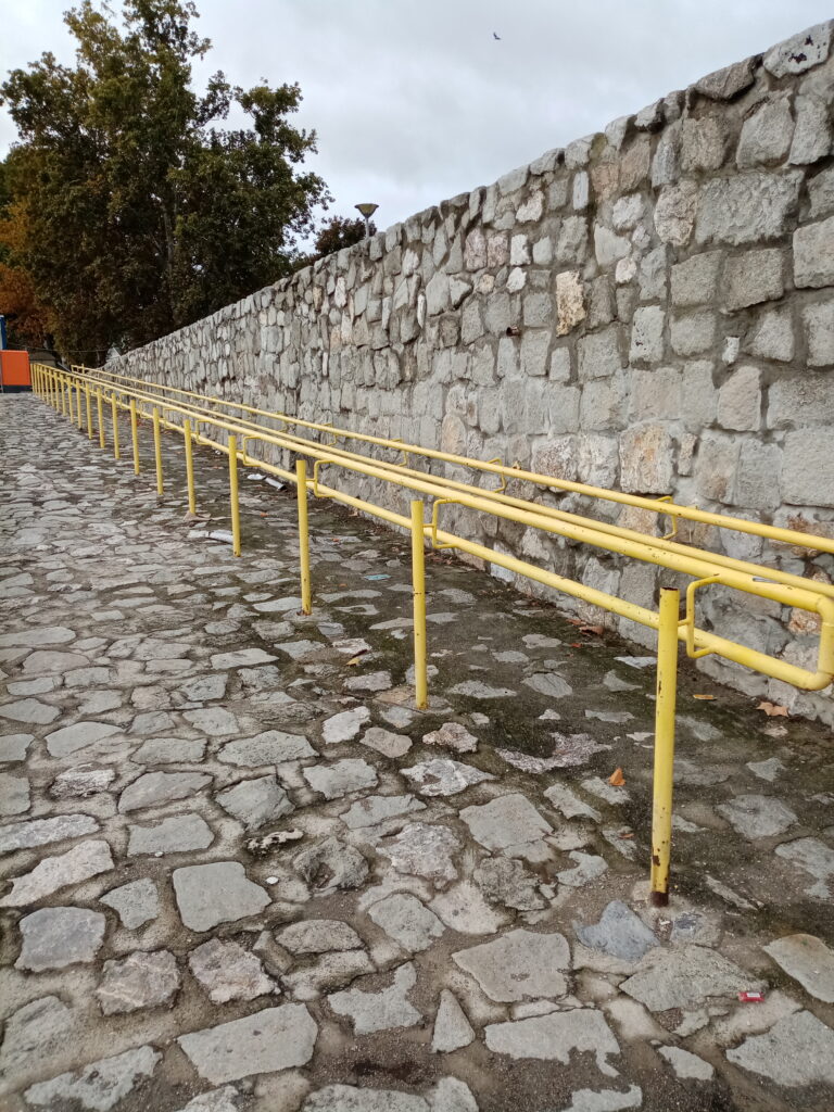
Therefor there is a lot of urban furniture adapted to elederly and people with reduced mobility : a lot of chairs and bench on the sidewalks, lower ticket machine in the subway for people in wheelchairs, ramp in buses and tram and elevators to access the subway and larges sidewalks. 

Credit by : Juliette Vincens de Tapol

In fact Vienna is one of the most accessible capital in Europe.

Accessibility map

About methodology

During our researches we decided to make one track together. Along the walk we took 25 pictures and added 25 markers.

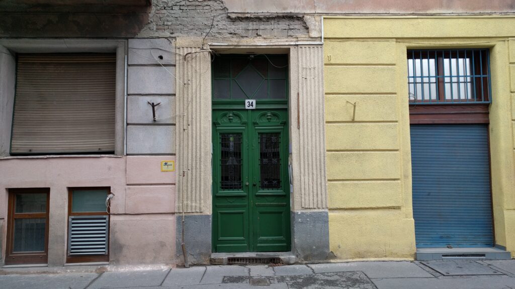
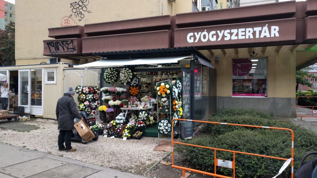
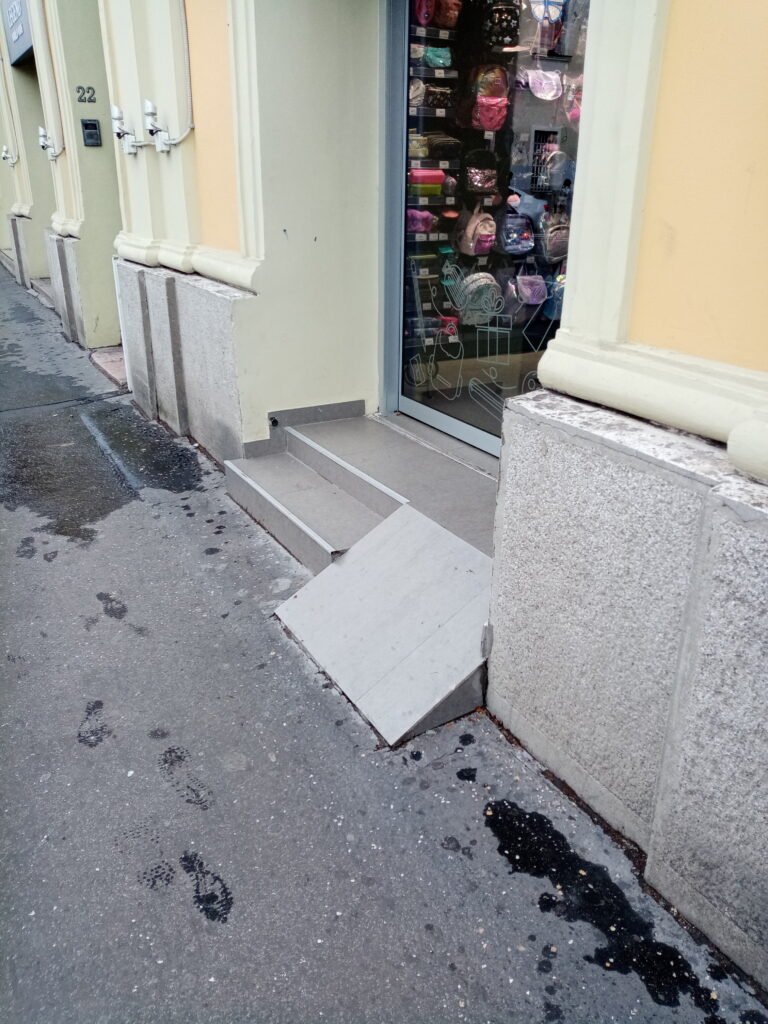
During the walk we also took notes of the general aspects of the site we were studying and the recurrent obstacles. For exemple more then 60% of the stores that we saw had a step at the entrance so we could not add a marker for all those stores.

Difficulties

During this project we faced many difficulties.

Credit by: authors

The handling of the Osmand app was not very intuitive at first, but we got used to it quickly.
To pass the data obtained to GeoJSON we had to follow the instructions since this type of work was new for both of us, so we were a bit slow.
Once the data was in GeoJSON, we had to fix parts of the route and this process was very slow since there were many points, and in order to fix the problem we had to erase point by point which was very tedious.
As for adding the Pop Ups with images, it was a slow process in which we had to be very focus and in which we often had to fix details in the code.

OTHER SOURCES

Categories
Accessibility

The accessibility of ordinary spaces in Budapest

Photo: Google maps and self-made lines

Our research was recorded on one of the streets of Budapest, Szigony. The street is located on the edge of downtown. A really special, diverse street scene has emerged in recent decades because of this pherical situation. Along with the development of Hungary and the Budapest, this district has also changed a lot. This kind of development has had an impact on the built environment – the buildings and the streets have been replaced, yet the role and social stratum of the area in the city have not changed much. For the past hundred years, the street has functioned as a kind of melting axis – this area was most characterized by poverty. Over the years, this area has also been nicknamed: the ghetto. This kind of negative reputation allowed different ages to try to implement mega-projects here. Their goal has always been the same: rehabilitation and gentrification. Today’s investments are also putting these words on their banner.

In our research, we are looking for the answer to how easily the gates of houses built in this special space and social situation are easily accessible. How buildings of different ages do relate to the street – and thus to their social and spatial environment. What gates do we enter through a house? What gates do we enter the city through?

Photo: Bing maps and self-made lines

The Site

Morphological history – development of the area

Morphological history – development of the area

In the 18th century, there was only a small field on the site of the district, with  one-storey houses, orchards and forests. The area fell outside the city border.

Szigony street and the neighbourhood (1782-1785) – First Military Survey

Source: Mapire
Szigony street and the neighbourhood – Habsburg Empire – Cadastral Maps (19th Century)

Source: Mapire

By the 19th century, the area was built. In addition to multi-storey apartment buildings, one-storey houses and large gardens and parks were also typical. Most of the workers from the countryside lived here, so the quality of the buildings is objectionable

Photo: Fortepan/Homoródy Károly
Szigony street and the neighbourhood (1941) – Military survey

Source: Mapire

Due to the Second World War, the area got into a difficult situation. Construction stopped and the neighborhood retained its semi-urban atmosphere. The condition of the buildings began to deteriorate rapidly. Increasingly poorer strata moved in here. There was a crisis throughout the country – but the already more vulnerable areas were more severely affected by the crisis. This is also true of Budapest’s most infamous district – the 8th district. Within that the Corvin district, the Ghetto.

Photo: Fortepan/ Homoródy Károly
Photo: Bing maps and self-made lines

As you can see in today’s aerial photo, huge constructions have taken place in the area over the last 50 years. This trend is also characteristic of today. Construction can be divided into two markedly different eras: dictatorship – socialism / democracy – capitalism.

Socialist architecture

The first plan for the area was drawn up in 1962 and adopted a year later – this is in VIII. included the demolition of the southern parts of the district. In retrospect, it contained unrealistic expectations, with the demolition of 5,800 homes and the construction of 8,200 new homes planned under the second and third five-year plans in the area. In the early 60’s, houses built with traditional technology were designed, the model of the future construction would have been the József Attila housing estate. But the technical, economic, and political changes that took place over the decade (the commissioning of house factories, a new economic mechanism in 68) have significantly modified previous ideas. (Source: https://welovebudapest.com/cikk/2020/4/6/volt-egyszer-egy-nyolcker-50-eve-volt-a-tomo-utcai-toronyhaz-botranyos-atadasa-15-eve-epul-a-corvin-negyed)

Photo: Alföldi György
Photo: Fortepan/Homoródy Károly
Photo: WBL
Photo: Alföldi György

Capitalist architecture

Perhaps the greatest and most controversial rehabilitation of the 21st century in Budapest has taken place in this area, The Corvin Quarter Project. Many refer to this as violent urban rehabilitation. A new luxury shopping street was built on the site of the ghetto. Detached from its surroundings and the past, the investment – which operates as an island – has greatly gentrified its surroundings – and now the surrounding streets have been flooded with new interventions and new constructions. The starting point of the Corvin Promenade is the Grand Boulevard (Grand Ring), while the end point is the Szigony Street. This gives rise to spatial tensions (and we have known since Mies van der Rohe that spatial tensions can be traced back to social tensions).

The development of the area raises many questions. What is a good urban rehabilitation like? Is there rehabilitation without gentrification? Is there good gentrification at all? Are displaced people just an additional loss? Is the city for the people or are the people for the city? Can neglected, low-quality buildings be the value of a neighborhood? Is it a historical heritage? Or is it just mere romanticization? The market first?

Photo: Google maps

Research Agenda

In our research, we are looking for the answer to how easily the gates of houses built in this special space and social situation are easily accessible. How buildings of different ages relate to the street – and thus to their social and spatial environment. Are they closed? Maybe they are open? What does the ground floor of a building serve? Your early social expectations, or your future and past at the same time?

During our research, we took photos of every gates that opens onto Szigony Street. These gates are the connection between the private and public space. The most obvious architectural depiction of their relationship.

Entrance to the other gate
Photo: Benkő Melinda

Results

Examining the buildings we can divided them into 4 different 4 groups.

– architecture of historical ages (before Second World War.)

The ground floor strip of the buildings is well divided – there are cellar passages, windows, shops and entrance doors. Due to this kind of classic façade design, the buildings are aesthetically open to the street, this is their main façade. But in detail, you can’t always achieve that openness – it often has stairs, low or even narrow doors, all of which make your way difficult.

– socialist modern architecture

The ground floor lane is very different from the facade and floor plan of the other levels of the building. This often results in openness – such as in the case of a pharmacy, local government office, or even a supermarket. In this case, the ground floor opens almost completely and is decorated with ribbon windows. This kind of aesthetic openness is also consistent with functional openness – the interior is easily accessible to older people and people with reduced mobility. But if no public function is planned for the ground floor, the facades will become closed, brittle and monotonous. The doors to the stairwells have often been lifted off the ground by a stairs – a delicate gesture on the border of the private and public space on the one hand, and on the other hand they can make it terribly difficult for residents to get around.

– contemporary architecture

Representation is terribly important for contemporary buildings – at least in this area. Rich use of materials, interesting shapes and quality workmanship characterize these buildings. But looking at the entrances, a lot of doubt can arise in us. We can meet visually completely closed buildings (Pázmány Péter University) and visually open buildings (Nokia Headquarter). But given the number and position of the gates, we can conclude that they are functionally closed masses. They try to minimize the direct contact with the street.

Ease of access is a requirement for today’s buildings, but it is important to emphasize that this kind of entrances is often not part of the building’s organization, but only a mandatory, secondary element of it.

– temporary architecture

Due to their design, a barrier-free approach could be solved, yet they do not take advantage of this possibility. Although visually all of the temporary elements are open – as they settled here to serve the local market and society – they are not always easily accessible physically.

Conclusion

After examining the street, we can conclude that the architects do not sufficiently address the issue of accessibility. Many times, easy accessibility is only due to chance or laws. But architects does not treat this as an important part of design.

Description of methodology

To get to know the location, we walked into the area several times. Due to the exchange of views during the walk, we finally decided to deal with the ground floor of the buildings – especially the entrances. We decided to take photos for the most spectacular presentation. During this task, we took 104 pictures, which can be seen in the first map. We chose 22 pictures (equally from every architectural era) from them to show the essence of this research for the better acceptability. This can be seen in the second map.

The movement of people usually has a purpose – and that goal is very often an inside space. This means that one crosses a gate starting from home, then travels outdoors, until finally crossing a gate again — the entrance of one’s goal. We dealt with the starting and ending point of the traffic, the entrances. While this is a limited, narrow area of barrier-free design, as an architect perhaps it can be shaped most consciously. What’s more, because of its dramaturgy, it’s in a particularly spectacular position.

Methodological reflection

It is pretty sad that the workshop was not in Vienna – so it was difficult to focus on both the task and the lectures. Although the app was easily accessible to everyone, the placement of the points was inaccurate and the phone was quickly drained. As an inexperienced wordpress user, it was difficult to insert direct maps, although we were able to easily record multimedia recordings at that location.

Overall, we will continue our research. For us, a different examination of the neighborhood and the buildings would be relevant (floor plan, facades, social strata, etc.) after these, in the future.

Authors: Bence Bene, Adam Pirity

Consultant: Melinda Benkő

Categories
Accessibility

Accessbility in Bratislava

The Site

Waterfronts of Danube
Source: Visit Bratislava (Matej Kovac)

Site that we choose for our research area of bikeability is situated near the centre of the capital city of Slovakia, Bratislava. Namely, we have focused on both sides of the Danubes waterfront.  The waterfront on the left side of the river  is in direct contact with the historic city center. The area between the castle and the old town, formerly known as the Jewish quarter,  was affected by extensive demolition due to the construction of the bridge SNP in the late 1960’s. Despite significant damages and split, which the bridge caused, nowadays it is a big architectural landmark of Bratislava and also a national heritage. We can describe this part of the city as a shrinkage area. Pedestrian promenade along the river is short, not well organised and ends on the private parking lot. On the opposite site of the parking lot along the Danube is New city centre with highrise buildings, administrative districts, cultural institutions and shopping facilities. This area is characteristic with fast construction and growth. 

Eurovea waterfront – part of new downtown
Source: Oto Novacek

On the right bank we can find the oldest public park in middle Europe, founded in the 18th century. This part has more natural character with embankment, summer beach, restaurants or botels. When you cross the park towards Austria, you can find here the biggest residential borough, built of prefabricated concrete panels during communist era, which is a home to 100 000 people.

Petrzalka
Source: Auto.sk

Research agenda

Our choice of locations consist of a touristically attractive small sightseeing circle across the two bridges in the old town area with local heritage, pedestrian promenade along the Danube,  and way from one of the most frequent bus stops to residential borough, Karlova Ves, along the river. These routes are used by a large part of citizens, whether for regular movement around the city, recreation or sport. We focus our research particularly for physical obstacles, hindrances, absence of traffic signs, guidance elements or rest places in public space.

Results

Track 1

We start our mapping under the bridge, at the beginning of a small sightseeing circle along Danube. It is a pedestrian promenade, very popular for tourists but also citizens especially in the summer, when it is really overcrowded, unfortunately not just with pedestrians. You can find here a lot of recreational cyclists and skaters. Promenade has variable widths, benches are located closer to frequent road than water and flood barriers obstruct the view. Boat piers are made of slippery materials and steep. Promenade ends at a small square before the Museum of  natural history. Museum’s main entrance is accessible only by stairs. At the square we find a lot of physical obstacles, such as high curbs, too narrow sidewalk and a lot of stairs. At this ending point is located a personal port ( offering Danube cruises ) also accessible only with stairs. 

Poorly accessible part of the waterfront on the left bank of Danube

Promenade seemingly continues but directly to the private parking lot. The sidewalk here is reduced only to the width of the crossing of two persons, on the opposite side of the road even for just a single one. A walk ends with a seasonal summer beach, accessible  by stairs again, which was flooded during the rainy day. Pedestrian paths are poorly sloped, damaged, have wrong top material and dangerous moments hinders your nice walk and during bad weather the puddles, which make the sidewalk impassable, only if with the right fishing shoes. If you want to get on the bridge or to the new city centre, you have to use alternative route through side streat to frequent crossroad/square before university. The entrance to the bridge is quite steep, but the bridge itself is a pleasant walk with a beautiful view, especially at sunset.

View from the Old bridge
Track 2

The track starts on the bridge for pedestrians, cyclists and trams to the residential borough on the right side of bank – Petržalka. Ending of the bridge crosses pedestrian sidewalk, cycle path and tram stop really unorganized. Along the Danube we can find an embankment with summer beach, parking lot and two parallel ways. One way is only for pedestrians, but it is also used by cyclists and skaters, with free time activities as sports, playgrounds or restaurants. The second way is between park (Sad Janka Kráľa) and an embankment.  This way is specified for one way car traffic and two way cycle path. We can find here crossing of many types of traffic, with no crosswalks. Entries into the park are not wheelchair accessible, there are just stairs and no ramps or not marked paths walked by people in the grass, now in mud.  There is a poor density of pedestrian shortcuts in this type of public space , we find barriers as fences of playgrounds, private properties of restaurants etc.

Pedestrian path with a deth end / gap

Entering and exiting the bridge SNP is hardly accessible for some people. There is no chance to  use an elevator, ramps are too steep, a lot of surfaces and materials, which is used for repairing damages and makes an obstacle in smooth walk.

Track 3

Promenade along the river Danube in natural landscape, mainly  for recreation, sports, but also used as pedestrian shortcut from residential district Karlova Ves, where is located student accommodation too, to the city center. We find here many physical obstacles, ramp protecting path from cars, big parts as unpaved areas just with mud or random gravel. Neglected greenery extends into sidewalk space and again absence of cycle path caused dangerous crossing cyclists with pedestrians.

Natural pedestrian path with no drainge solutions

Methodology

During the accessibility study in Bratislava (Slovakia), several methods of spatial field research were used. Our approach to the topic consisted of GPS movement tracking, which was converted into the path visualizing the researched area. Problematic places and their elements were geolocalized along these paths.  Those were further evaluated by making memos in the form of handwritten comments and remarks. Additionally, our observations are illustrated on photos of the observed places and elements.

The field research was executed with the use of freeware application OsmAnd. Accessibility mapping focused on the total number of 3 tracks in the total length of 6 kilometers. Altogether, 6 number of places were observed, and 36 photos were made with the use of this app. Collected data of the field research were further converted into GeoJSON format  of geographic data structure via geojson.io webpage. This type of conversion ensured further presentability of the acquired data, as well as the possibility of the further research and comparison. The whole approach is embedded within the OpenData principle, when the data are publicly aqurrible, and accessible. 

Methodological reflection

Problems and/or difficulties

The problem point of our research was the un-compatibility of mapping tools from the used application for Iphone users and an unfortunate coincidence of really bad autumnal weather with heavy rain through data acquisition days. We also get into some dangerous situations in confrontation with cars at places without pedestrian/cycle infrastructure. 

Easy points

We consider the easy part of the research site selection and identification of problems.

Potentials and constraints in using the methodology

As a big potential we can suggest using this system by citizens as a real time tool for reporting damages, obstacles or problems to municipalities also as a valuation tool for public spaces, which can be used as part of the participation process. Constraint of this usage is un-objectivity of acquired datas. However, such tool already exists in Slovakia ( Odkaz pre starostu – https://www.odkazprestarostu.sk/, Pocitové Mapy – https://www.pocitovemapy.sk/).

What was good/bad suited to illustrate the observations
Mast creates a significant barrier

Overall observations show the poor condition of the basic sidewalks, coverings, channel outcrops, lack of accessibility caused by high curbs, stairs without ramps or alternative paths, poor markings for the blind, incorrect transitions when designers change the pathway materials, steep ramps, sidewalks ending nowhere, neglected greenery. Shared scooters and bikes parked in the sidewalk area. Waste bins, pillars of signs, lamps or barriers for cars, still occupy an area for pedestrians and it becomes dangerous. Pedestrian connections and shortcuts are not supported by crossings.

Many access points to Sad Janka Krala park are stairs
Which questions could be relevant for further research?

Daily usage of focused areas, which kind of people we can find here and how they are moving or behave in locations. 

Categories
Accessibility

in/visible layers

LGBTQ+ Spaces in Piotrkowska Street, Łódź, Poland

https://en.wikipedia.org/wiki/Piotrkowska_Street#/media/File:Piotrkowska_Lodz_1900.jpg

Piotrkowska is a 4.2 kilometers pedestrian zone and the central street of Lodz that functions as a commercial center; a cultural and historical space of architectural landmark, art installations, creative activities, and event; a tourist attraction for both local and foreign travelers, and a political space with government buildings, and official celebrations, and protests occur in the street.

In 2019 several municipalities of Poland declared themselves as LGBT free zones. While this act has ongoing debates regarding its constitutional legalities, as a symbolic action, it has intensified homophobia and exclusivity of LGBT spaces and communities. Lodz is considered as one of the Red Zone areas according to the https://atlasnienawisci.pl.

Screenshot from https://atlasnienawisci.pl

While inclusivity and accessibility of LGBTQI+ spaces requires visibility of such spaces, this also brings problematic situations in increasing the physical visibility of identified LGBTQI+ spaces or establishments as it may present safety issues and harm the same spaces.

We set out to look for visible signs that would show a sense of accessibility, safety or friendliness on the street of Piotrkowska by looking at the exterior and interior of establishments.  We embarked on this search, taking into account that the most used symbol that we could look for is the rainbow flag, which represents the movement of this large community.

We searched the addresses that we found online through https://gayplaces.pl and advertised in Google maps. Based on this online data, nine are in the main street of Piotrkowska while six are close to the parameters of this main street. On the other hand we kept our eyes open for other visible visual signs of inclusiveness in the area we delimited as our perimeter.

Screenshot from https://gayplaces.pl/search/Łódź

During our excursion, we traced, marked places, took pictures, and recorded audio on the spots that had some relevant data for our research. Comparing the online data with our on-site observation, we found that only two establishments had a visible sign of LGTBIQ+ friendliness with images of stickers and poster on the windows or door of a shop. Another important finding was the sighting of three graffiti on the walls of Piotrkowska Street of the rainbow flag with a black cross on top. One of the graffiti corresponds to the address of the Fabryka Równości, an equality factory-LGBT+ organization setup in Lodz. Other than that, we could not find two places that were advertised online.

It is also important to acknowledge that we are somehow outsiders to the culture mainly because we are foreign students and has language barriers. Our interpretation of the finding could be short-sighted, but we also wanted to address this issue exactly from this position, which others can share with us as international students, immigrants, or tourists in this city.

The majority of the establishment did not put up any visible sign or symbol of their LGTBIQ+ friendly policy or accessibility for people of the community. We question this fact taking into consideration the context of the city at this moment, where it has been declared as one of the LGTBIQ+ ideology-free zones. Perhaps the lack of visibility is a response to the possibility that advertisement may be a hazard to these places, making them a focus of some form of harassment from the supporters of this policy. In a way, online visibility seems to be more open and perhaps safer than the physical one.

It is difficult to assume the series of events connected with the graffiti. It is curious to know who or when it was painted, was the rainbow painted first, and then overlayed with the slash sign later. Still, these signs affect feelings of exclusivity and inclusivity in a public space. 

Credit by: authors
Field audio recording, Piotrkowska 71; The audio is an ambient sound of the park which can be combined with the AR art installation. Credit by: authors

If these identified LGBTIQ+ establishments start putting up obvious signage, it does not necessarily guarantee their visibility; rather, this physical visibility of signs also becomes problematic. How then can accessibility to LGBTIQ+ spaces are provided through increasing their visibility while considering the safety of such space?

If intervening in the physical dimension presents constraints, perhaps it can be intervened through a digital space. With our background on media arts and visual arts practice, a recommendation for increasing this visibility can be through Augmented Reality (AR) where a dynamic interaction may happen between the physical and augmented space, and the mobile device user or audience navigating these layers of spaces.

The AR station is in mock up stage, but it is inspired with concept of wall graffiti and digital vandalisms. Whether if this is the best digital solution to solve the visibility and accessibility of LGBTIQ+ spaces is yet to be researched further but creating creative and artistic solutions may create a dialogue thus contributing to a sense of visibility.

Credit by: authors, Software: ARpoise

“Augmented space provides a challenge and an opportunity for many architects to rethink their practice since architecture will have to take into account the fact that virtual layers of contextual information will overlay the built space. If we assume that the overlaying of different spaces is a conceptual problem that is not connected to any particular technology, we may start to think about which architects and artists have already been working on this problem”. Manovich, L. (2006). The poetics of urban media surfaces. First Monday. https://doi.org/10.5210/fm.v0i0.1545

Authors: Czarina Calinawagan, Julia Bande, Meraj Sharifi
Students of the Erasmus master program at DUK Media Art Cultures, currently at Łódź University.

Categories
Accessibility

“U.A.U.I.M. Accessibility – Călărași –

” Hello and welcome to our blogspot! Our names are Cristian and Patricia and we put up below some informations about the city Călărași and about our study on it. “

Location

   Călărași is a city situated in the south – eastern region of Romania, on the bank of Danube’s Borcea branch, at about 12 km from the Bulgarian border and 125 km from Bucharest.

History

Situated on the site of a prehistoric village ‘Lichirest’ from the time of Mihai Viteazul, the settlement appeared for the first time on a map drawn by Constantin Cantacuzino, in 1700. It got its name after it was made by the Wallachian princes, in the 17th century, a station of “mounted couriers’ service” on the route from Bucharest to Constantinople. The service was operated by horseback riders (”călărași”), so this is where it got its name from. It expanded into a small town, and in 1834 became the surrounding county’s capital.

source: https://en.wikipedia.org/wiki/C%C4%83l%C4%83ra%C8%99i

source: https://dariocaballeros.blogspot.com/search?updated-max=2012-11-09T13:00:00-07:00&m;

Access

The city connects by A2 (“The Sun’s Motorway”) which has 3 exits for Călărași and also is connected by DN3, DN21, DN31 and DN3B. The city lies on the 7th pan-European corridor of transport (the Danube river) and is next to the 4th pan-European transport corridor (Dresden–Constanța) at 26 km (16.16 mi). It is also connected by a railway, so you can visit by boat, train or car.

Danube and the city

The “Danube River” borders the city of Călărași to the south, and the “Borcea” arm, which detaches on the left bank downstream of the “Chiciu” point, crosses the urban area from south-north to southwest, after forming the Borcea bend. The Borcea arm is 99 km long. On the left bank, an industrial canal (13 km long) was built to allow barges loaded with raw materials (scrap metal, ore, coal) for the industries. The canal is crossed by a modern bridge with four lanes that connects the city to the Danube crossing point at Chiciu – Ostrov, being also an excellent place for fishing and training for water sports.

The entire urban development of the city comprised in The General Urban plan of Călărași  is oriented towards capturing the resource represented by the Borcea arm and its connection with the Danube. Both from the point of view of the orientation of the central functions, and from the morphological point of view, Calarasi pursues in its planning program the better opening to the water, the functionalization of the rivers banks and opening to the public, as well as the use for public interest of the extremities –ex-industrial sites, that can become part of a larger green recreational area and promenade.

Demography

The general evolution of the population of Calarasi after 1990 is marked by a decrease in population, a decrease in natural growth and evolution negative increase in migration, until the years 2003-2004. In the last 4-5 years there is a slight increase of the population and a positive evolution of the migratory increase.

Heritage

Protected natural areas:

Caiafele Forest, Ciornuleasa Forest, Fundeni Forest, Tămădău Forest, Vărăşti Forest, Special Protection Area of Avifaul C commune Cuza Vodă and the Municipality of Călăraşi), Haralambie Island Nature Reserve (on the Danube river, km 400), Şoimul Island Nature Reserve (on the Danube river, km 350, near Dichiseni locality), Ciocăneşti Island Nature Reserve, on river 39, Ciocăneşti commune).

Building protection:

The most important protected buildings, included in the “List of historical monuments classified in group A and B, published by the Ministry of Culture and Cults.

Morphology

   As an urban form, the city is adapted to the position and geomorphological features of the territory, its tissue is linear, orthogonal and oriented with the long side parallel to the bank of the Danube. The street plot is differentiated according to the main connections of the city with the territory. The main street – Bucharest Street – crosses the urban fabric parallel to the waterfront, establishing a West – East axis; Eroilor Street connects the city with the southern area and Sloboziei Street with the northern one. The central area is detached by the drop in built concentration and by the presence of the large buildings of important institutions and services. A particular element is the pedestrian street 1 Decembrie 1918, between the Prefecture and the central hall, an area that was originally designed for trade and the promenade, with potential of rearrangement of the public space, currently having a few points of interest and too few connections to the waterfront.

   The green structure of the city follows the linear and rectangular plot of the streets, with concentrations arranged near the waterfront and with some points of recreational interest in the vicinity.

Our research agenda

   In our research of the study area we encountered several problems that could be placed in categories as followed below.

   The main problems are the ones endangering all the citizens. The city lacks maintenance of the public space so as a result the pavement is displaced from its initial position or cracked with holes, the boundary between the sidewalk and the roadway dissipates, as in the case of several exists from the park or behind the collective housing units.

   The secondary problems are the ones that endanger citizens with disabilities. The city lacks proper accessibility so the connection between the sidewalk and the crosswalk is not made accessible for disabled citizens, the dimensions of some sidewalks is too small for maneuvering wheelchairs, the crosswalks and bus stations are not marked with tactile surfaces or sound traffic lights, most of the public and housing buildings do not have access ramps/ have too steep ramps or the ramps are blocked by deposited construction materials or scaffolding, the grill of the sewers is oriented the same direction as the travel path that could cause wheel blocking or damage.

   The tertiary problems are the ones that create discomfort for both types of citizens, both visually and kinestethic. Some objects, like old wood sash windows or common garbage disposal bags, are disposed of outside in the streets in some areas, there are blockages at the park entrances, most of the ramp connections are actually patches of asphalt.

Research questions

   How could GIS based platforms help solving some of the architectural – urbanistic problems of the danubian cities?

   How could the citizens contribute to the improvement of their cities by using these GIS based platforms?

   Would the integration of data collecting platforms within the social structure of the city become a necessity for it to become smart?

Results

{
}

We observed the way in which certain neglected aspects of the infrastructure can influence the general accesibility of the citizens, so the city becomes an uncomfortable place particularly for the disabled.

We also noticed that the city has a real potential for development in relation to the Danube and many neglected spaces that can be arranged as public promenades for pedestrians. This recreational potential is also related to the Danube beaches, places little known, which can represent a leisure destination not only for the locals, but also for the people from other cities.

Description of methodology

What did you do?


Task I: Preparation of data acquisition

  • participation to the online presentations
  • installing OsmAnd
  • inform about Geodata& GIS format
  • troubleshouting
  • informing about site
  • creating the 2 group on topics
  • creating the FB group
  • dialog with teachers

Task II: Data acquisition:

  • going on site- Călărași
  • meeting with stakeholder – Călărași Museum
  • making the route- as pedestrians, observing
  • taking pictures, video, notes

Task III: Data preparation

  • Cleaning data
  • Sharing data

Task IV: Web-mapping

  • linking the photos with pic2map.com
  • checking the accuracy of photos and tracks
  • importing the .gpx file with the tracks and markers on geojson platform
  • adjustig the geometry of the track

Number of tracks recorded: 1

Number of markers recorded: 73

Number of media created: 73

Methodological reflection

Problems/difficulties encountered?

In the beginning we encountered some problems in understanding how to work with these geospatial data and tools, but they were quickly overcome, especially thanks to the collaboration between our teams and the project coordinators.

What was easy?

The easiest and the most pleasurable part was observing all the aspects of accesibilty in a critical manner while walking and experiencing the city ourselves.

Potentials and constraints in using the methodology

Potential – to use this method in other projects, cumulating various data and providing a real picture of the studied territory.

Constraints – related to the participants’ level of knowledge and speed of assimilating the procedures of data acquisition, cleaning, visualization and sharing.

What was good/bad suited to illustrate the observations

The positive aspects were that the visual tools were easy to use in the project results and we had the chance to learn how to use a new useful application of data acquisition, as well as managing the blog.

The less satisfying aspects were related to the fact that there were no other tools for collecting data about real “sensing the city” – at the level of involving all the other senses.

Which questions could be relevant for further research?

Is it possible, through the same GIS and geodata tools, to move from the level of acquisition and visualizing aspects, to the level of interpretation and modeling (2D and 3D)?

……………………………………………………………………………………………………………………

Ion Mincu University of Architecture and Urban Planning

The ”ACCESIBILITY” GROUP

Cristian Mormenschi and Patricia Stan

Faculty of Architecture

October, 2020

……………………………………………………………………………………………………………………

Categories
Accessibility

Belgrade • Zemun

Creative Danube

“An inclusive city is one that values all people and their needs equally. It is one in which all residents – including the most marginalized of poor workers – have a representative voice in governance, planning, and budgeting processes, and have access to sustainable livelihoods, legal housing, and affordable basic services such as water/sanitation and electricity supply.” – Rhonda Douglas

https://nextcity.org/informalcity/entry/commentary-what-we-mean-by-inclusive-cities

Research focus

The methodology of work is based on the identification and mapping of the characteristic spatial elements that satisfy the user regarding to accessibility. Namely, the research includes an overview of the existing infrastructure points that enable the traffic inclusion of all users.

The main point of the research is focused on the elderly, people with disabilities, blind and visually impaired, and deaf-mute people.
We presume that the current conditions are not in line with the projected regulations, but we hope that there are possibilities for correcting them.

:: Definition of research area

:: Route plan with major urban landmarks

:: Micro-zoning based on urban matrix and functions

Location

Zemun is sincerely a unique part of Belgrade. It hides the beauty of its authentic atmosphere on the Great War Island, an oasis of greenery, a bird sanctuary, and the pearl beach of Lido. Zemun is one big promenade in history with numerous cultural and historic monuments, which together form a valuable urban ambient. Catering facilities, barges, cafes, hotels, galleries, shops of forgotten crafts, winding streets under the cobblestones and gastronomic wonders – all this is Zemun, with an old and nurtured tradition of hospitality.

The starting point of the route is the Main Street, which leads to the cultural and historic entity of Millennium Tower. The route continues towards three squares: Veliki (Eng. Large), Magistratski (Eng. Magistrate), and Masarik Square, with the tour of the port of Zemun. The last phase of mapping involves the analysis of the City Park, by which the route ends.

The research area includes three zones:

  1. Lower town (inner core);
  2. Millennium Tower (Gardoš);
  3. Ćukovac.

Within them, five inner cultural-historical ambient areas can be identified:

  1. Millennium Tower;
  2. Zemun Quay;
  3. Three central squares;
  4. City Park;
  5. Main Street.

:: Movement dynamics diagram

:: OsmAndMaps

Local heritage

:: Mapping urban landmarks

  1. Church of St. Demetrius

The Church of St. Demetrius or better known as Hariš’s Chapel is the temple of the Serbian Orthodox Church in Zemun. It is located in the Zemun Orthodox Cemetery. It was built in 1874-78. a year and dedicated to the Holy Great Martyr St, Demetrius, the protector of the Petrović Family. The chapel was built by Grigorije Hariš, a merchant from Zemun, as the will of his wife Marija, born Petrović. The builders of Hariš’s chapel are Arch. Svetozar Ivačković, designer, Josif Marks, builder, Pavle Simić, iconostasis painter and craftsman Jovan Kistner, woodcarver and Samuel Colmayer, iconostasis goldsmith. The chapel was built on two levels, on the first level, which is partly buried in the ground, there is a morgue whose entrance is in front of the stairs leading to the chapel. Above the morgue is the basic space of the chapel where church rites are performed.

2. Zemun cemetery

The Zemun Cemetery is a public cemetery located in Zemun on the Gardoš Hill. The cemetery has been declared as cultural monument. In the Orthodox part of the cemetery is the protected endowment church of St. Demetrius, the chapel of the Spirta Family (around 1911), Fallen and dead Serbian fighters 1914-1918 (1928), important graves of the former colony of Greeks and Aromanians, Russian emigrants (since 1920), among them the first pilot’s Yugoslav passenger planes, businessmen, philanthropists, priests, scientists, writers, artists, and others, which contain a significant number of works by famous sculptors: George Jovanović, Dragomir Arambašić, Vojin Bakić, Petar Palavičini, Tomo Rosandić, and others. In the churchyard, there is a memorial on the grave of the found citizens of Zemun, who died in 1943 in”Stara Gradiska” Ustaše Concentration Camp.

3. Millenium Tower

What makes the city municipality of Zemun recognizable is certainly the Millennium Monument (lookout tower, postcard tower). It was built by the then Hungarian government, which was supposed to highlight the 1000th anniversary of statehood, as well as the longer affiliation of these parts to the Kingdom of Hungary.
Monumental buildings sprouted in all parts of the monarchy, and the tower, which is located today on the territory of the Municipality of Zemun, was the one.
The 36m high tower was designed by Hungarian architects, in a combined construction of stone and brick, it was made as a mixture of styles, with a predominance of Romanesque elements. It certainly captivates with its style and beauty of architecture and elements. It is 36 m high. The construction of the tower was completed on August 5, 1896. The ceremonial opening was 15 days later when a solemn worship service was held in all Zemun churches. Throughout history, it has been a symbol of power, an observatory, and a lookout, and today it is equally sublime in the service of art and culture.

4. Madlenianum Opera and Theater

The Madlenijanum Opera and Theater (more often Madlenianum in Latin, according to the official website) is the first private opera and theater company, both in Serbia and in Southeast Europe. It was founded by Madela Zepter, the wife of Filip Zepter, a Serbian businessman.
Madlenijanum was founded on January 26, 1999, in the building that previously housed the second building of the National Theater in Belgrade. After seven years of operation and five different phases of reconstruction, on April 19, 2005, the completely renovated, reconstructed, and conceptually enriched building opened its doors to the public. It is located in the old town of Zemun, which is a spatial, cultural, and historic ambient zone of an exceptional importance. The theater shows opera, ballet, concerts, as well as drama and music programs.

5. City park

The main part of the present-day Zemun has an interesting history. On the site of the park, from 1730 to 1871, there was so-called contumacy (Kontumca) i. e. quarantine, which housed passengers who would travel from the other side of the Sava River to the then Austro-Hungary. The rearrangement of the Kontumca space into a park according to European standards was carried out in the 1880s. The idea creator and manager of the works was Ivan Perković, with the great support of the city leaders. It covers an area of ​​7.72 ha with deciduous and evergreen trees, of which 15 trees are under state protection.

6. Homeland Museum Zemun

The Zemun Homeland Museum is located in central Zemun, in the building of the Spirta Family, built in the middle of the 19th century. The museum was founded in 1954 and was opened to visitors in 1970 when the house was adapted into a museum. Since 2002, the Museum has been closed to visitors because reconstruction is still underway (2020). The main part of the building reaches the height of the neighboring houses. It is of three-tract type, with a side wing in the yard and an asymmetrically placed carriage entrance. It has a richly equipped interior, characteristic for rich civic houses. Decorative wallpapers, stylish ceilings, ceramic stoves, fireplaces and luxurious stylish inlaid parquet stand out. The main facade is composed in a pattern of odd numbers, the feature of the Romantic period. The eclectic spirit of the epoch and the taste of the owner are expressed in the decorative shallow plastic of the facades, in the processing of construction carpentry and in the processing and ornamentation of the floors, walls and ceilings of the building. The building is built of hard material. With its construction line, it documents the old regulation formed in the 18th century. It is part of the Main Street in Zemun.

7. Karamata printing house building

The building of the Karamata printing house is located in Main Street in Zemun. It represents a cultural monument under state protection. The building is located on the corner of two streets: Strossmayer and Main. There was retail space on the ground floor and a residential one on the first floor. Built at the turn of the 18th and 19th centuries, it is one of the oldest preserved houses on the main shopping street of Zemun. It is designed in the Baroque spirit with elements of classicism. The spatial composition of the corner building is characterized by simplicity in which the characteristic steep roof stands out. It is built of brick in mud. Its constructions are partly vaulted and partly architrave. In addition to the architectural features that place it among the most important examples of civic architecture. The building also has ambient values ​​as a corner building that fixes part of the regulation of the street network from the 18th century.

8. Zemun post office

The building of the Zemun Post Office is also a cultural monument. From its construction until today, the building has served exclusively its original purpose. This building is a two-tract type with a corridor in the middle, developed disposition, adequate to the content. It was designed in the Neo-Renaissance style with the influence of the Northern Baroque in the roof decorative elements. The Post Office is built of hard material, the most common is brick with lime mortar and it is mostly covered with tiles. The use of different materials, polychrome facades and disjointed roof plastic give this building the character of a representative building. The building of the Zemun Post Office is one of the most important public buildings that document the historic and urban character of the inner core of Zemun, as well as the high level of the architectural culture of Zemun from the end of the 19th century. The architecture of the Post Office can be ranked among the most significant and most successful examples of mature historicism in the territory of Serbia.

9. Aviation Command Building

The Palace of the Air Force Command is a monumental building. In 1945, the first medical commission for pilots started working in the Command building, from which the Aviation Medical Institute will emerge. The Aviation Museum was founded in this building on February 15, 1957. The building of the Aviation Command in Zemun was built in 1935, according to the project of the architect Dragiša Brašovan, on the site of the buildings of the former Military Command in Zemun. It represents one of the most original works of the architect Brašovan and a significant work of Yugoslav modernism in the period between the two world wars. In terms of total volume, for a long time this building was one of the largest in Zemun, and even today it is one of the most dominant buildings within the Old Town of Zemun. It was built with a quadrangular base, with an inner courtyard and antechamber. It was set up as an independent block-building, conceived as a part of the building of the Zemun Military Command. It has five floors, above which rises a proportionally harmonized tower with additional two floors, the volume of which is divided and accentuated by the central dominant. The symmetrical volume of the main façade is emphasized by the side projections of the ground floor and the first two floors.

10. Zemun High School

Zemun High School is one of the 17 Belgrade high schools of “gymnasiums”. The school is located in the City Park in Zemun. It has three floors. It is conceived representatively and monumentally, and is designed in the Neo-Renaissance style. The main façade with a shallow central projection is particularly emphasized. The facades are divided into three belts, of which the lowest of the massive squares, the middle one is calmer, and the higher one is accentuated with plastic. The building has a single-tract system with hallways to the yard and classrooms to the park. All the principles of historicist architecture, both in composition and decoration, have been consistently applied in the spatial and surface schemes of the building.

11. Faculty of Agriculture

The Faculty of Agriculture was founded in 1919 as one of the six initial faculties of the University of Belgrade. Immediately after the end of the First World War, At the first session of the University Council, held on March 28, 1919, the rector announced an act of the Ministry of Education, in which he expressed a desire to open – start working at the University of Belgrade, Faculty of Agriculture, with two departments: agriculture and forestry. That is why this day is marked as – the Day of the Faculty of Agriculture.

Recognizing the elements of accessibility

In line with the workshop topic – accessibility of marginalized pedestrian users – a special pedestrian tour through Zemun was carried to identify the needs of this specific group.
What is adequately arranged in this area is the distance of pedestrian crossings from bus stops. Furthermore, the lighting master plan for this area is well planned. Street regulation on some streets allows the larger group of people to move comfortably. It is also possible for them to pass unhindered when moving from opposite directions. However, some streets have a very pronounced narrowing of the width of the sidewalk, until the moment of its complete disappearance. The street front becomes equal to the edge of the facades of the neighboring buildings. The only barrier separating the street from the building is the curb.

The access ramp, designed according to current standards, was not observed at most facilities. There is no physical or audible signal for the blind and partially sighted. The lack of parking spaces for people with wheelchairs is a big problem. Also, motor vehicles are parked in spaces that are not intended for that. Urban furniture (benches) are not placed in areas of high ascent, where the elderly and people with reduced mobility need a place to rest.

The traffic infrastructure is in a bad condition because there are big holes and terrain deviations. In some streets, there is no necessary traffic signalization. What is important to single out for the analysis of the spatial inclusion of all, is the access to the Zemun Quay. Concretely, there is only one ramp along the entire quay that provides access for people with special needs. Although it exists, its materialization is subject to change under the influence of atmospheric precipitation, and it is unsafe to move.

Target user groups meeting accessibility requirements

Conclusion

The mapping the urban elements that support accessibility implies that their lack was noticed in important parts of the historic core of Zemun. Namely, it was determined that the most endangered group of users is blind and visually impaired persons, as well as people in wheelchairs. Damage to the sidewalks in the form of holes and denivelations significantly endangers their fee movement. Perceiving open public areas from the aspect of different groups of users, it was concluded that a different approach to urban design is necessary. In order to be able to include everyone in traffic, it is necessary to understand the different experience of open urban space. This, new approach to urban design had to support different lifestyles, especially in the case of more vulnerable users.

Hence, the ultimate goal of any future urban intervention should be oriented to create inclusive spaces, which will include diversity in their design and enable the smooth movement of all users.

Best regards from Belgrade.

Nevena Petrović :: Emilija Radenković :: Milica Jovančević :: Milena Stojković

Categories
Accessibility

Novi Sad Accessibility

About Novi Sad

• Country: Serbia
• Province: Vojvodina
• District: South Bačka

Area
• Urban 129.4 km2
• City proper 106.2 km2
• Administrative 702.7 km2

Position
Novi Sad is the second largest city in Serbia and the capital of the autonomous province of Vojvodina. It is located in the southern portion of the Pannonian Plain on the border of the Bačka and Srem geographical regions. Lying on the banks of the Danube river, the city faces the northern slopes of Fruška Gora.

Population
Novi Sad is the second largest city in Serbia (after Belgrade), and the largest city in Vojvodina. Since its founding, the population of the city has been constantly increasing. Novi Sad’s administrative city limits hold 341,625 inhabitants.

History
Novi Sad was founded in 1694 when Serb merchants formed a colony across the Danube from the Petrovaradin Fortress, a strategic Habsburg military post. In the following centuries, it transformed into an important trading and manufacturing centre as well as a centre of Serbian culture, earning it the nickname Serbian Athens. Today, along with the Serbian capital city of Belgrade, Novi Sad is an industrial and financial centre important to the Serbian economy.

Role of Danube (City-water relationship)
The city lies on the meander of the river Danube, which is only 350 meters wide beneath the marking stones of Petrovaradin. A section of the Danube-Tisza-Danube Canal marks the northern edge of the wider city centre. The main part of the city lies on the left bank of the Danube in the region of Bačka, while the smaller settlements of Petrovaradin and Sremska Kamenica lie on the right bank, in the region of Srem (Syrmia).

Local Heritage
The Name of Mary Church
Petrovaradin Clock Tower
The Our Lady of Snow ecumenic Church
Town Hall
Petrovaradin Fortress
Building of the Matica srpska
Liberty Square
Bishop Palace
Novi Sad Synagogue

Introduction

We wanted to address persons with reduced mobility. The indicators we wanted to focus on were unreachable obstacles where, unfortunately we expected to meet with lots of unreachable places for the disabled persons. The main aim was to raise awareness for the actual problems in the city of Novi Sad for people with limited mobility. The location we selected were city fortress and city centre, which both have major touristic and historical aspects. These localities possess numerous public objects and spaces with high efficiency, narrow streets and focus mainly on pedestrians. As predicted, we expected to identify irregularly parked cars, unreachable transitions between different pavements, public stairs without proper ramps. The tracks are the length of maximum 2.5 km and the methods we used to comprehend with the problems are tracking, photos and notes.

General information

An important topic that is always relevant is the accessibility of public areas and services. In order for all citizens to participate equally in all spheres of city life, they must have access to facilities such as public institutions, municipal buildings, social work center, health centers … In some facilities, accessibility is partially provided, where the ramp provided at the entrance is at a great slope or there is the next obstacle behind it. The biggest problem is that interventions of this type are implemented to fulfill the form, and not to facilitate access for people with disabilities.

Everyone should be able to enter buildings or public areas, without anyone’s help, with ease and without feeling ashamed.

Mandatory elements of accessibility are for:

1. overcoming height differences

2. movement – residential and commercial buildings and facilities for public use

3. roads

Targeted places:

Route number 1 and 2 – Petrovaradin Fortress – a historical site, the main tourist attraction in the city. We walked around the upper and lower fortress and noticed many irregularities. For people with disabilities, this tourist place is completely inaccessible without assistance.

Route number 3 – City center – Every tourist and resident of the city always comes to the city center, so these spaces must be adapted to everyone! We have noticed many minor irregularities on this route, but there are still some, and it is also impossible for a person with a disability to do everything himself.

Increasing the mobility of citizens is not only the establishment of relations in space and time, but it is a very important prerequisite for achieving social contact and independence of people. The integration of all citizens (regardless of their different physical, mental, and/or intellectual characteristics, abilities, and capabilities) in everyday life depends on adequate planning of the environment to increase their mobility and independence.

The complexity and multiplicity of problems faced by citizens with difficult movement and/or communication are particularly pronounced in public buildings, residential areas, and areas of intensive pedestrian and motor traffic (public space and public transport). Approaches to public buildings, entrances to collective housing buildings, inaccessible apartments, underground and above-ground stairs and passages/corridors, inadequately placed urban furniture, inaccessibility of various attractions in the city, quality, and type of curtains and profiles of pedestrian flows, shape and size of pedestrian curbs, improperly parked vehicles, difficult crossing of streets due to a large number of vehicles and/or inadequately signaled intersections, and many other obstacles that can be found in the public exterior, make life difficult for a large number of citizens on a daily basis.

Photo documentation of the accessibility exploration at the city center (private archive)

In the last ten years, in our larger cities, and mainly in their centers, the needs of these users, especially people with disabilities, have been taken into account to some extent. In most cases, unfortunately, the interventions are limited to improving access at pedestrian crossings and introducing sound signals for the visually disabled at signalized intersections. It is certain that the causes of such a situation largely lie in unregulated regulations, inadequate and unsystematic planning and design, both facilities in general and elements of the street network, in accordance with the needs of all citizens.

Photo documentation of the accessibility exploration at the city fortress (private archive)

Goals:

1. Raising awareness of the need for comprehensive accessibility

2. Initiating innovative solutions through a more accessible and sustainable environment

3. Good practice and design guidance on comprehensive accessibility in order to enable the widest range of users to use independent public and service spaces independently and undisturbed

Tracking map


Links

City foretress – one of the sites
City center – one of the sites

About us

UniversityUniversity of Novi Sad
TopicAccessibility
Group membersOlivera Markovic, Anastasija Radovanovic,
Marko Mihajlovic, Petra Jovanovic