We have examined the existing cycling tracks on the riverbanks of Budapest City Center that are now used mostly by locals and tourists. Based on planned developments and extant, but unexploited possibilities, we claim that these tracks can be used by the inhabitants of the suburbia and agglomeration as well. This requires the development of B+R (Bike&Ride) infrastructure. We have chosen those 3 HÉV lines (H5, H6 and H7) that are positioned very close to the Danube, and 2 of them connect Danubian SMSc (Szentendre, and Ráckeve) to the city center. We have examined various possibilities of approaching the center (in our case, the main, riverside entrance of BME) by crossing over 3 different bridges.
THE SITE
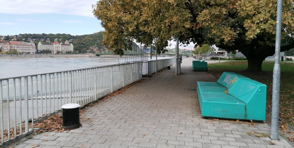
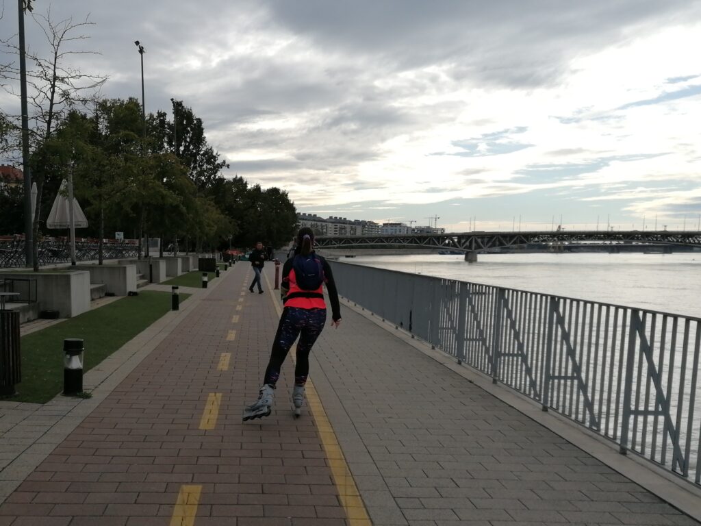
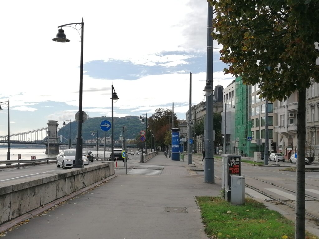
The examined cycling tracks are almost fully on both riversides of the Danube. They are also part of the EuroVélo network and on the EV6 (Atlantic–Black Sea) route. One of the most popular sections of the route is the Danube Bend – Budapest track. We studied the Budapest City Center routes on both (right=Buda/left=Pest) sides of the Danube River. Our tracks fulfil the given condition of being approximately 2 km long.
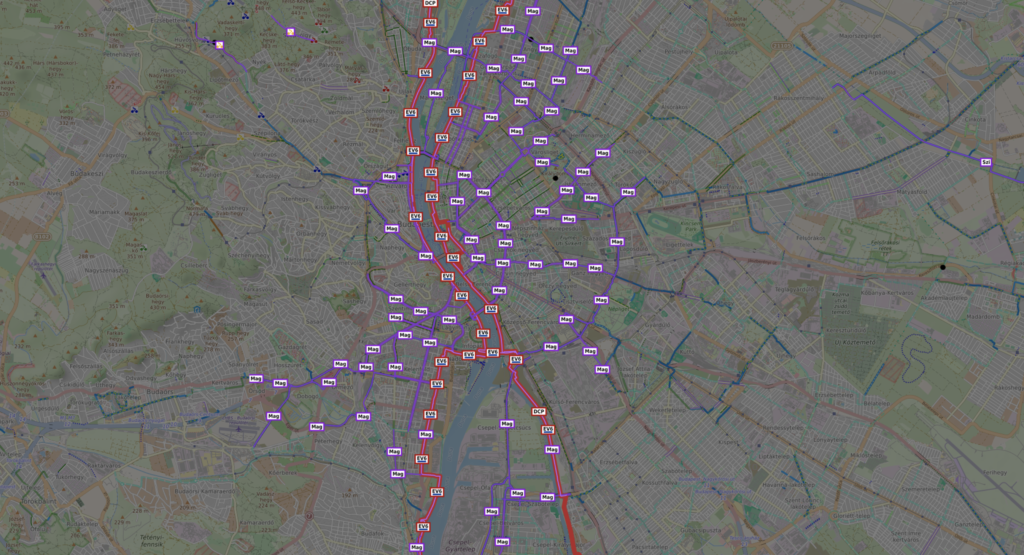
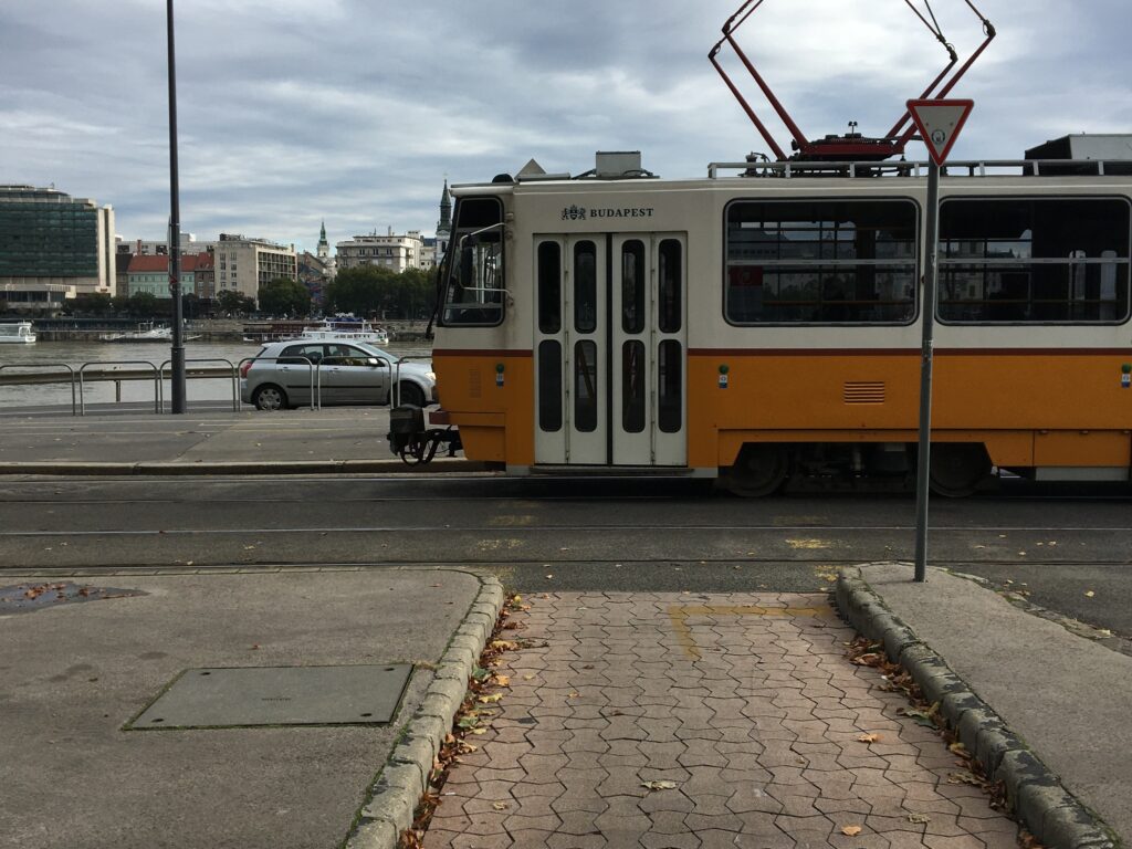
The five Suburban Railway lines are operated by the public transport company MÁV-HÉV Zrt., a subsidiary of Hungarian State Railways. Three out of the five HÉV lines connect Csepel (south), Ráckeve (far south) and Szentendre (north) with central Budapest, and their end stations are very close to the riverbanks. In our research, we focused on these lines. Inside Budapest, standard BKK tickets and passes are valid on the HÉV, but outside Budapest, a separate ticket must be purchased. This will (hopefully) change in the forthcoming months by launching an integrated agglomeration-wide ticket, which is a necessary condition for a proper B+R use.

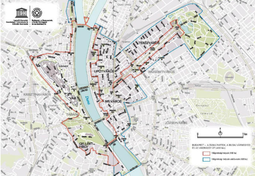
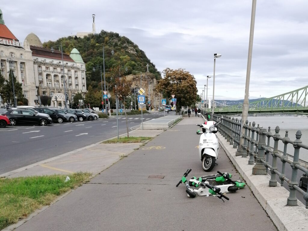
Budapest, including the Banks of the Danube, the Buda Castle Quarter and Andrássy Avenue, is a UNESCO World Heritage site. This site has the remains of monuments such as the Roman city of Aquincum and the Gothic castle of Buda, which have had a considerable influence on the architecture of various periods. It is one of the world’s outstanding urban landscapes mainly because of the Danube location. The contrast between the flat Pest side and the hilly Buda side is even more dramatic at the foot of Gellért Hill which is very close to the river. Otherwise, we can see a high-density historic urban fabric that consists mostly of XIX. Century buildings. The riverside cityscape is partitioned by the bridges and their heads, where we can see some smaller squares and parks.
Map of the examined HÉV stations along the Danube
RESEARCH AGENDA
Problem description
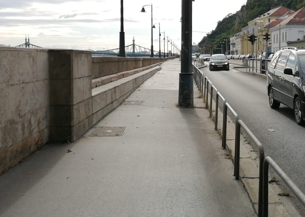
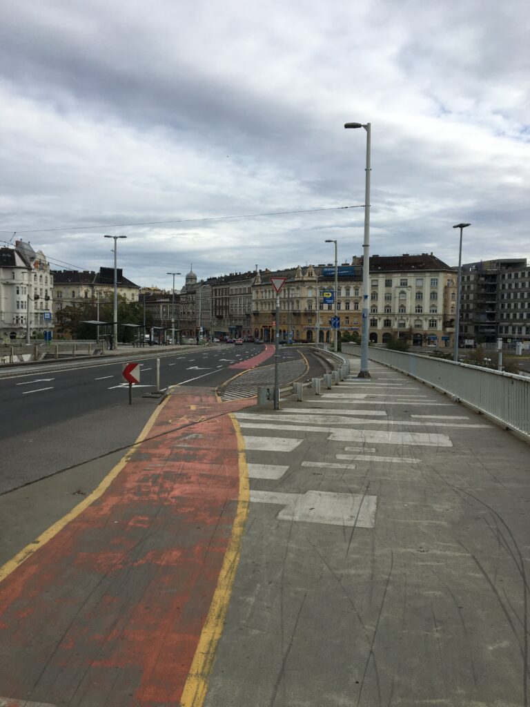
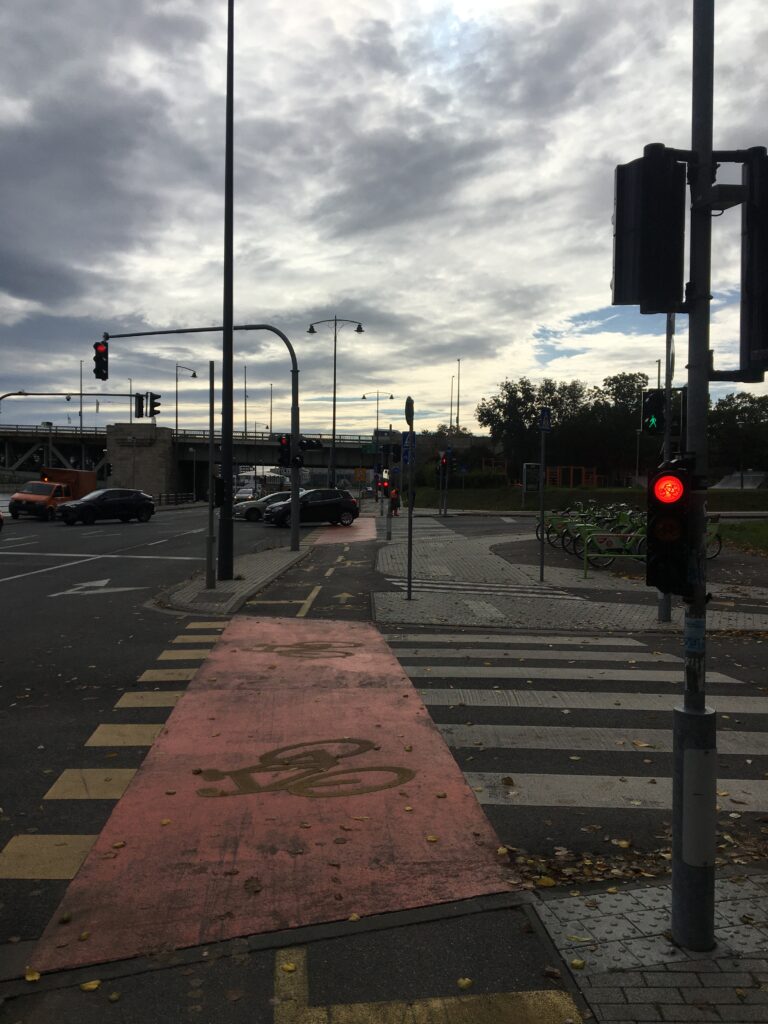
The cycling routes on the riverbanks of Budapest are almost contiguous and are in relatively good condition, but it is obvious that there are many conflicts at the junctions and bridgeheads that make circulation slow. And because of the narrow promenades, there is a usage conflict between pedestrians and cyclists in many sections. The cycling infrastructure is not complete, and there are not enough parking places and other services (incl. B+R parking lots).
Research questions
It is not possible to carry bikes on most of the public transport lines of Budapest, but it is allowed on Railway (MÁV) and Suburban Railway (HÉV) lines. This is why we claim that (in parallel with recreational use), it would be possible to use them for everyday commuting from agglomeration because it is easy to reach HÉV endstations. This would valorize the quality of life in several Danubian SMCs and former settlements in the outskirts (along Line H5, Budakalász and Szentendre; along H6, Csepel, and along H7, Pesterzsébet, Soroksár, Dunaharaszti, Szigetszentmiklós, and Ráckeve). In addition, there is a possibility for tourists and locals of Budapest to use HÉV lines for one-day cycling trips towards these settlements that have various undiscovered architectural and natural resources.

So we examined the possibilities of B+R use from the outskirts of Budapest and agglomeration. Although there are some accessibility problems, the question in our case is not focused on this. We concentrated on the smaller obstacles and too complicated junctions that make cycling routes slower, and we listed the missing infrastructure elements.
RESULTS
Our overall impression
Two of the three members of our group have a lot of experience with these routes because they are everyday cyclists. But one of the group members can be called a beginner because she biked in Budapest for the first time. In this way, the overall impression is very different among the group members. The experienced ones remarked that until now, they didn’t focus on infrastructural elements, so they have learned a different approach. The “beginner” person remarked that – although there are some complicated and/or dangerous sections – the routes are safer than expected, but the usage conflict between the pedestrians and cyclists is disturbing.
Covering and barriers
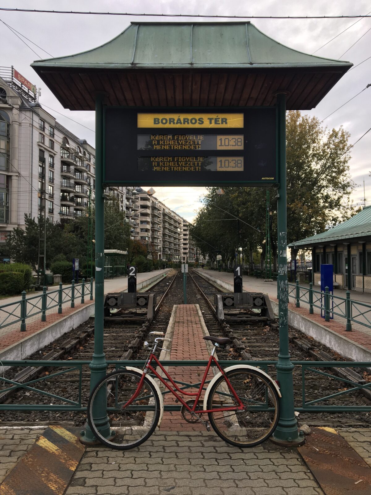
The overall condition of the route covering is relatively good, except for some sections like Boráros tér and Közvágóhíd (where there is actually no dedicated bike lane). But we have seen some bumps and pits that can be dangerous, especially on coverings consisting of small stone/concrete elements. These could be easily repaired but no-one is taking care. We have seen some hollow areas that, after a heavy rain on the previous days, have become big puddles. There are very different barriers (parapets, rails, hems, etc.) along the routes, but they are not missing or misplaced, so they don’t cause any major problem. The signage of the cover is wear-off in many places that can be extremely disturbing for beginners. On neglected and broken surfaces, there is weed growing from the cracks that become bumps.
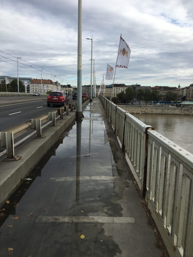
Puddle 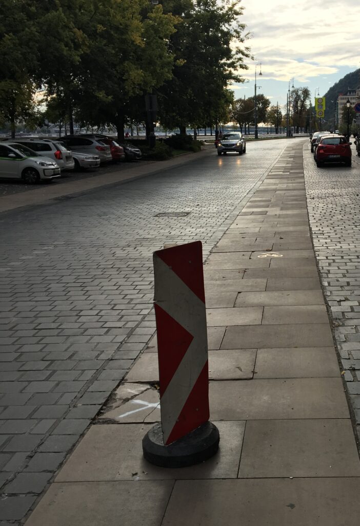
Crack of cover 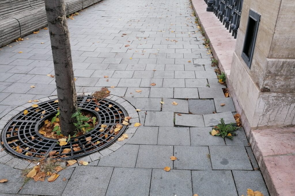
Pothole
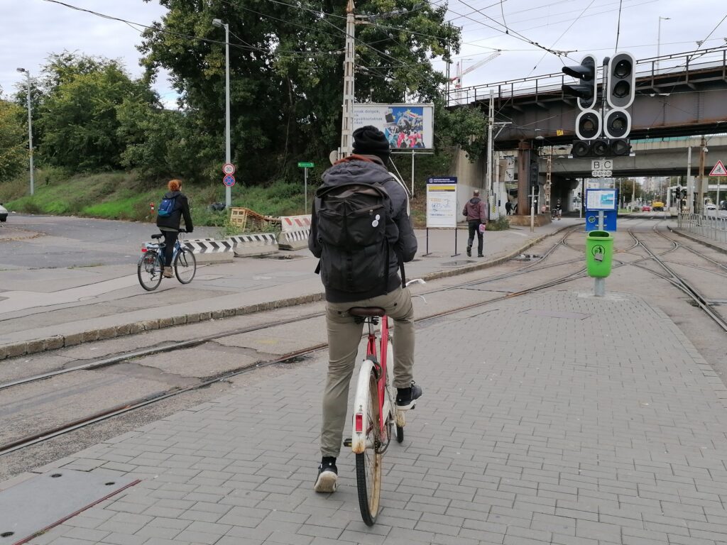
Typical obstacles and hindrances
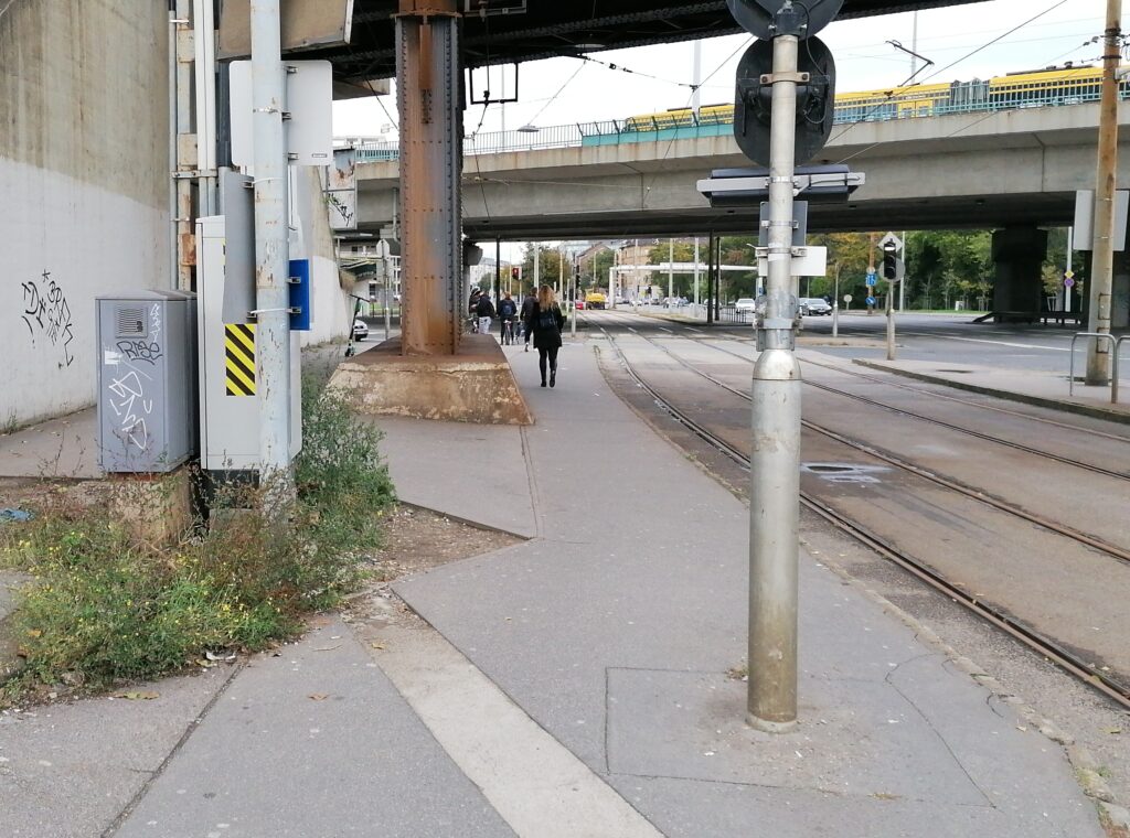
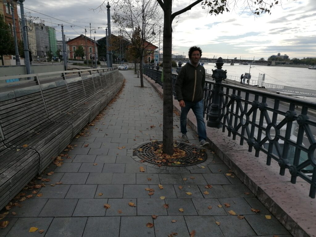
There are some bottlenecks where the route becomes more narrow. These are not marked before, so they are surprising points for beginners. There are many misplaced utility objects (lamps, transformer boxes, etc.) that are positioned in a bad way. (We must add the fact that most of the bike lanes were constructed later, so the planners had to adapt to these existing boxes and lamp posts.) There are some misplaced trees that obstruct circulation, and there are missing grids around the trees that can be pits for cyclists.
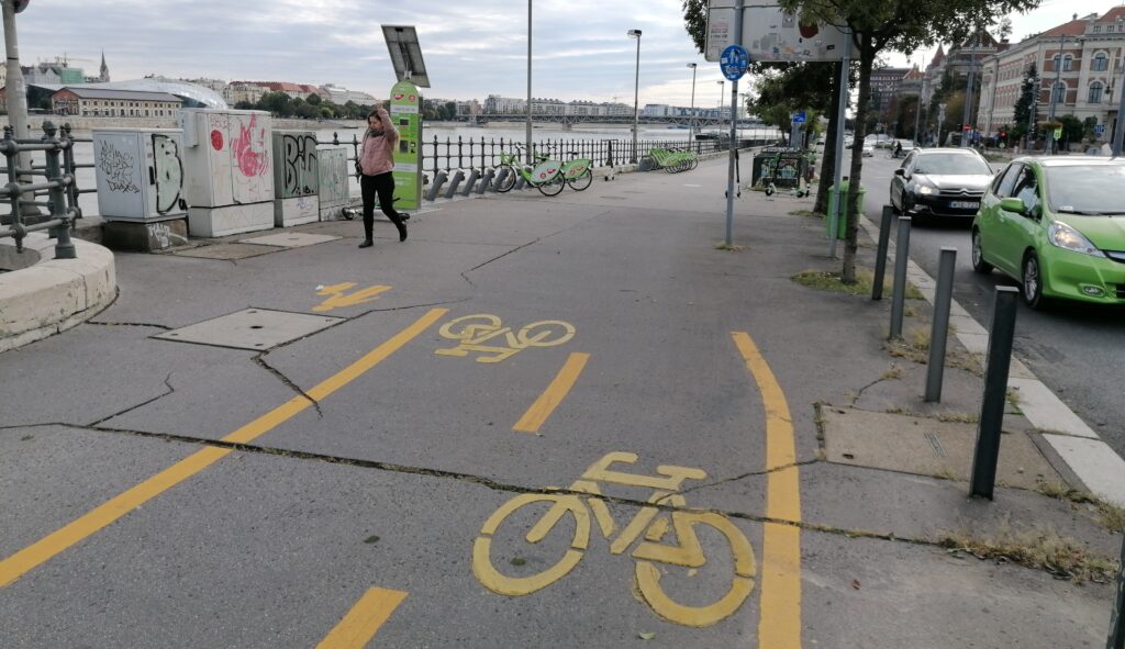
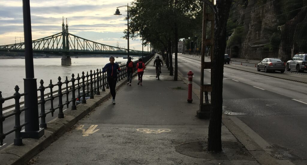
Usage conflicts
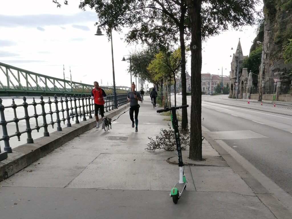
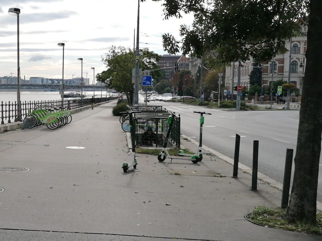
On the more narrow routes, there was no opportunity to designate a separate bike lane, only the side is defined. In this way, pedestrians are not protected from cyclists. On the other hand, there are (naturally) much more pedestrians and runners on these routes, so they occupy most of the surface. We have experienced that pedestrians often use the surface for cyclists. This occurs in some overused sections where there is a separated bike lane, but next to the footway. Electric rollers are left everywhere and obstruct circulation.
Typical helpings and advantages
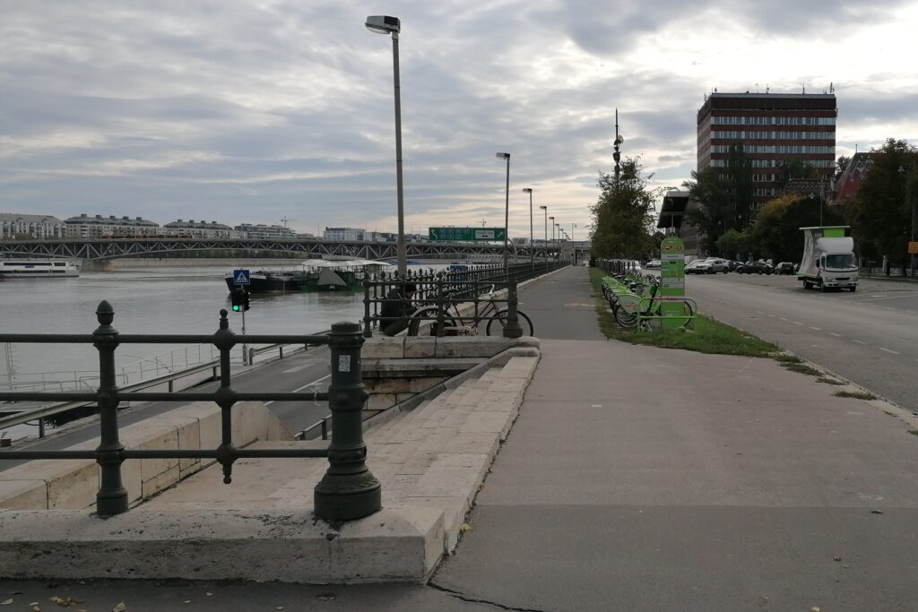
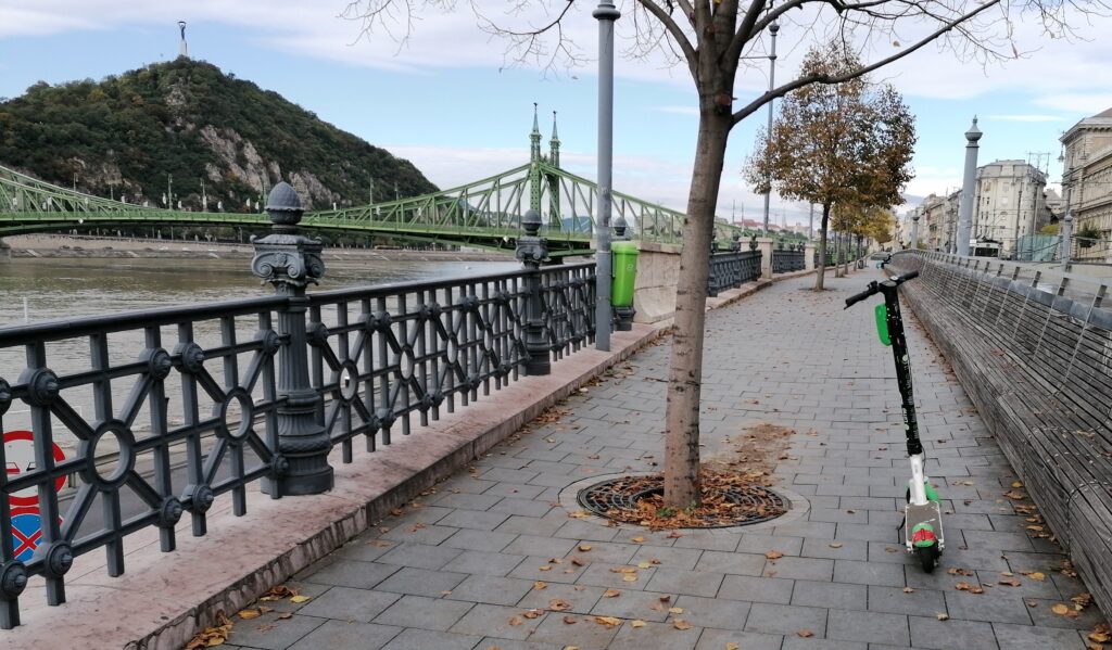
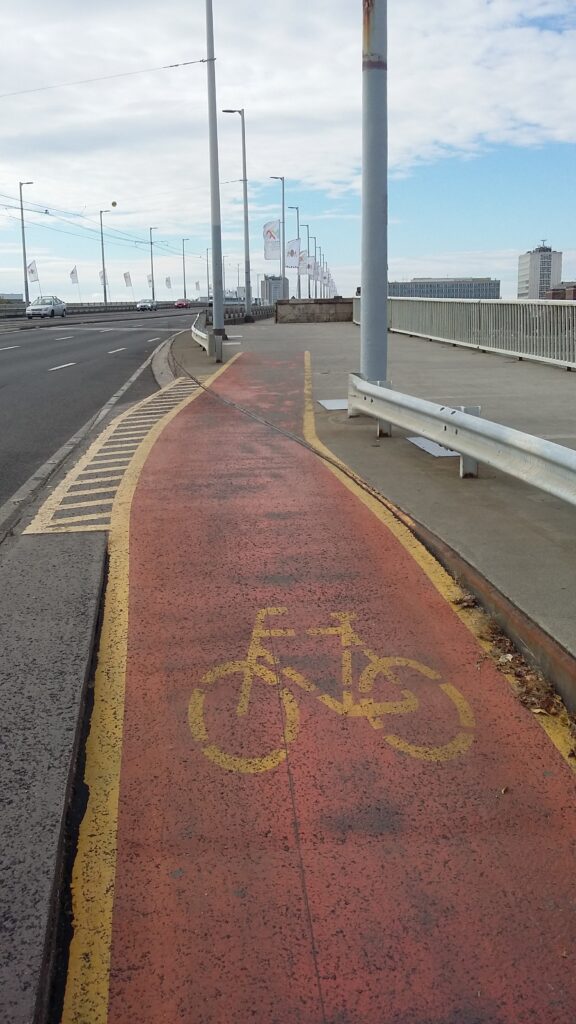
There are enough bicycle parking places between BME and Boráros tér, but they are missing from BME to Batthyány tér and from Boráros tér to Közvágóhíd (which is obvious because there is no bike route near Közvágóhíd junction). There are some buttresses and bike pumps at the junction of Gellért tér. Drinking wells are almost missing, except for the one at Boráros tér and Nehru part (which belong to the park infrastructure). Fortunately, there are enough traffic lights and signages, except for Közvágóhíd junction.

Drinking well 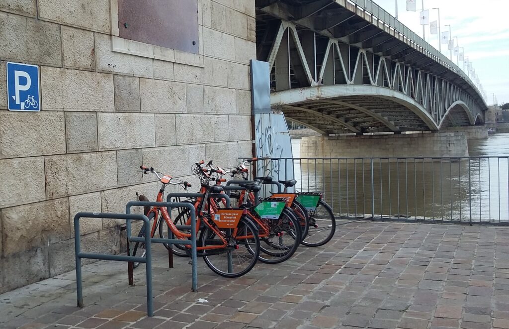
Parking 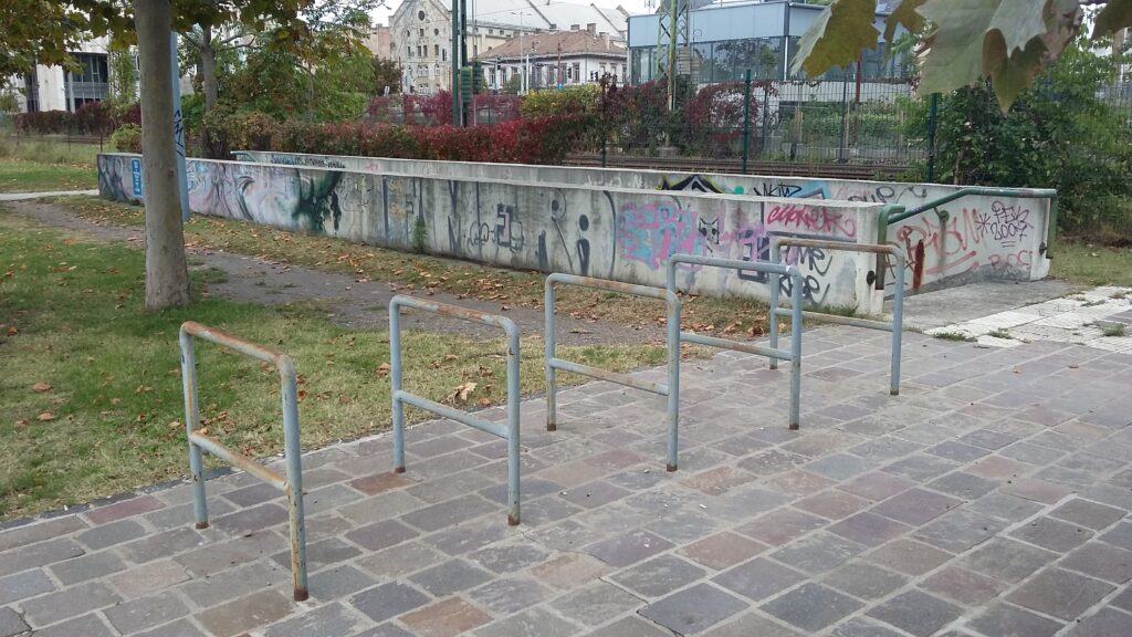
Parking 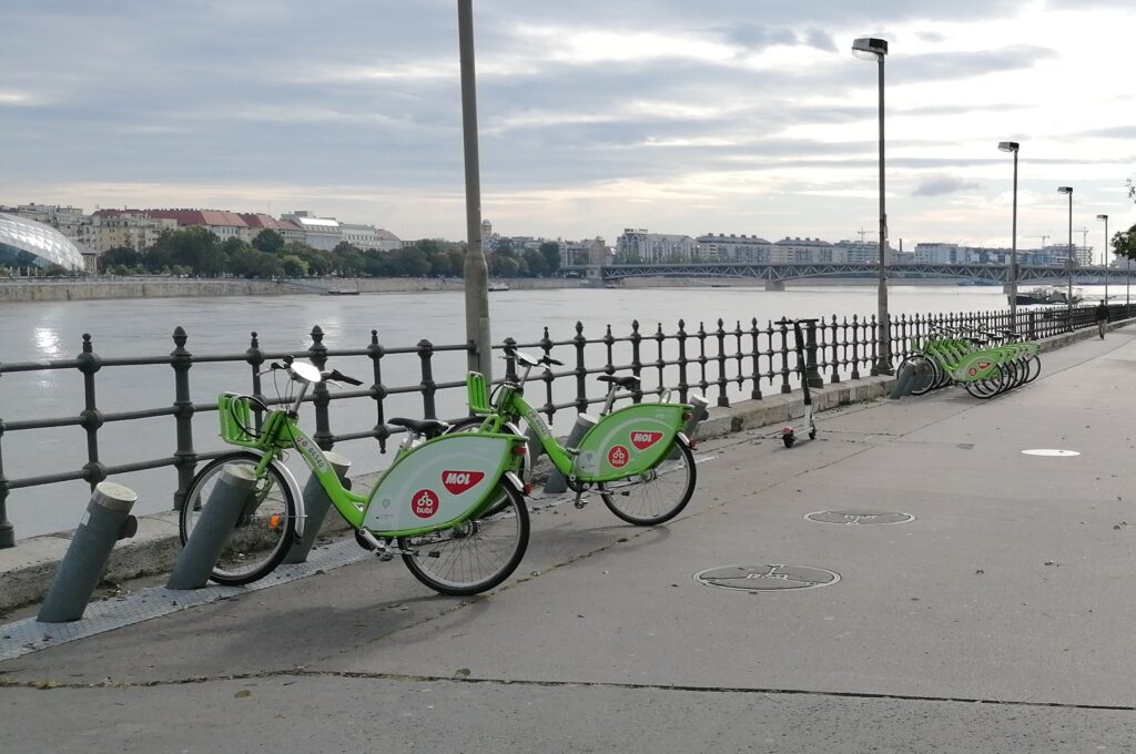
BuBi parking 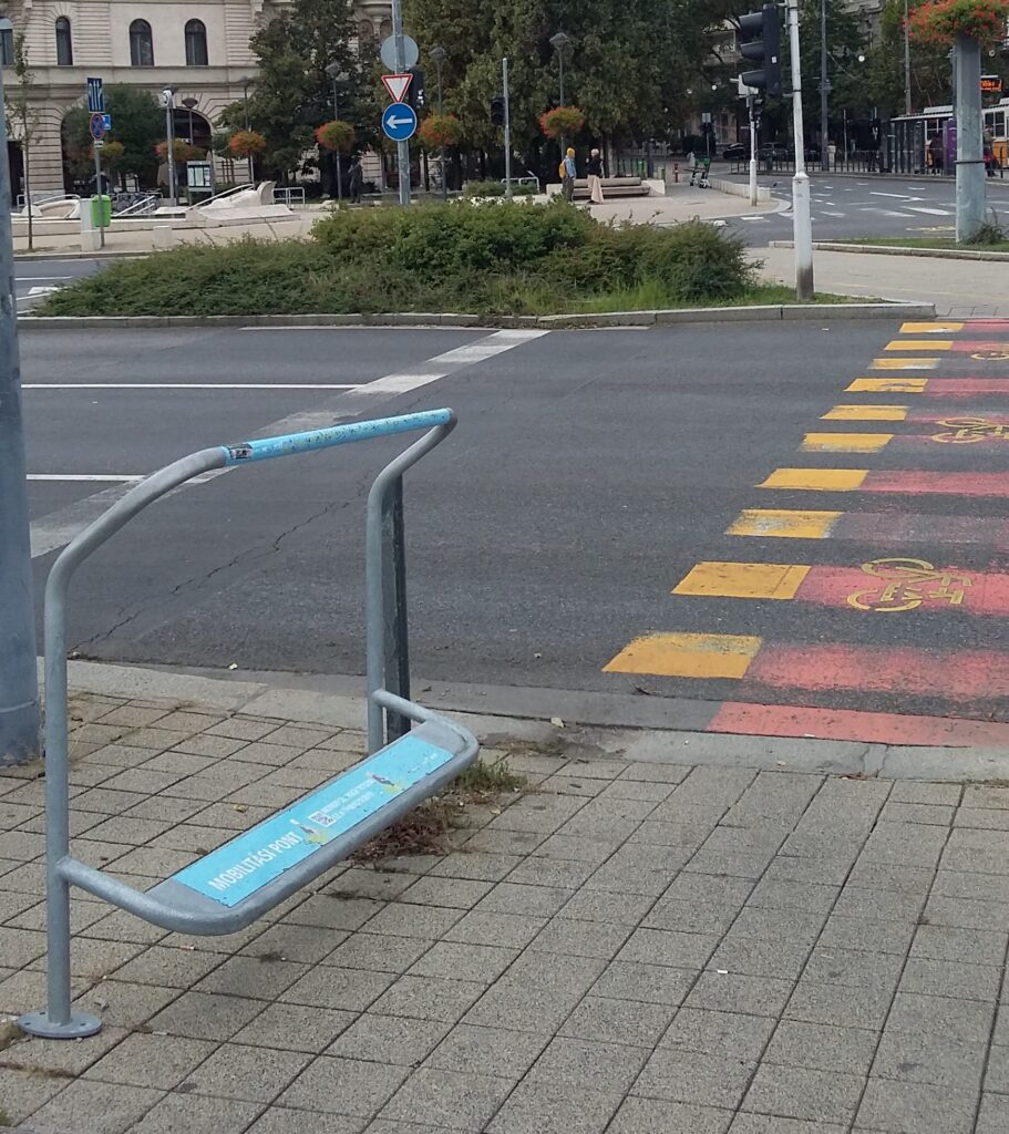
Handrail 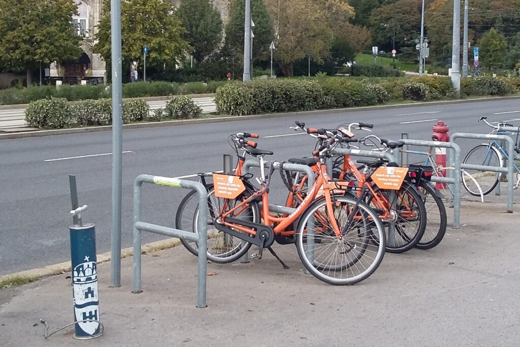
Bike pump and parking
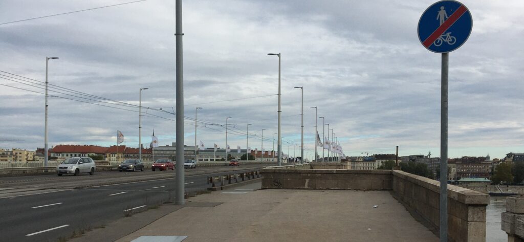
Junctions, including bridgeheads
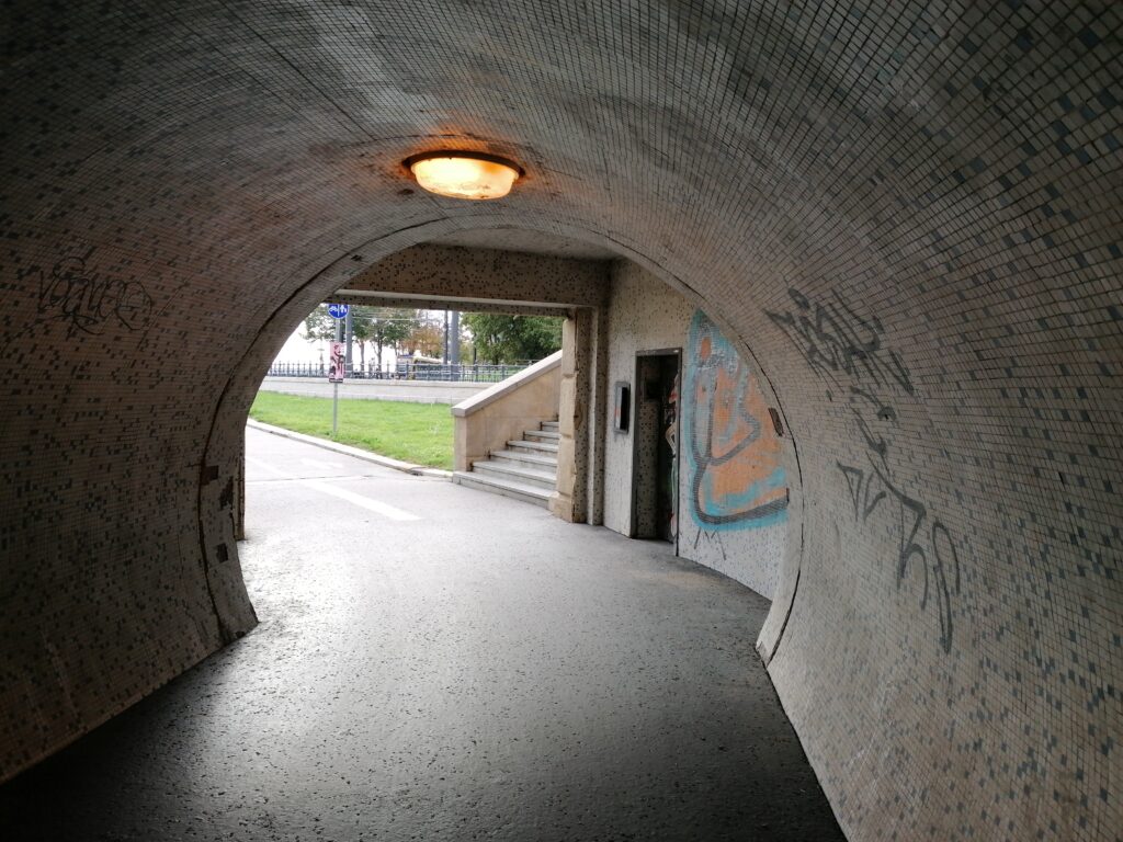
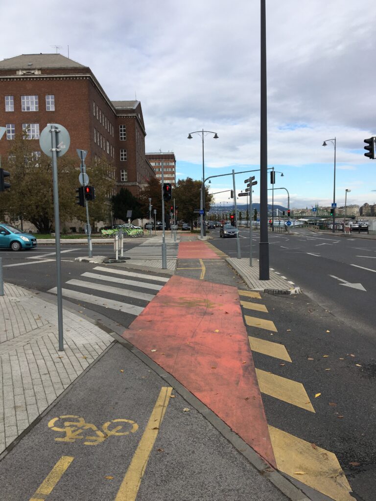
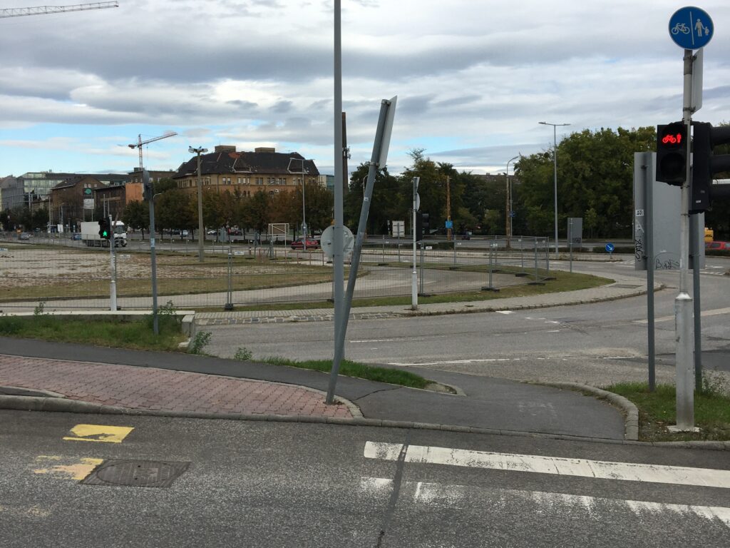
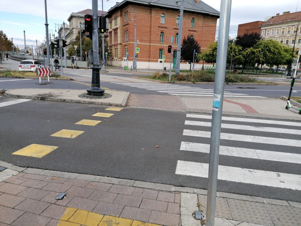
At junctions and crossings, we have remarked that the tracing of the routes is too complicated, especially at Boráros tér. At Közvágóhíd junction, there is no bike route which There are too many traffic islands at Döbrentei tér and at Csarnok tér. But it is a positive thing that there are enough traffic lights and signages. The most dangerous crossing for bikes is near Halász utca crossing.
Conclusions
We have remarked that junctions and crossings should be simplified to decrease circulation time because they are complicated and not even pedestrian-friendly. The worst junctions in this case are Boráros tér and Közvágóhíd. There are crossings where cyclists (and pedestrians) have to wait long minutes, like Csarnok tér. Pedestrians and cyclists should be separated because mixed surfaces are dangerous for both users. Situations where the bike lane is next to the pedestrian promenade are not working because people don’t respect the borders. The curbs are not always suitable for cycling – you have to carry your own bike.
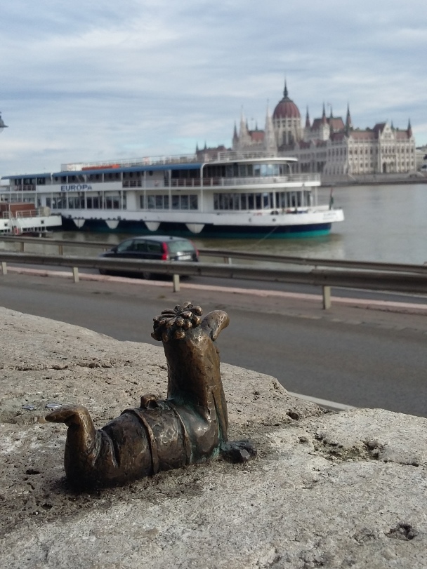
Kolodko ministatue
DESCRIPTION OF METHODOLOGY
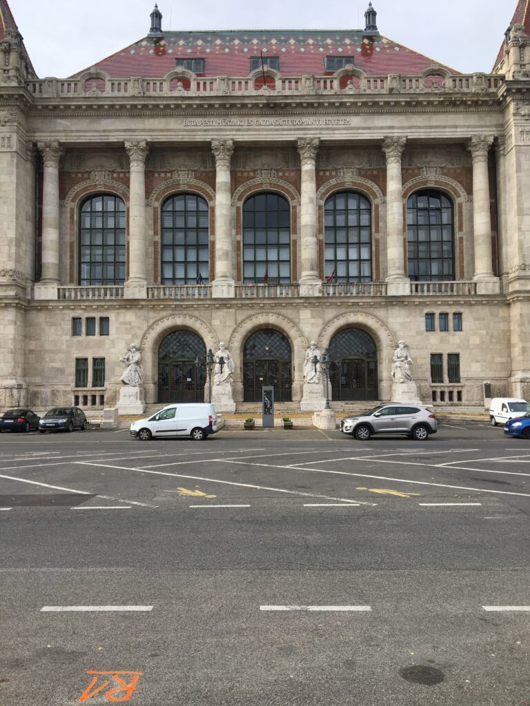
Our aim was to observe how a cyclist can reach the University from the nearby HÉV stations, and vica versa. The chosen HÉV stations are the following: H5: Budapest-Batthyány Square – Szentendre; H6: Budapest – Boráros Square – Csepel; H7: Budapest – Közvágóhíd – Ráckeve. We wanted to figure out which is the fastest and safest way to reach our highlighted places, where can we find the most, and the less problems during our way, so our group members separated on each road and cycled either 2 or 3 different routes.
- At first we started our observations in the Batthyány Square, from where one of our group members cycled in the Fő Street – as a main street, with bicycle lane – and two others used the Danube Buda side quay’s bikeway.
- Our second road was from the University to the H6 HÉV station (Boráros Square). Here we separated again into two groups. One person used the Buda side quay and the Petőfi Bridge, and two people used the Liberty Bridge, and the Pest side quay.
- The third measurement took place between the H7 HÉV station (Közvágóhíd) and the BME University. Here we separated in three. One person used the Rákóczi Bridge and the Buda side quay as the observed road. One person went on the Pest side quaye till the Petőfi Bridge, and continued her journey on the Buda side quay. And one person went along the Danube on the Pest side till the Liberty Bridge, and observed that bike road.
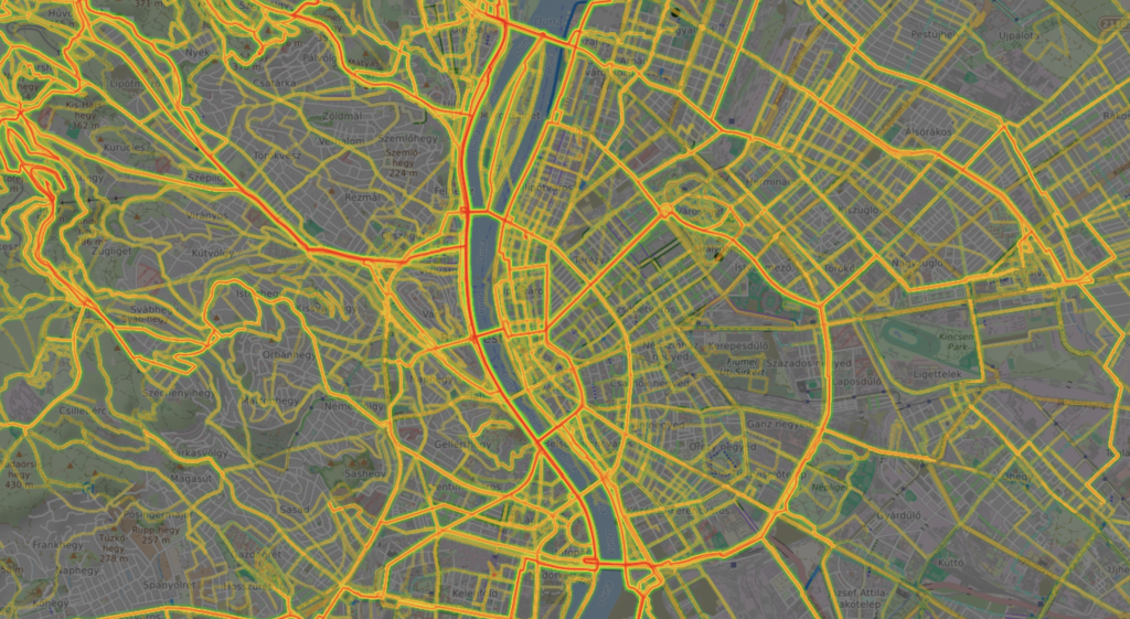
Map of all routes recorded during the field work
During each bikeability measurement we were collecting datas about the obstacles, and problematic situations, difficulties we faced with like: crossings, bridgeheads, bottlenecks, bumps, usage conflicts, etc.
And we also collecting datas about some positive aspects asd useful things for bikers like: bike pump, bike parking places, prehensile, place for water intake, etc.
We used OsmAnd Application for collecting datas – pathways, points and pictures from the problematic, or useful elements – by phones. We did not take sound or video records, because there was a strong wind, and it would distort the sonority, and also because the application quickly drains the phone’s battery.
Number of Tracks Recorded
Number of tracks: 9.
Distribution of the recorded tracks: 3 times 3 routes were recorded
- Batthyány square HÉV Final station – BME Main building (3 different recording)
- BME Main building – Boráros square HÉV Final station (3 different recording)
- Közvágóhíd HÉV Final station – BME Main building (3 different recording)
From Batthyány tér HÉV final station to BME main building
From Boráros tér HÉV final station to BME main building
From Közvágóhíd HÉV final station to BME main building
Total Number of Markers Recorded
Close up of the 3 routes taken from Közvágóhíd to BME
All recorded markers from Közvágóhíd to BME
Markers with Media content, showing problems and potentials from Közvágóhíd to BME
Methodological reflection – application, geojson, wordpress
Problems/difficulties encountered?
- For one of us, the markers could be downloaded only one by one
- The Iphone cannot make pictures with the app
- It takes long to make markers and notes, and because the recording is on, you will have many points in the same place or anomalies
- It is hard to clear the unneeded but recorded points in geojson from the measured road (for example when you stopped to make markers and pictures)
- The app quickly drains the battery of the phones
- It would be nice to automatize the uploading of the pictures in the popup file, because now you have to do it one by one
- It is hard to coordinate the different programs
What was easy?
- It is easy to use the application: just start recording and it will goes till you stop it
- It is easy to get the data, and the pictures from the OsmApp, and put it into Geojson
- The WordPress is easy to handle, and it gives many opportunities for editing
Potentials and constraints in using the methodology
It could be good for doing data collections and research in special areas, but with that a huge amount of data that it can create would not be manageable by this method that we did – manual work – so you need automatization.
What was good/bad suited to illustrate the observations
- It was nice, that we could create easily maps from our recorded routes
- In wordpress you can easily create a photo galeria – you can show and highlight all the problems, and positive aspects with pictures
- It is also good, that our markers and pictures show up immediately together with the routes
- It is hard to create popups one by one, and connect the pictures with the markers
Which questions could be relevant for further research?
How can automatization help to get and handle all of this recorded data and pictures?