DESCRIPTION OF THE SITE
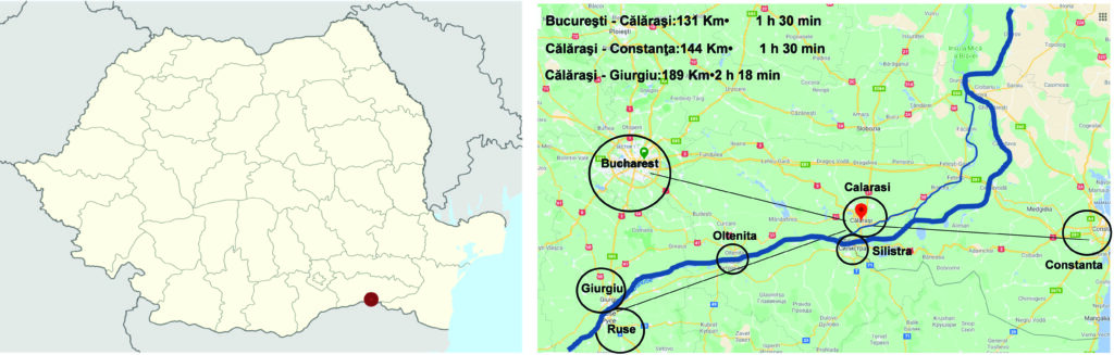
Position: Călărași city is situated in south-east Romania, on the bank of Danube’s Borcea branch, at about 12 km from the Bulgarian border and 125 km from Bucharest.
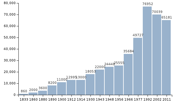
History: The city is on a site of a prehistoric village, called ”Lichiresti” from the time of Mihai Viteazul. Călărași appeared for the first time in 1700 on a map drawn by Constantin Cantacuzino. It got its name after it was made by the Wallachian princes, in the 17th century, a station of “mounted couriers’ service” on the route from Bucharest to Constantinople. The service was operated by horseback riders ( ”călărași”). It expanded into a small town, and in 1834 became the surrounding county’s capital.
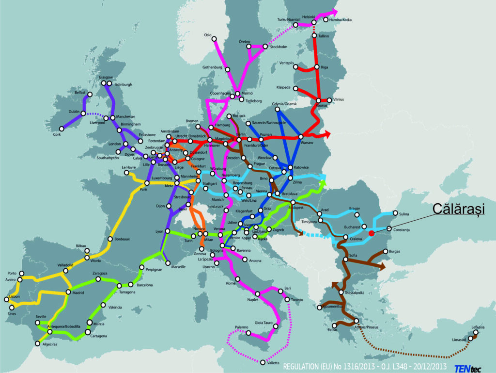
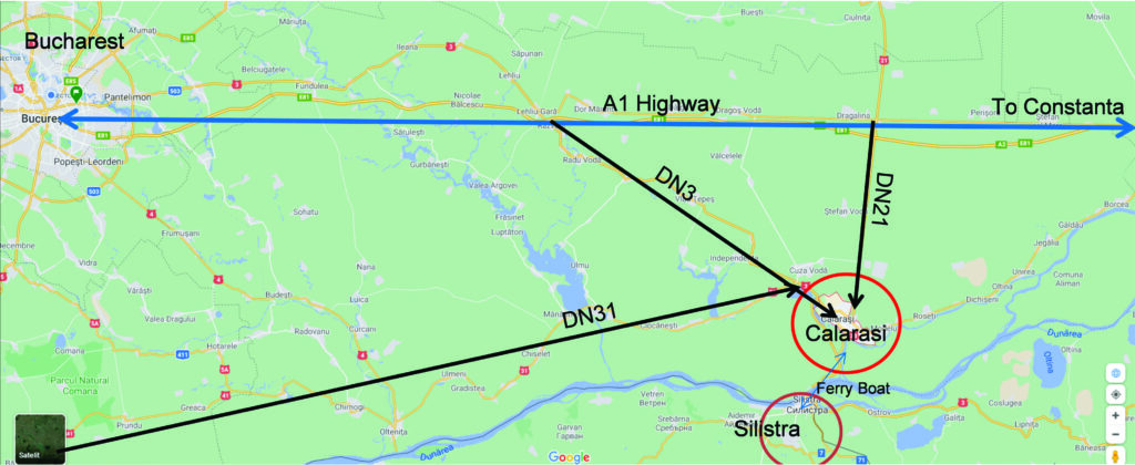
Accessibility: Călărași is connected by A2 (“The Sun’s Highway”) which has 3 exits to the city and ith has also connections with DN3, DN21, DN31, and DN3B. The city lies on the 7th pan-European corridor of transport (the Danube river) and is next to the 4th pan-European transport corridor (Dresden–Constanța) at 26 km (16.16 mi). The town is also connected by rail.
Role of Danube (City-water relationship)
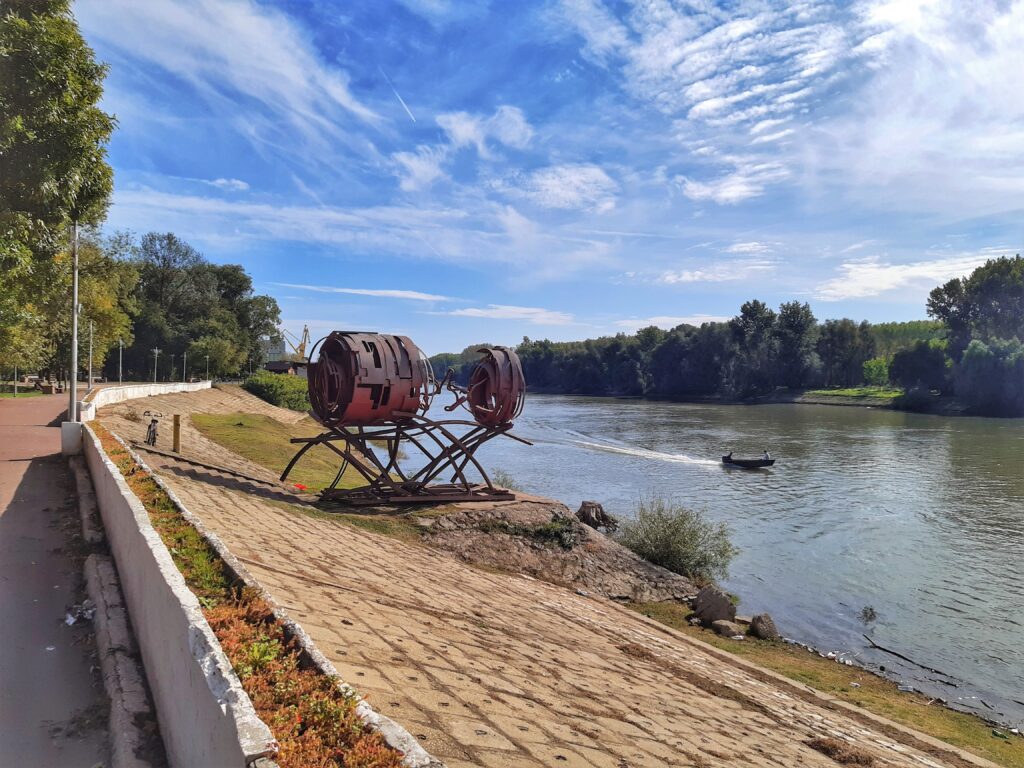
The “Danube River” borders the city of Călărași to the south, and the “Borcea” arm, which detaches on the left bank downstream of the “Chiciu” point, crosses the urban area from south-north to southwest, after forming the Borcea bend. The Borcea arm is 99 km long. On the left bank, an industrial canal (13 km long) was built to allow barges loaded with raw materials (scrap metal, ore, coal) for the industries. The canal is crossed by a modern bridge with four lanes that connect the city to the Danube crossing point at Chiciu – Ostrov being also an excellent place for fishing and training for water sports.
The entire urban development of the city comprised in The General Urban plan of Călărași is oriented towards capturing the resource represented by the Borcea arm and its connection with the Danube. Both from the point of view of the orientation of the central functions and from the morphological point of view, Calarasi pursues in its planning program the better opening to the water, the functionalization of the rivers banks and opening to the public, as well as the use for the public interest of the extremities –ex-industrial sites, that can become part of a larger green recreational area and promenade.
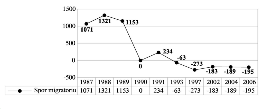
Demographic development (Shrinkage, growth)
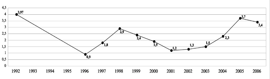
The general evolution of the population of Calarasi after 1990 is marked by a decrease in population, a decrease in natural growth, and evolution negative increase in migration, until the years 2003-2004. In the last 4-5 years, there is a slight increase in the population and of the natural increase and positive evolution of the migratory increase.
Local Heritage
Natural protected areas: Caiafele Forest, Ciornuleasa Forest, Fundeni Forest, Tămădău Forest, Vărăşti Forest, Special Protection Area of Avifaul C (commune Cuza Vodă and the Municipality of Călăraşi), Haralambie Island Nature Reserve (on the Danube river, km 400), Şoimul Island Nature Reserve (on the Danube river, km 350, near Dichiseni locality), Ciocăneşti Island Nature Reserve, on river 39, Ciocăneşti commune)
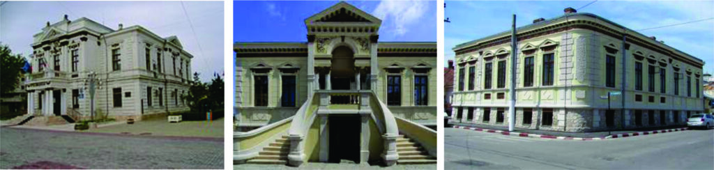
Building protection: The most important protected buildings, included in the “List of historical monuments classified in group A and B, updated”, published by the Ministry of Culture and Cults are :
- Archaeological site of Calarasi, point „Gradistea Calarasi” located 2 km from the city;
- Old town hall, sec. XIX, today School of Arts, Str. December 1, 1918, no. 3-5;
- Commercial school, Str. December 1, 1918, no. 88;
- Ana and Marinache Popescu House, today DJCCPCN, Str. December 13, no. 9A;
- High school, Str. December 13, no. 12;
- Municipal Financial Administration, Str. December 13, no. 16;
- Demetriad House today County Library, 1888, Str. Bucharest no. 102;
- “Stirbei Voda” High School, 159 Bucharest Street;
- Ensemble of houses with shops, 20th century, Str. Bucharest no. 161-163;
- Vasile D. Marinescu House, 1932, Str. Bucharest no. 168;
- Former primary school for girls, 1896-1897, Str. Bucharest no. 172;
- Constantin Tican House, 1908, Str. Bucharest no. 185;
- Old Post, 1904-1905, p. Bucharest no. 193;
- Deculescu House, 1905, Str. Bucharest no. 219;
- Moara, 1912, p. Bucharest no. 315;
- The church „St. Emperors Constantine and Helen ”- Volna, 1856, Str. Heroes no. 2
- Dumitru Bazu House, 1939, Str. Heroes no. 38;
- Christian Church after the Gospel, 1916, Str.Grivita no. 52;
- Former Calarasi court, 1905, Str.Grivita no. 86;
- Crutescu House, 1896, Str. Heliade-Radulescu Ion no. 13;
- Moia House, today Baptist Church, 1915, Str. Heliade-Radulescu Ion no. 13;
- State Archives, 1897, Pompierilor Street no. 1 (arch. Cioconi);
- Grup Scolar Agricol, 1929 – 1938, Str. Bucharest extension no. 8;
- Calarasi County Prefecture, 1898, Str. Sloboziei no. 1, (arch. Cioconi);
- Calarasi County Court, inc. sec.XX, Str.Viitor nr. 69;
- + 51 houses built between 1888 and 1930.
Protected historical monuments in Călărași
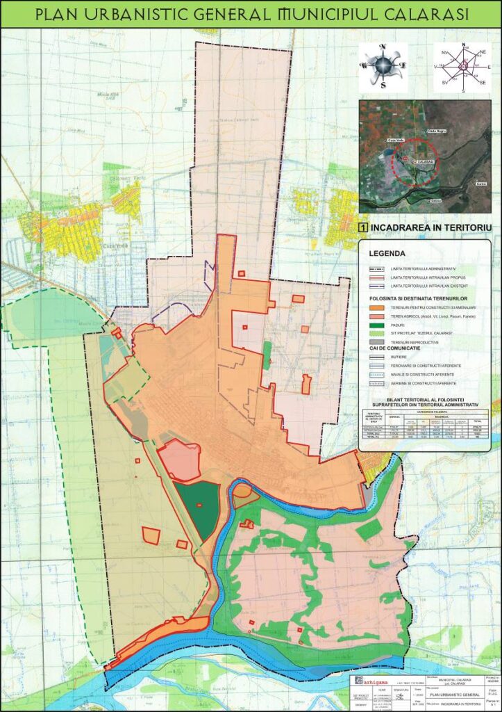
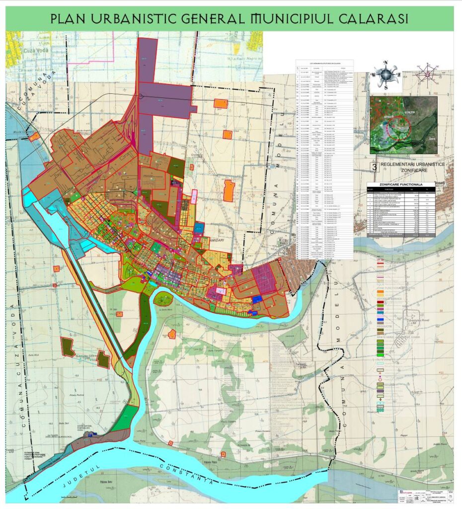
Urban Morphology
As an urban form, the city is adapted to the position and geomorphological features of the territory. its tissue is linear, orthogonal, oriented with the long side parallel to the bank of the Danube. The street plot is differentiated according to the main connections of the city with the territory. The main street – Prelungirea Bucuresti – crosses the urban fabric, parallel to the waterfront, and Eroilor Street connects the city with the southern area, Chiciu, and making the connection with the Western Belt. The central area is detached by the presence of larger urban islands, with important institutions and services for the city (Prefecture, City Hall, County Council, Museum, school, church, etc.). A particular element is the pedestrian street 1 Decembrie 1918, between the Prefecture and the central hall, an area that was originally designed for trade and the promenade, with the potential to re-arrange the public space, currently having too few points of interest and too few connections to the waterfront.
Green Urban Structure
The green structure of the city follows the linear and rectangular plot of the streets, with a concentration of signs arranged on the waterfront (central park, prefecture square, zoo, stadium) and with some points of recreational interest in the vicinity(beaches).
Focus area
The study area is situated in the south part of Călărași, near the city center, on the riverbank of the Danube. Part of our route was through one of the green areas of the city, and the other part was through the city center and the residential area. The total distance we covered in one track was approx. 2.5 km.
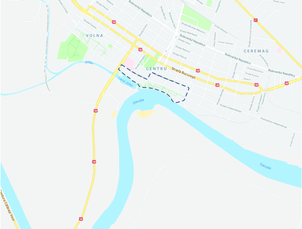
study area in Călărași
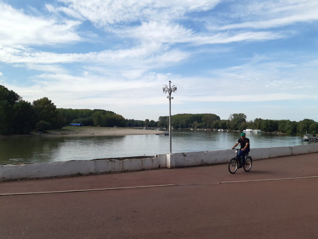
waterfront promenade 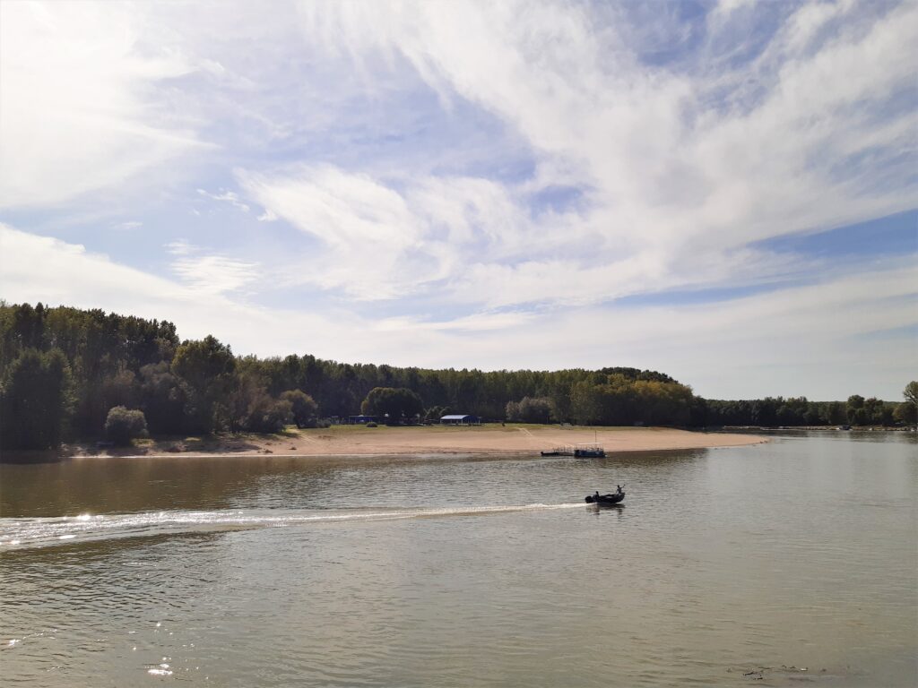
island with an urban beach
RESEARCH AGENDA
Problem description
In our study we researched and analyze the urban public space, making some tracks in the city center that connects services of public interest important for the local communities (the Danube riverbank, urban public garden, public bibliotheque, administrative institution, and health institution), using the bikes and an electric scooter.
For a better understanding and a complete overview of the zone, we collected information in an organized way using the application OsmAnd which is a GIS-based program that has a database where we tracked our path in the city. Along our route, we marked some points with images, videos, and sounds where we considered some problems or some strong points for our project.
Research questions
- How to use and apply alternative data acquisition techniques, based on GIS, for the purpose of spatial analysis and planning of Danubian small and medium-small cities?
- How to test and assess alternative data acquisition techniques and create together an overview of the potentials and limits of these methods?
- How to work simultaneously together and separated and presenting/ visualizing the observation and data acquisition results on a common project blog?
bikeability map
Paths:
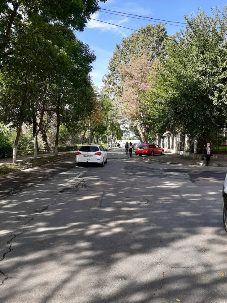
- Geometry of paths – Our study area is part of an orthogonal morphology of the city and it is orientated with the long side along the Danube river. The study area has predominant linear streets.
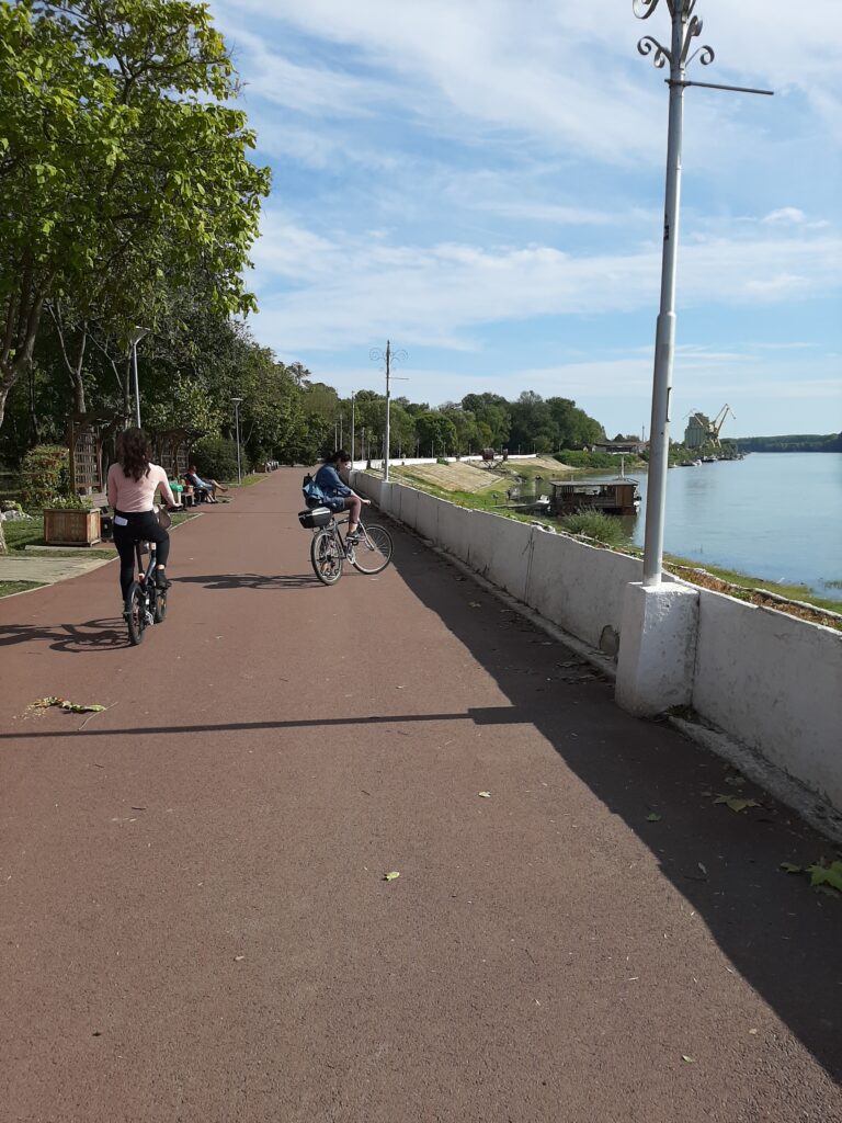
straith path along the Danube river in the public park
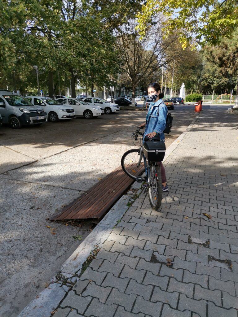
- State of pavements – Along our route we experienced various types of textures on the ground with different kinds of quality from really good to bad.
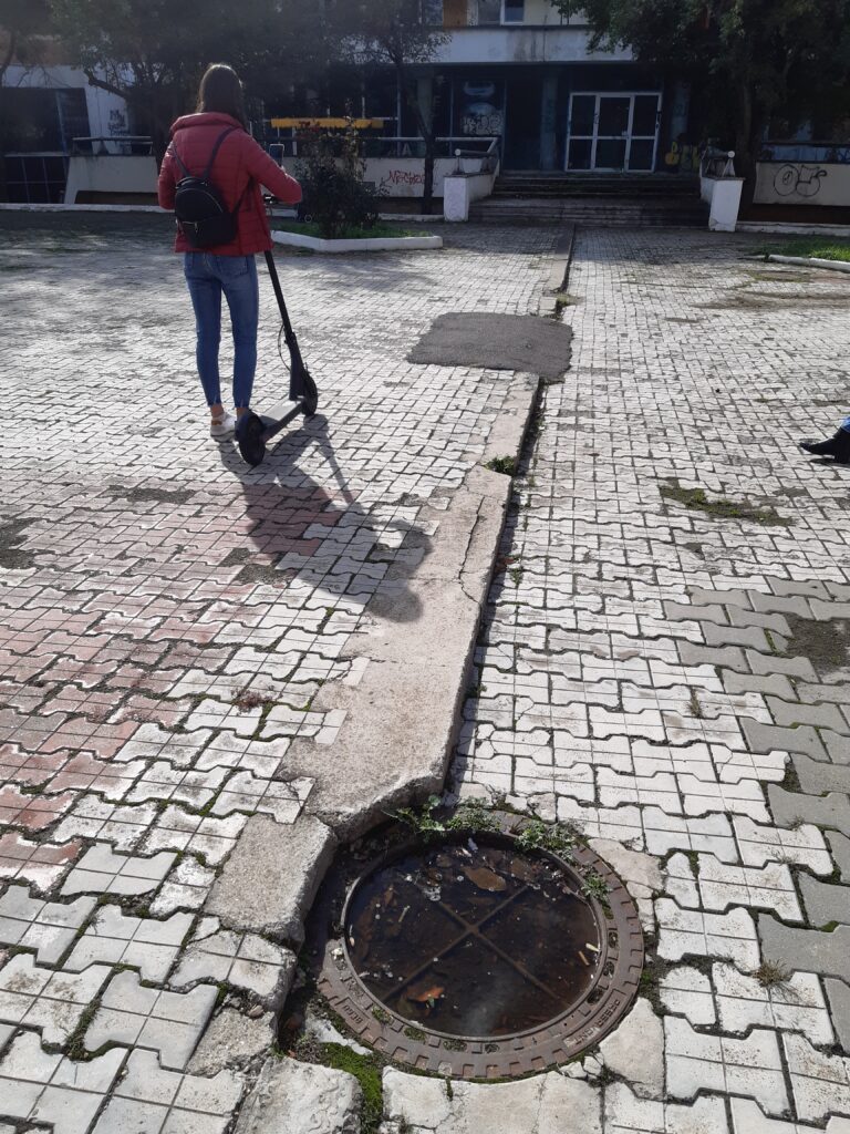
unfriendly pavments for electric scooters 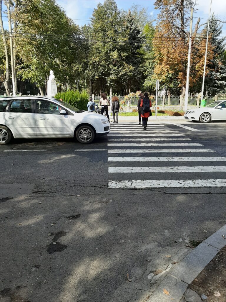
poor design on transition between streets and pedestrian paths 
good quality pavment 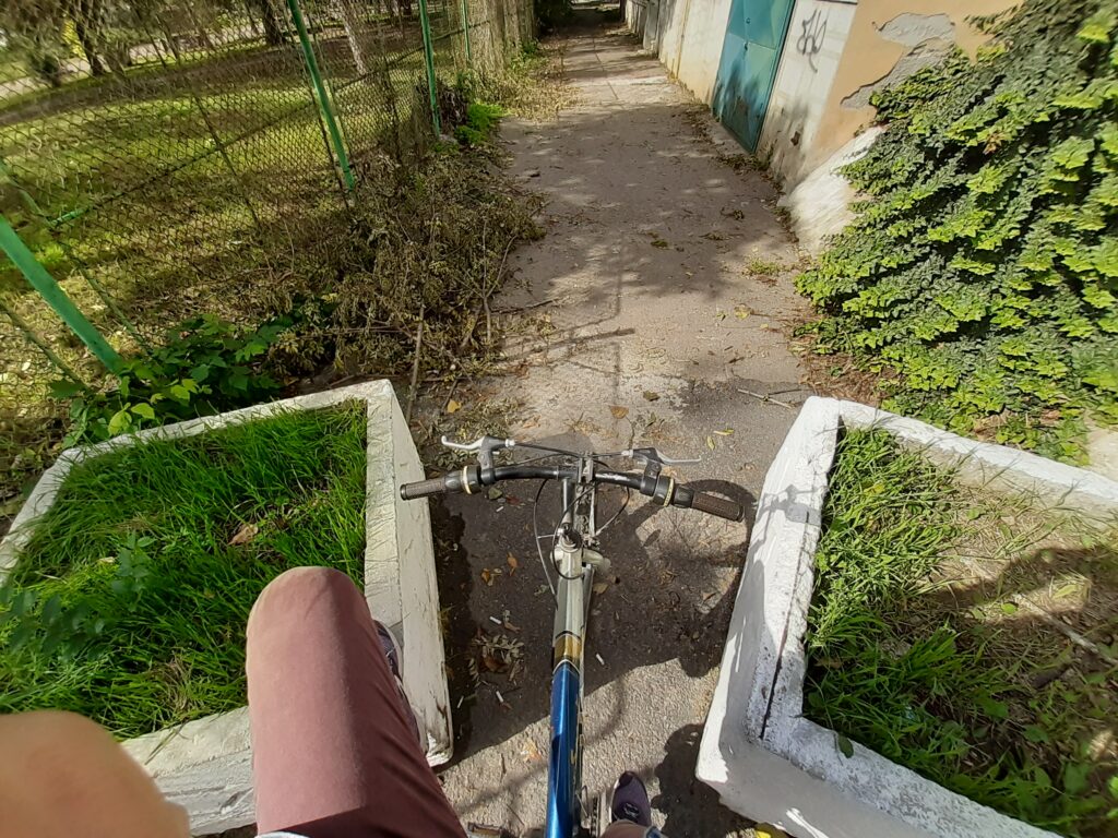
obstacles along the route
- Equipment for disabilities – no (very few). Most transition between different kinds of circulation had some improvision for ramps and some transition was not designed at all for bikers, electric scooters, or wheels
improvised ramps
- Ownership – Most of the streets were public spaces where we could transit without problems along our track. Along the riverbank in the park, the entrance of the bikes was restricted but the main paths were used by bikers.
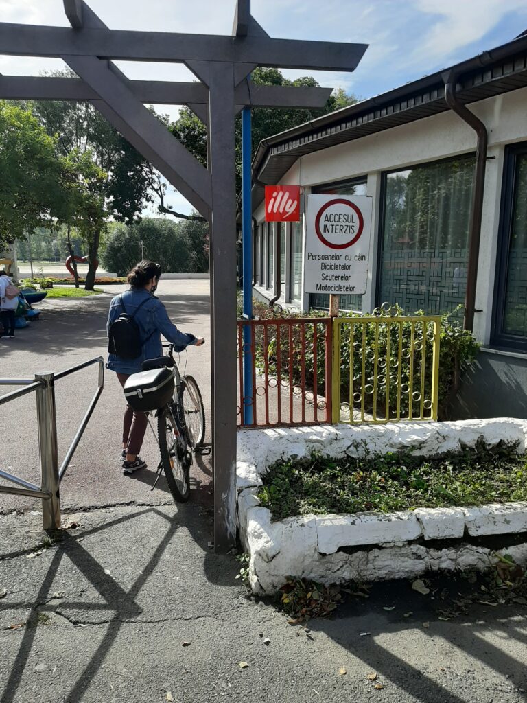
accses forbiden in the public garden near the river
- Uses – Along our track, we remarked various types of activities most of them related to public services like parks, restaurants, bibliotheque, shops and also residential areas.
The hospital 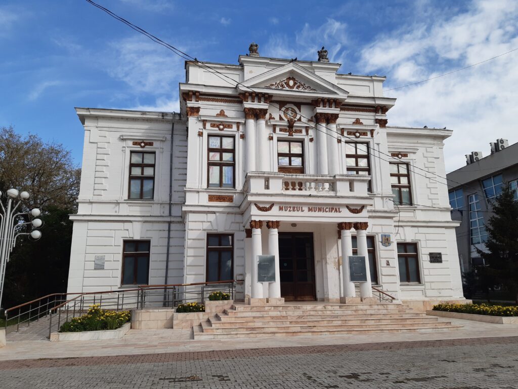
The museum of Călărași
- Water visibility and connectivity– The city center does not have a strong relation with the Danube river. Along our route, we could spot the water just from the path that was created along the river in the public park. When you start to take a distance from this area you don’t have any kind of signs to the water. There are no perspective or any other types of design that can lead you to the existence of some natural elements(Danube).
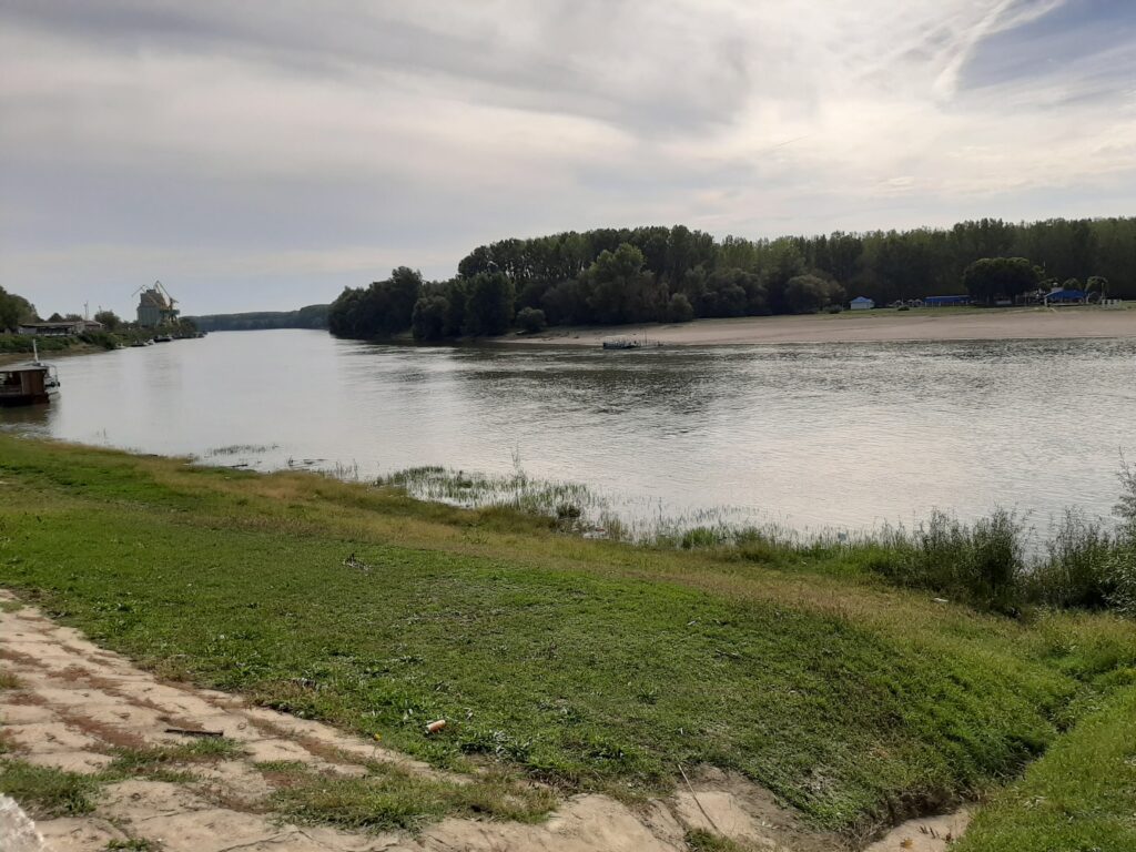
the view to the Danube river from the public park
- Dedicated bike paths – In Călărași there are not any kind of dedicated lanes for bikes in the city center or other neighborhoods. Also along the river in the public garden, the bikes were restricted. Some streets were unsafe for bikers because of the width of the streets and the high traffic of the cars.
watch out for cars! road without bike paths
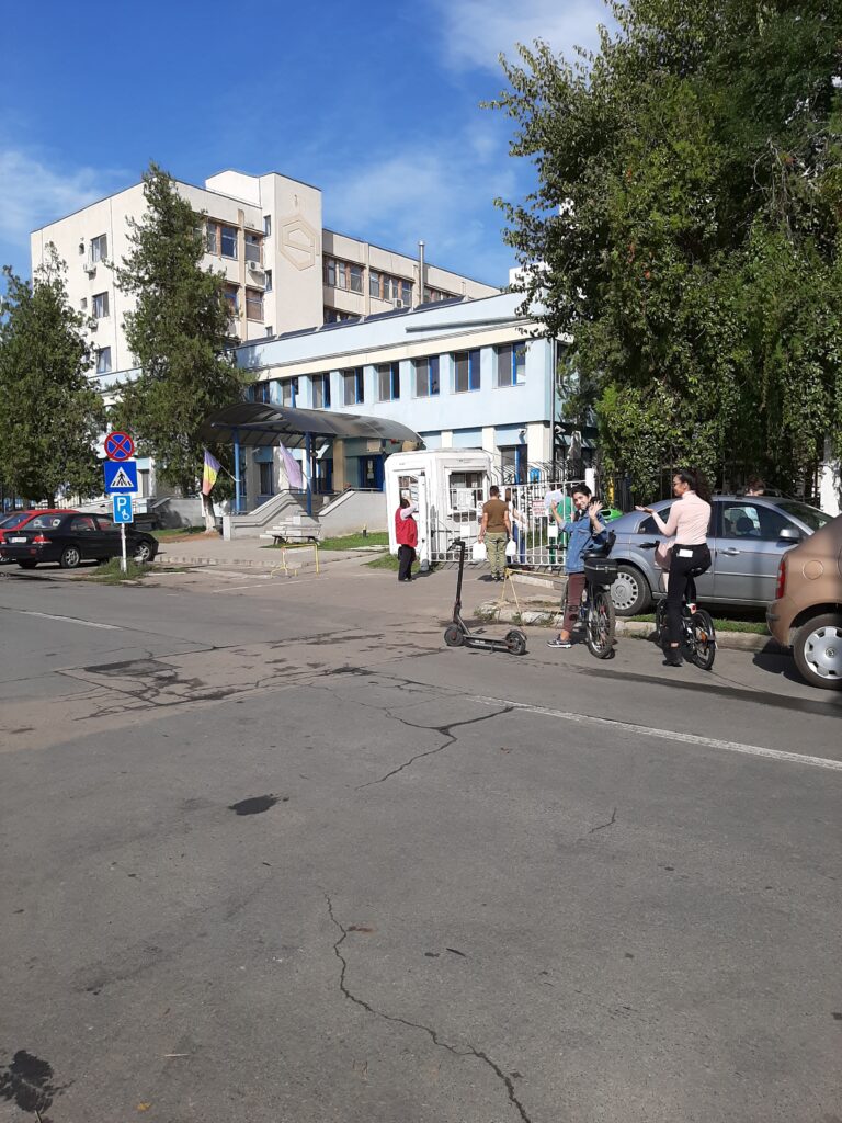
- Bicycle parking spaces – very few or improvisation. The only designed parking spot for bikes it was near the hospital. Other spaces where we could see the need for these facilities was near the river bank for the local fisherman.
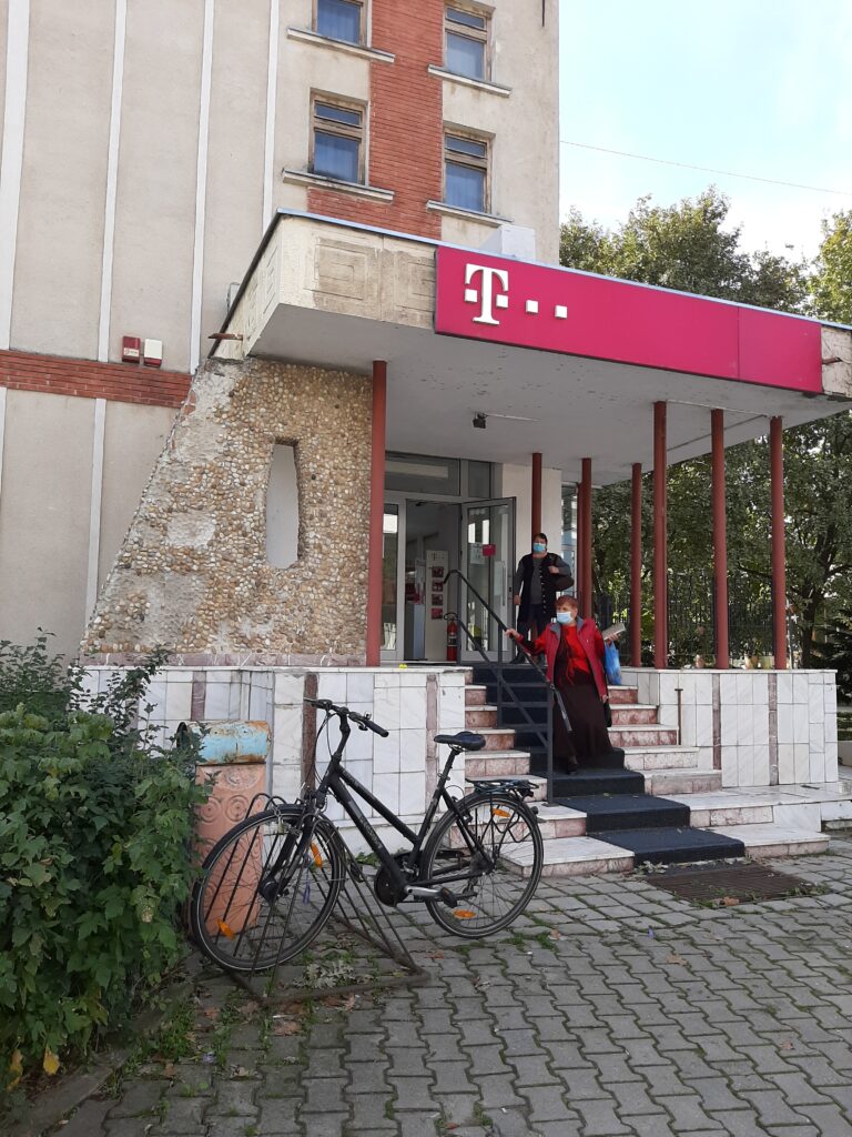
bike stop in front of the hospital 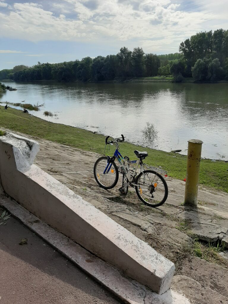
locals adapt to the context –
improvised bike stop
Experience:
- General ambiance – good. The ambiance was really good and pleasant when we used the paths that were designed for pedestrians, bikers, or when we used the smaller streets that are used just by the neighborhoods. Sometimes because of the poor design of the streets, we got lost and we could not orient ourselves for some moments.
- Traffic Noise and pollution – medium. Depending on the area that we transit the traffic noise and pollution were different. We could hear it and feel it most of the time when we were on the main streets of the city where the space was used for transit.
- Social aspects– The public park along the river was used by many categories of peoples and groups. We could spot groups of children and also elders that were doing their activities sometimes in open space but without any kind of relationship with the water. On the river, the only users were the fisherman. Another public open pedestrian space was in front of the public library but was barely used by the locals, most of them just transiting the space. Other groups of youths (bikers, skaters, rollers) were spotted on the entrance of different buildings that had space and design for their activity.
RESULTS
The area and the track that we observed in Călărași has a big potential of becoming a pole of leisure activities and culture for the communities that exist in the city because of the position in the city, the natural elements (Danube) the existent activities and services that are already there. The actual problem is that each kind of space does not speak to the others and many of them are taken out from the context. The stakeholders should speak together and make a strategy for developing the actual potential that can be lost.
Regarding the use of bicycles especially in the city center, we understand that many locals are followers of this kind of transport and they try to adapt in the given context. Right now in the city, there is no kind of bike lanes, dedicated spaces, or specially designed spaces for bikers even if there are many users. Because of the morphology of the city that is orthogonal, it is quite simple to orient yourself from a space to another even when riding a bike. Many streets are not marked properly or designed well, so, because of that sometimes you can get lost and confused but just in a few places.
DESCRIPTION OF METHODOLOGY
Task I: Preparation of data acquisition
- participation to the online presentations
- installing OsmAnd
- troubleshooting
- informing about site
- creating the groups on topics
- creating the FB group
- dialogue with teachers
Task II: Data acquisition:
- going on site – Calarasi
- meeting with stakeholder – Calarasi Museum
- starting the route
- taking pictures, video, notes
Task III: Data preparation
- Cleaning data
- Sharing data
Task IV: Web-mapping
- checking the photo location accuracy on pic2map.com
- importing the .gpx file with the tracks and markers on geojson platform
- adjusting the geometry of the track
- Number of tracks recorded: 2
- Number of markers recorded: 64
- Number of media created: 64 (52 photos, 12 video files)
Methodological reflection
- Problems/difficulties encountered?
We didn’t encounter any serious problems in the methodology process. The only difficulty we had was in the web mapping phase, regarding the small geometrical errors of the recorded track.
- What was easy?
The data acquisition and preparation were the easiest parts because they were directly connected and they did not require any additional knowledge.
- Potentials and constraints in using the methodology
One of the potentials of using the methodology was the consistent preparation of data acquisition and the troubleshooting meetings which helped us to clarify some aspects.
As a particular constraint, we can mention the relatively short time we had for the data acquisition on-site, due to the fact that we had only one day to go there and collect them.
- What was good/bad suited to illustrate the observations
Using visual material such as pictures was the best way to highlight the pros and cons of the bikeability concept in Calarasi.
We want to thank the host of our tour in Calarasi, Florin Radulescu, and the Calarasi Municipal Museum for helping and guiding us.
Ion Mincu University of Architecture and Urban Planning
Team members